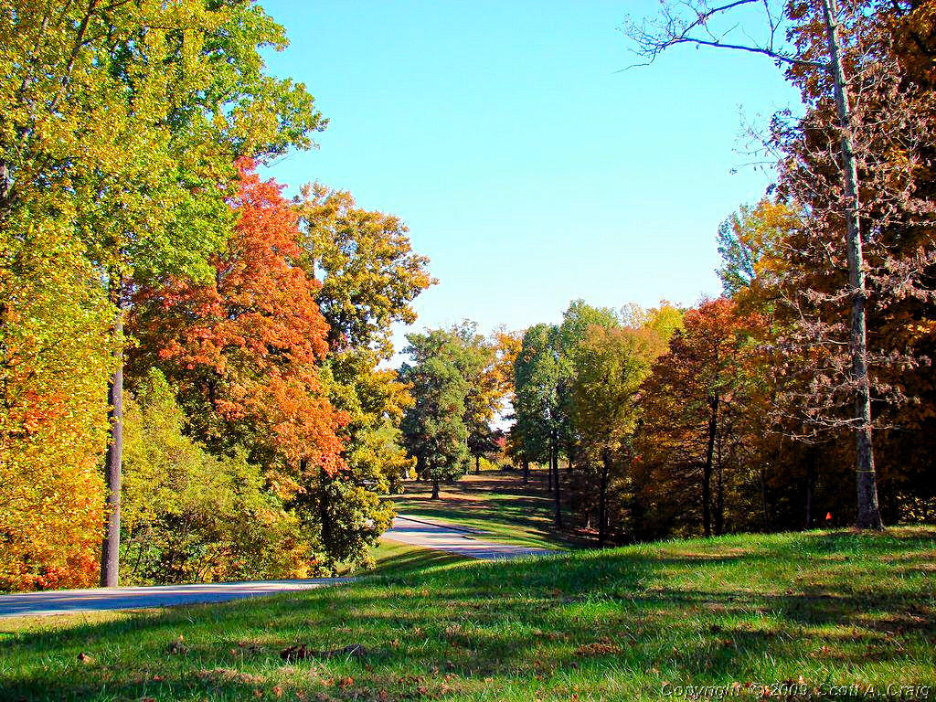
|
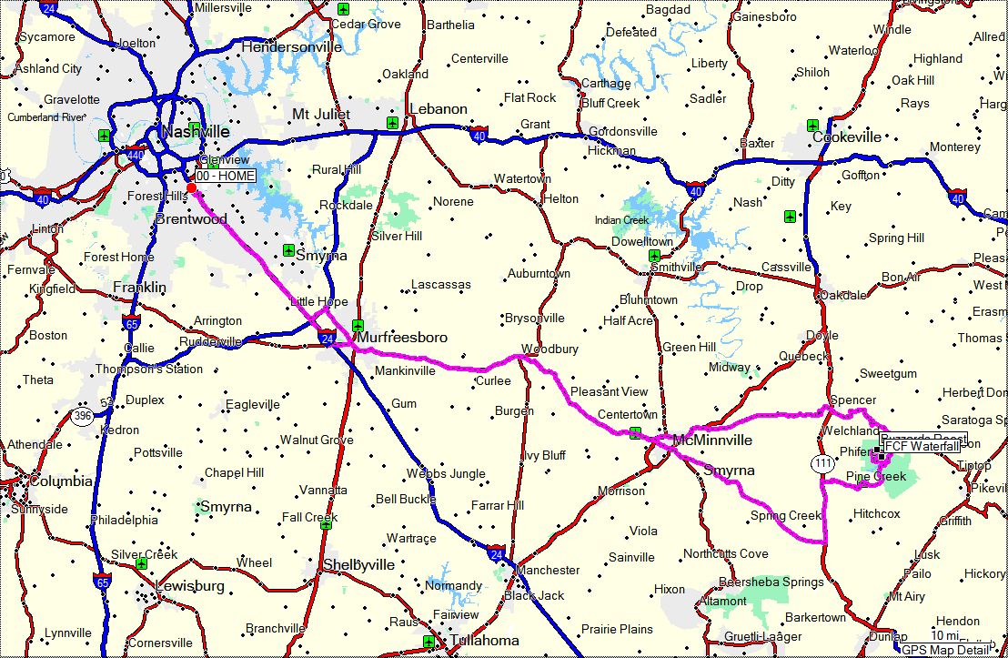
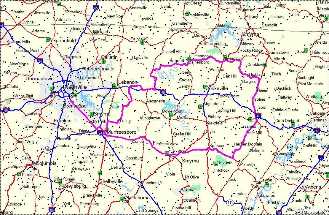
Here are some photos from recent day trips or just riding around. All
of the images are links to larger photos. Click the image to view the large photo. The large
image will open in a new window on most browsers. Web sites for destinations that have one may be
visited by clicking the link below the photo or in the text of the section.
Many of the sections will show GPS coordinates in the title. I try and remember to save the
coordinates when I arrive at a site, but sometimes I forget to do so. In those cases I get
the coordinates from the GPS software on my computer and show them as "+/-" to denote that they
are not exact.
Most of the photos were taken by me, but some were taken by friends and other riders. ALL PHOTOS ARE COPYRIGHTED
AND MAY NOT BE USED FOR ANY PURPOSE WITHOUT THE EXPRESS WRITTEN PERMISSION OF THE OWNER
|
|
|
NEW YEAR'S DAY -- January 1, 2008 |
|
Not much going to happen today as far as riding goes! 2008 is starting with a bang of cold
weather. The forecast high for today is 35° and winds gusting up to 40 mph. Tonight
is supposed to dip down to 19° so tomorrow won't be much better. I might manage to run a
few errands on a bike this afternoon but there won't be much in the way of a real New Year's Day
ride this year.
Oh well, Happy New Year anyway!
|
|
|
CABIN FEVER -- January 5, 2008 |
|
I HAVE CABIN FEVER! Not a single mile on a bike in the past week and I am having
serious withdrawals! The sad thing is that it hasn't rained much either. The
problem has been the temperature. As mentioned above it has been cold! When
I left for work on Wednesday (1/2) it was 18° at 6:00am. Thursday was even
worse. When I left it was 11°! Friday it warmed up decently but early
in the morning it was 22° when I left.
So now here we are at the weekend. It was supposed to rain today so I didn't plan
anything. Naturally it didn't rain any to speak of. Tomorrow I am OUT OF
HERE! It's supposed to be clear and 60° and I am on the road! I don't
care where, I don't care how long, I don't care which way I go, but I am going to ride
a bike tomorrow.
Update - 01-06-08 - Oh boy did it feel good to get out and ride today! It was really windy,
gusting around 25mph, but it was so nice and warm. According to the weather service it topped
out at 65° today and after our freezer of late last week it really felt great. I even wore
my mesh jacket with a liner and lightweight gloves instead of all my heavy winter gear.
I was going to ride down around Center Hill lake since Highway 96 around the lake is a blast to ride,
but the roads were wet from overnight rain so I decided to forego tight, twisty roads for today. I
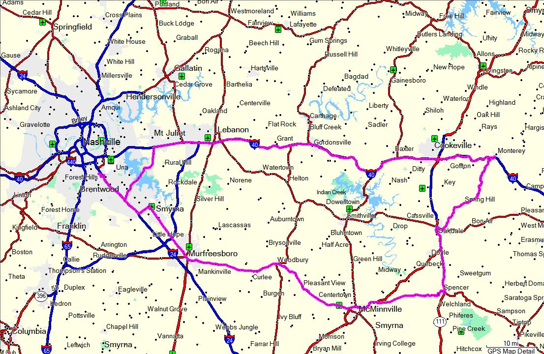
rode to Smyrna, TN and cut over to Highway 231. Highway 231 to Murfreesboro and then Highway 96 to
Franklin. Then, since I was so close, I had to make a run down the Natchez Trace Parkway for a bit.
Out and about for 125 miles and it felt great. I could have done without the wind and the wet roads
but actually I hardly noticed them. I'll sure be glad when spring gets here and there are more days
like this one.
|
|
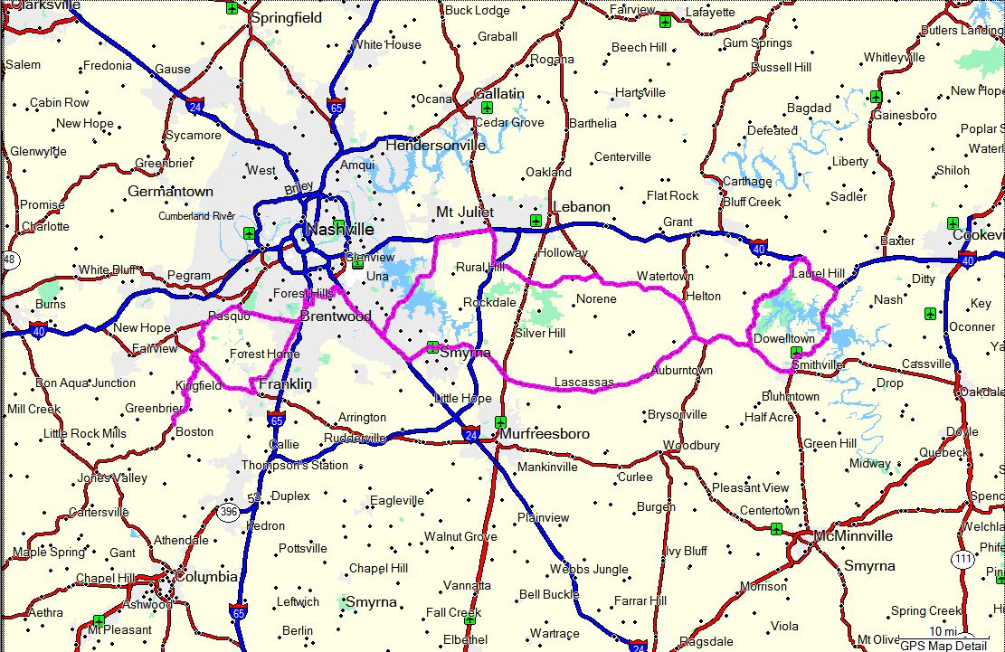
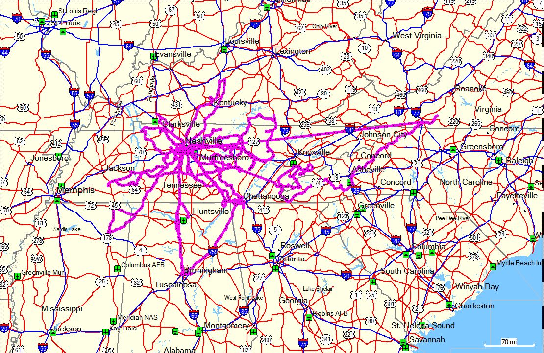
GPS Track Log - 01/06/2008 |
|
|
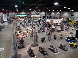
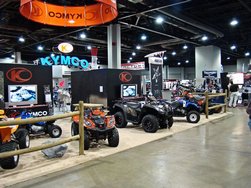
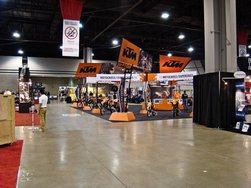
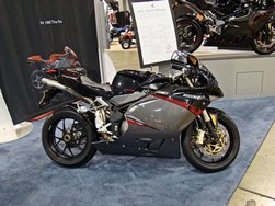
CYCLEWORLD INTERNATIONAL MOTORCYCLE SHOW -- January 19, 2008 |
|
My case of Cabin Fever is, if anything, getting worse. I did manage to ride to work on January 14,
and that was actually a mistake. It was 25 degrees when I left home and the windchill on part of my short
ride to work was about 1°F! That was not much fun. This week doesn't look any better with very
cold temperatures and some snow and rain forecast.
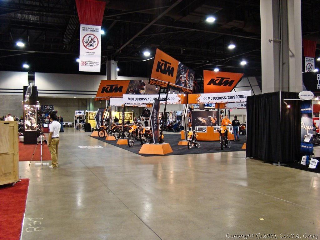
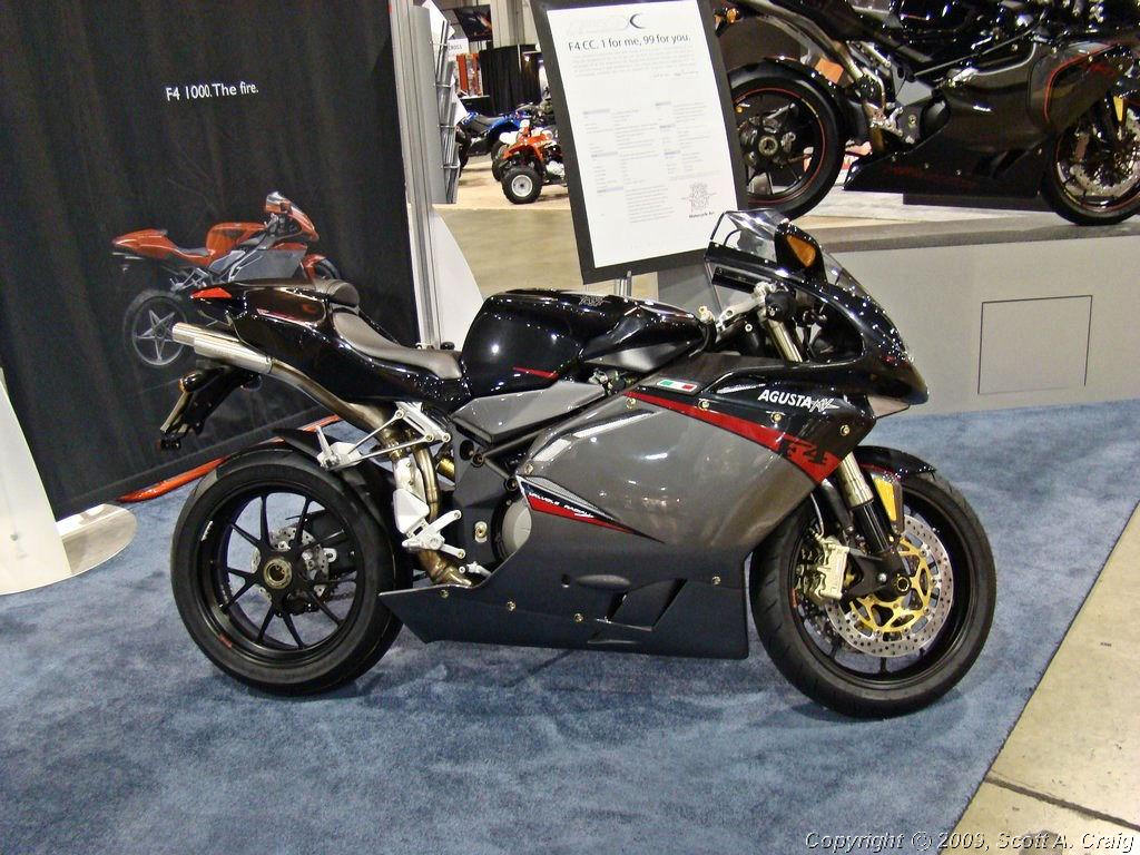
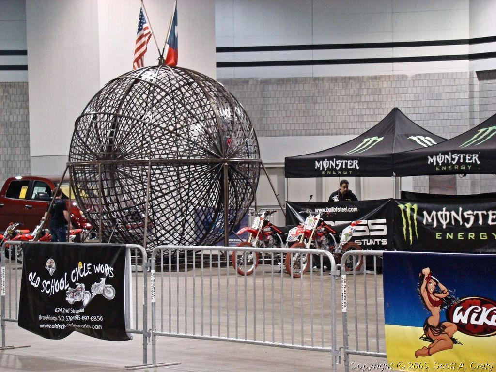
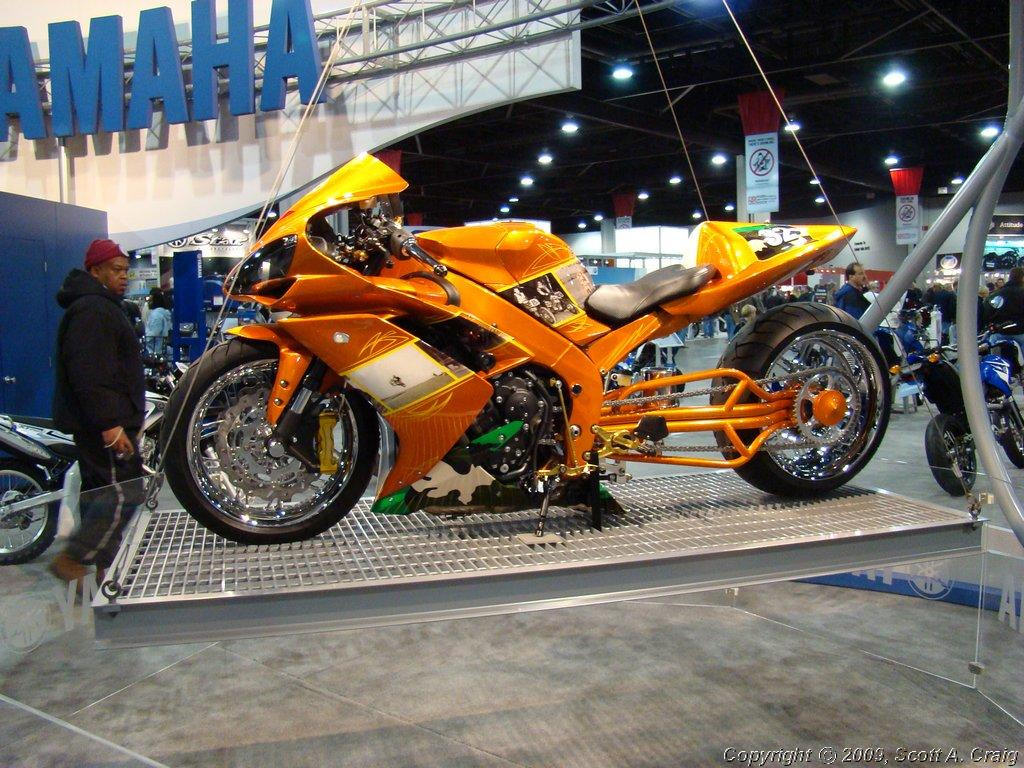
To combat the mid-winter blues I met a friend in Crossville, TN and we drove (yes, "Drove", not "Rode!") to
Atlanta, GA. to the Cycleworld International Motorcycle Show. We left on Friday, spent the night in
Atlanta, and came back on Saturday evening. When we left Atlanta there was about an inch of snow on the
ground there with a good bit more forecast for the rest of the day.
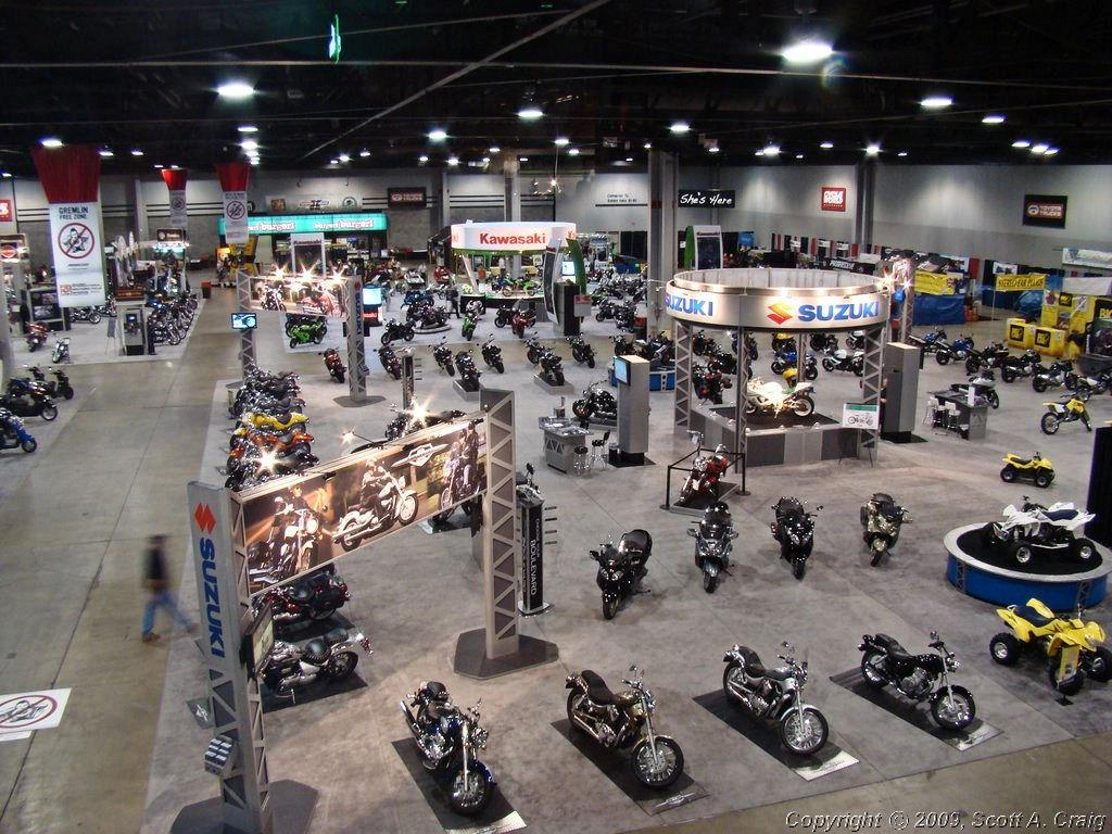
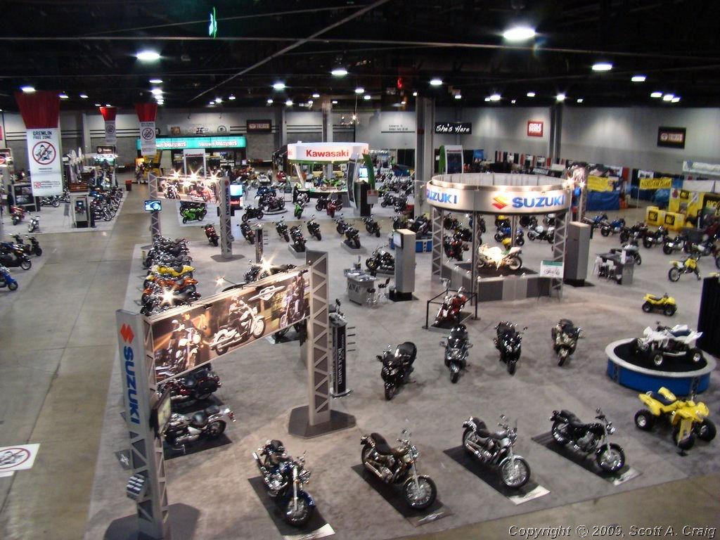
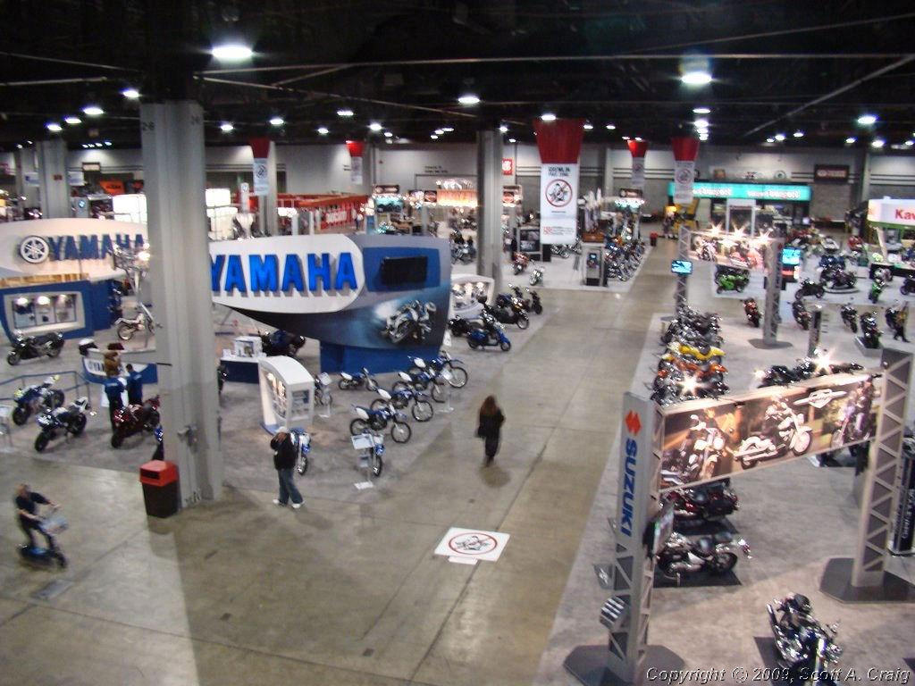
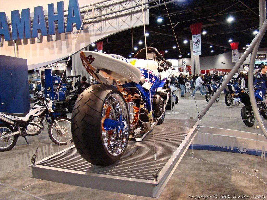
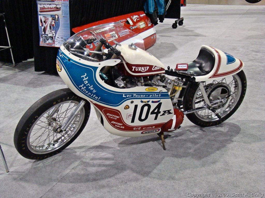
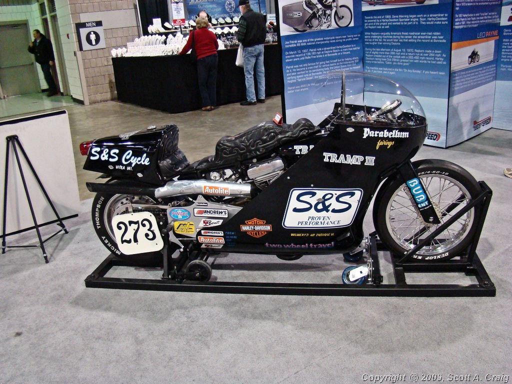
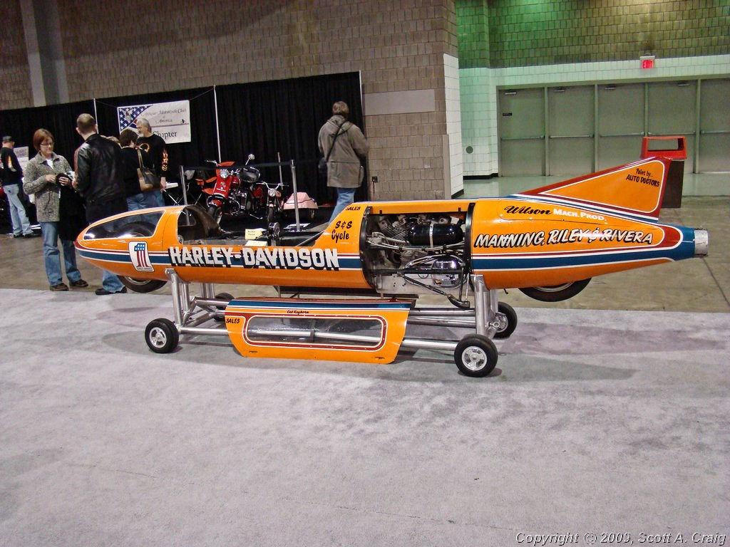
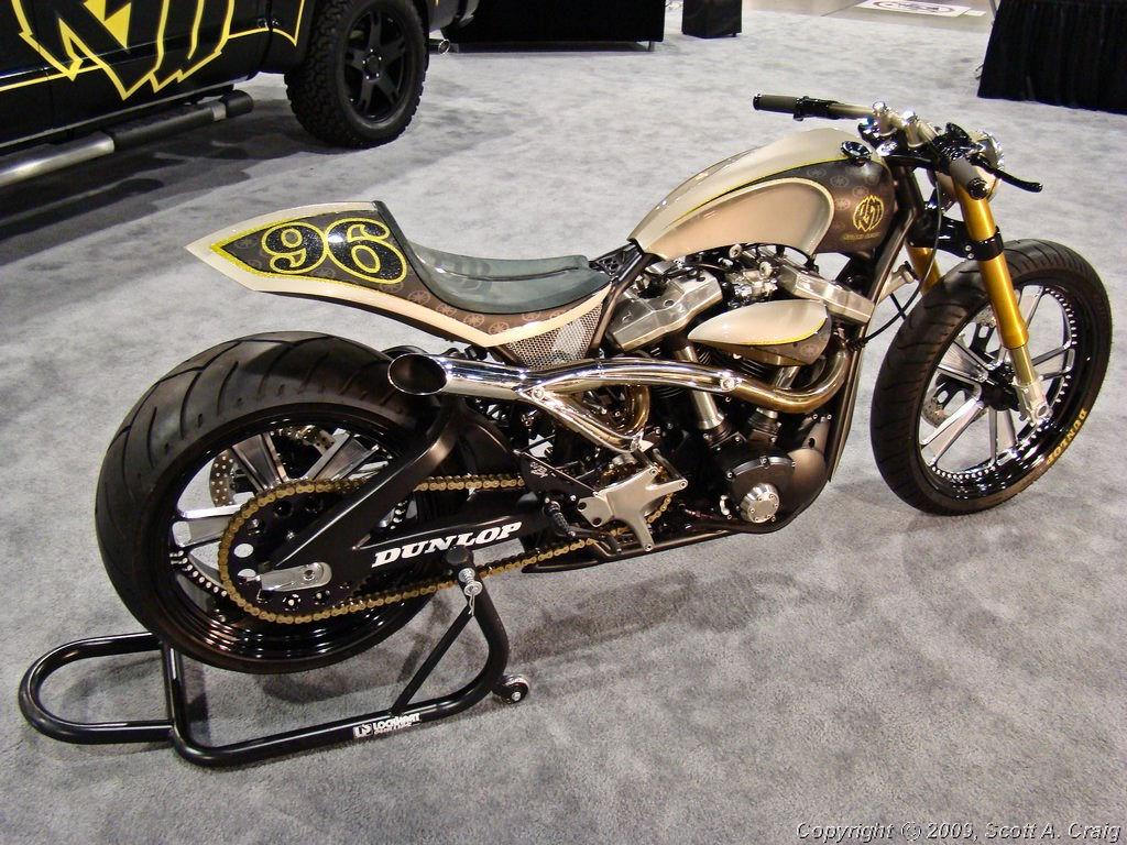
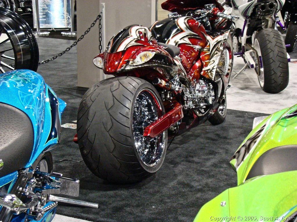
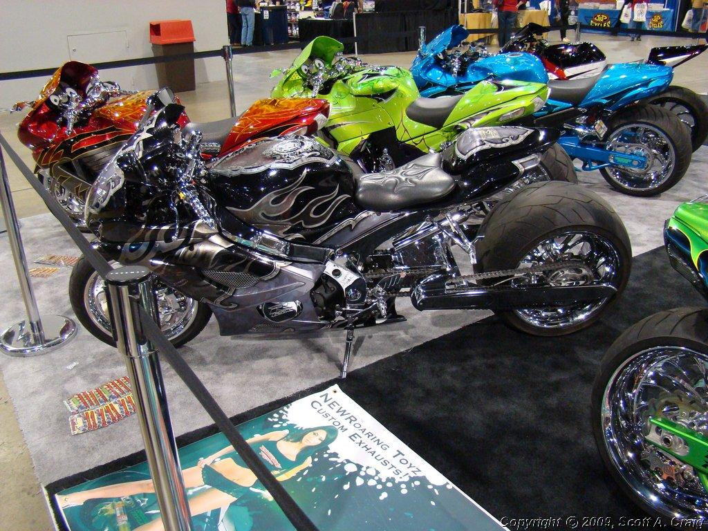
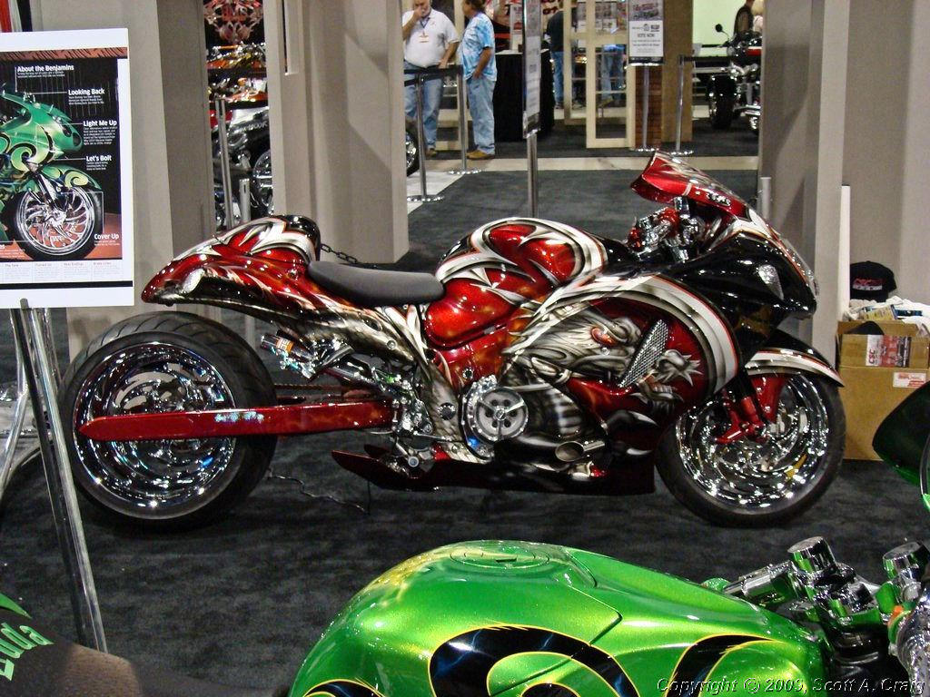
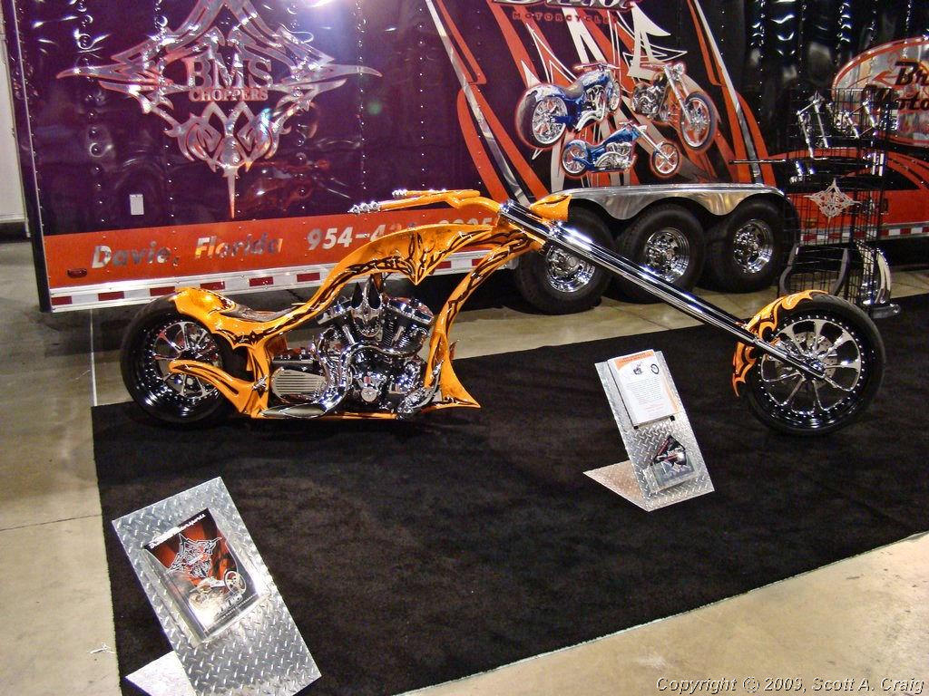
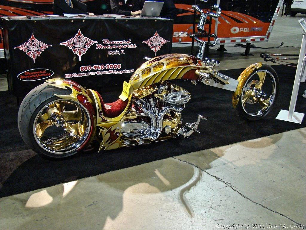
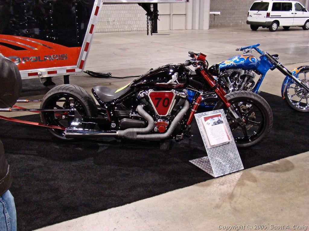
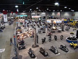
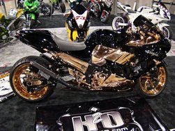
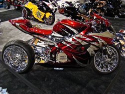
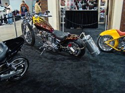
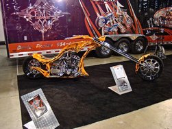
The show was good with all of the major motorcycle manufacturers showing off their 2008 models. All of the
big boys were there; Honda, Suzuki, Yamaha, Kawasaki, BMW, Harley-Davidson, Buell, and even Aprilia, Hyosung,
and a few others. There were booths set up by numerous distributors and a LOT of people there! It
was a lot of fun to see some of the new models and a lot of toys and riding gear in one place.
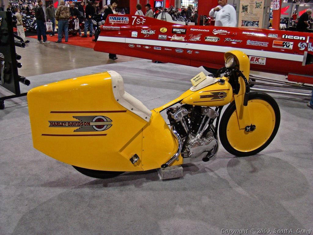
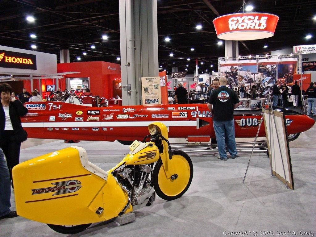
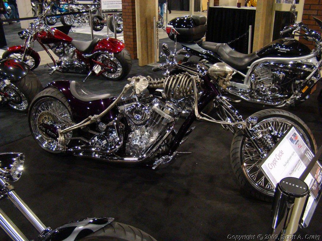
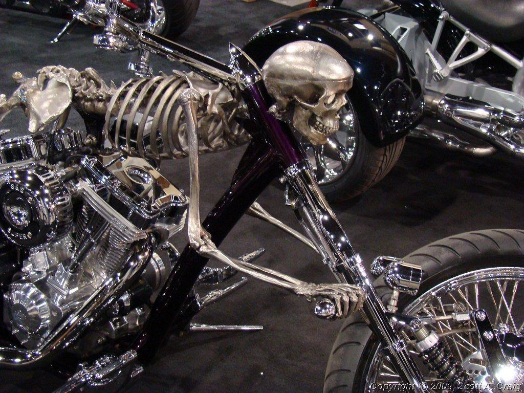
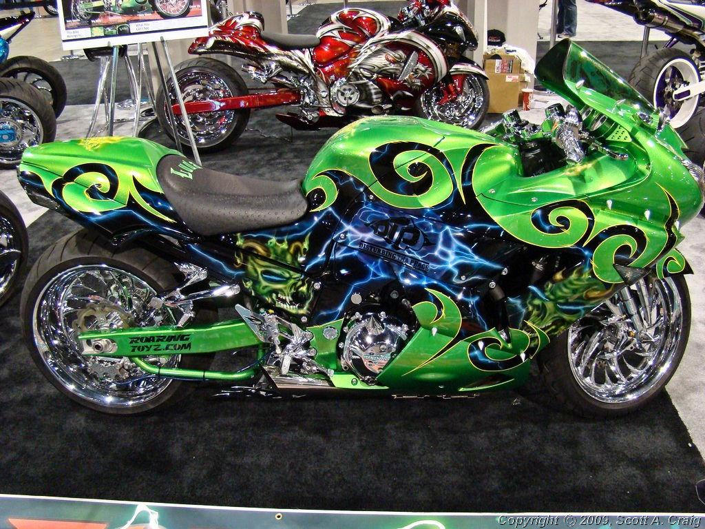
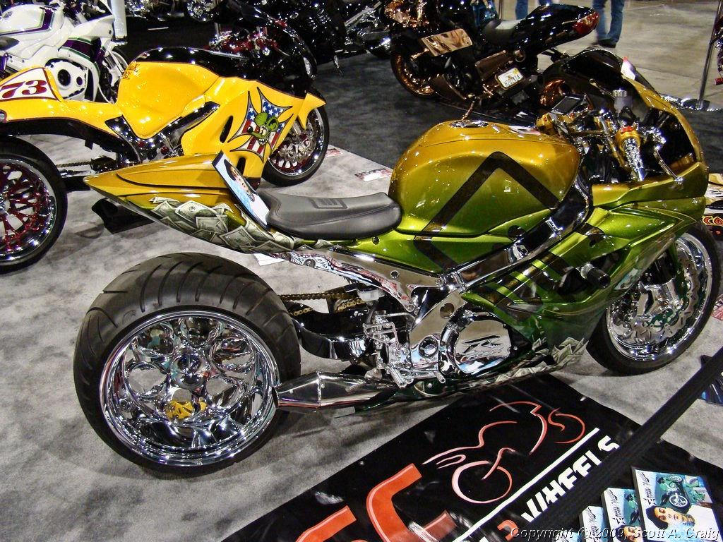
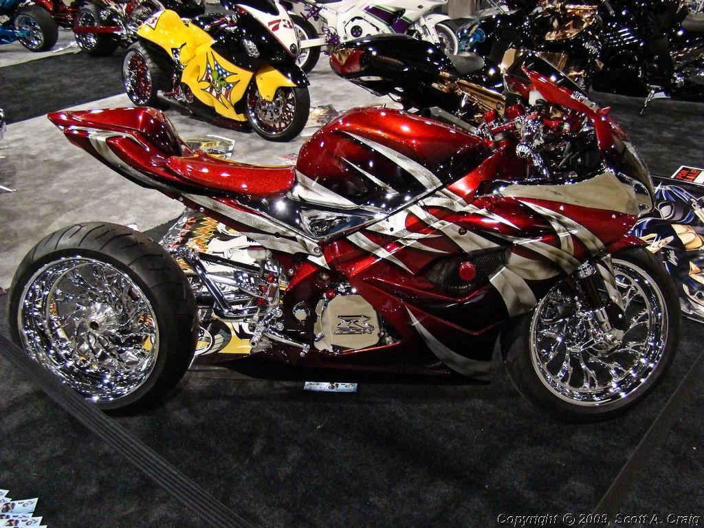
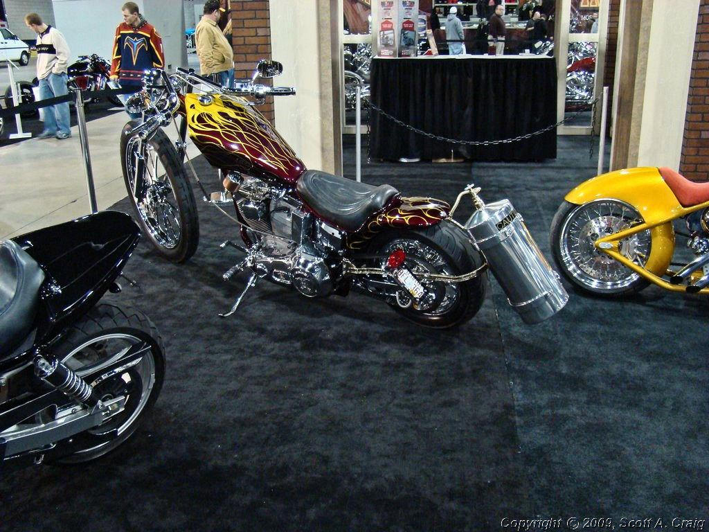
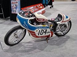
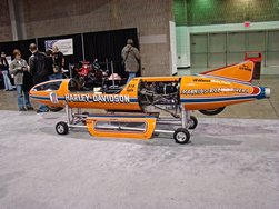
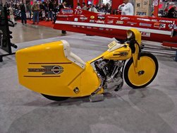
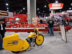
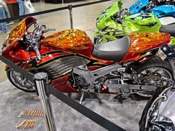
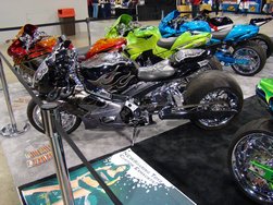
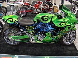
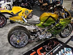
There were also a number of custom motorcycles, and that's where I took most of the photos. Most people who
would read this web site are familiar with the offerings from most of the manufacturers, but we don't get to see
the custom bikes very often. Photos are below, and as always clicking one of the smaller images will display
a larger photo.
|
|
 |
 |
 |
 |
 |
 |
 |
 |
 |
 |
 |
 |
 |
 |
 |
 |
 |
 |
 |
 |
 |
 |
 |
 |
 |
 |
 |
 |
 |
 |
 |
 |
 |
 |
 |
 |
|
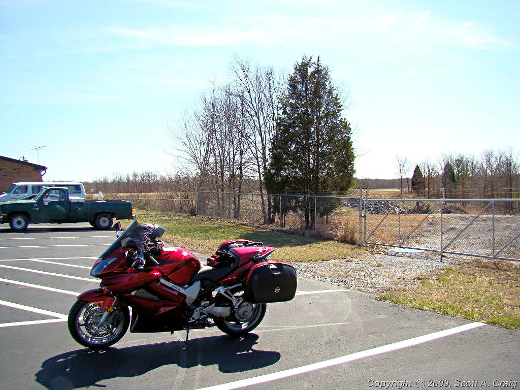
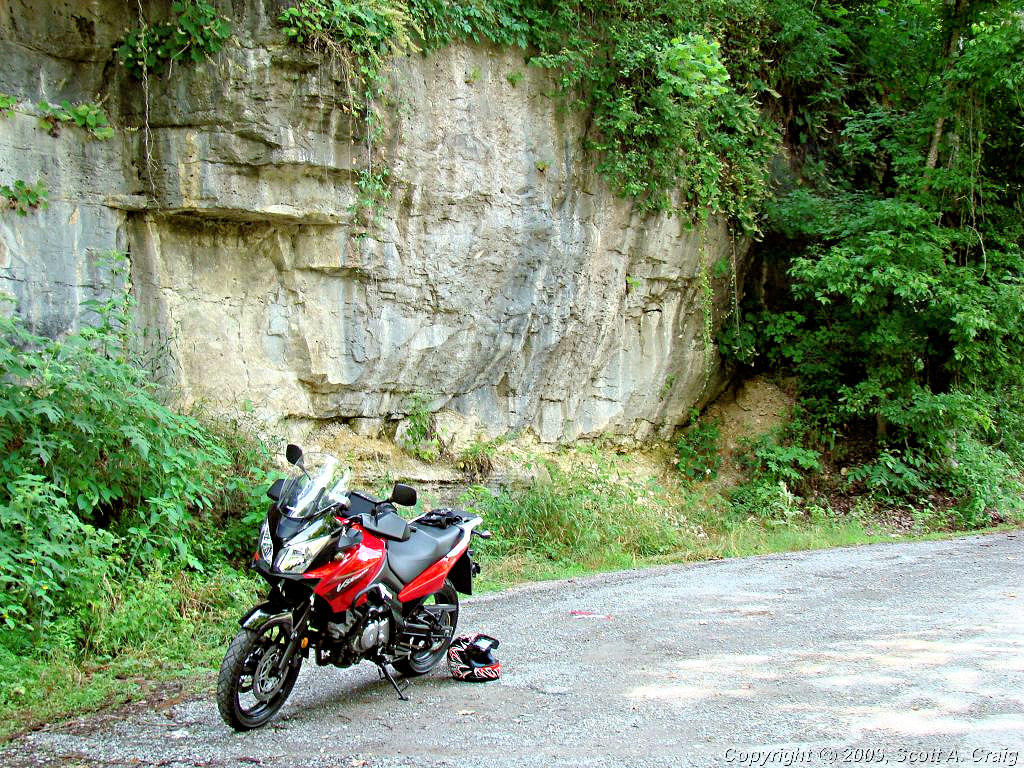
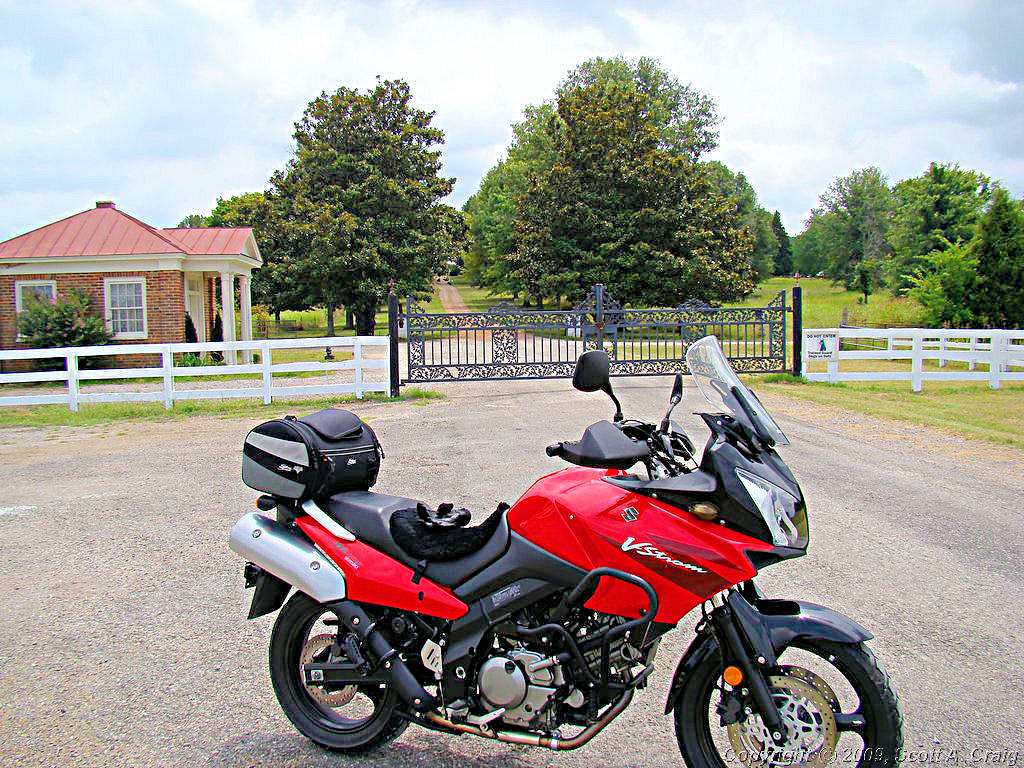
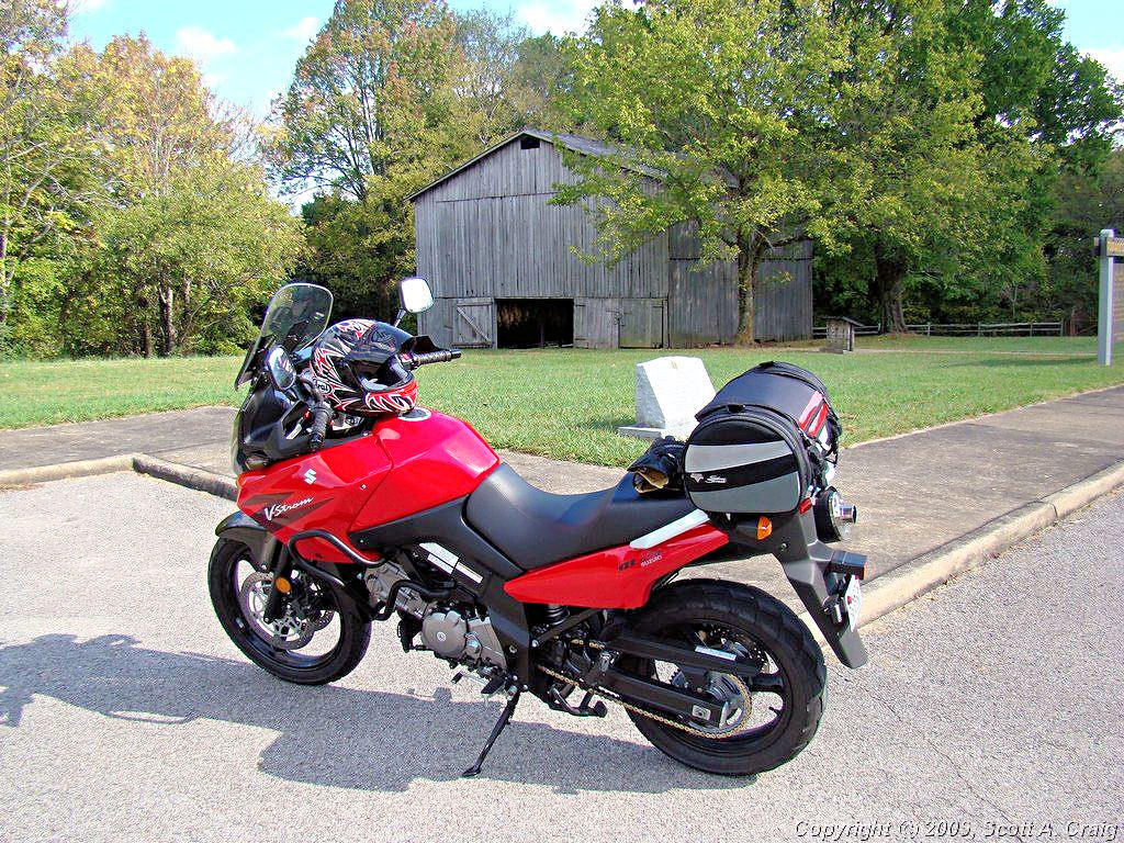
JUST OUT RIDING -- January 27, 2008 -- Suzuki DL650K6 |
|
Aaaaah! Boy did it feel good to get out and ride today! This past week has seen nightime
low temperatures in the low teens (as in 11°!) and daytime highs barely above freezing. Yesterday
was a bit better and today was almost "Nice". I got out of the house about 11:00 and it was about
40°. When I got home about 4:00 it was around 50°. I can almost handle that!
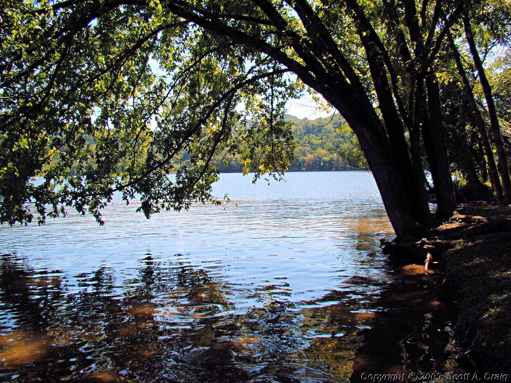
I rode over to Center Hill Lake and across the dam. Then on up Highway 96 to Interstate 40. From
there I rode up to Baxter, TN and back to Lebanon via Highway 70N. A hop alongside Percy Priest Lake
to I-24 and back home. About 175 miles round trip and it really, really felt good to get out and ride!
No photos today but the usual GPS track log is below.
|
|
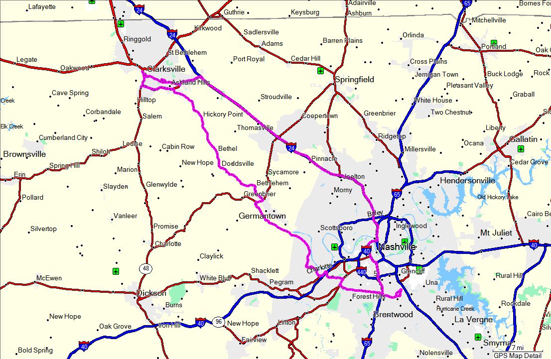
GPS Track Log - 01/27/2008 |
|
|
|
|
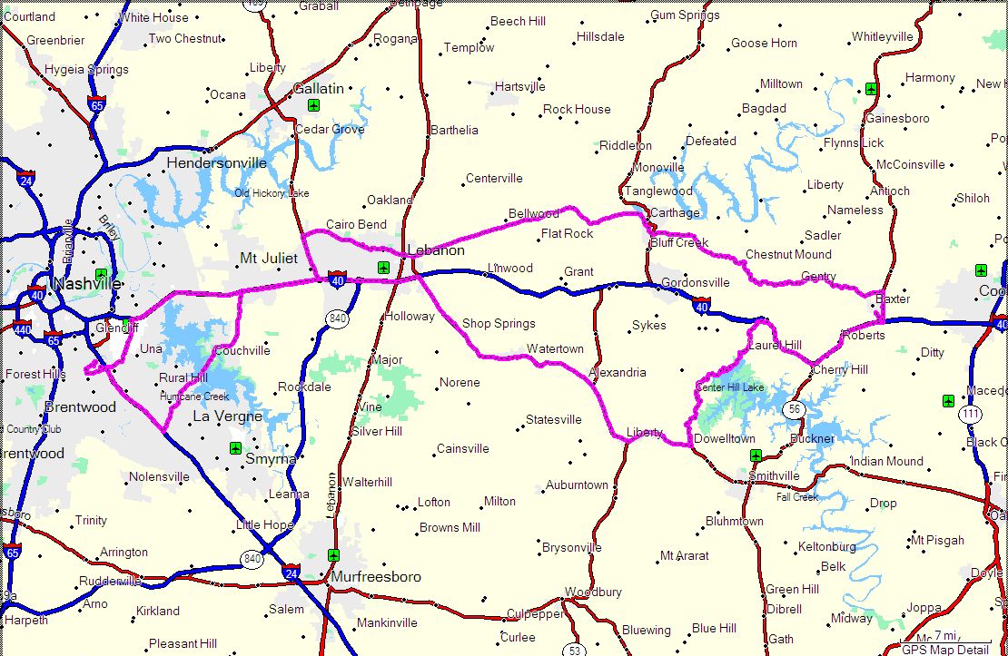
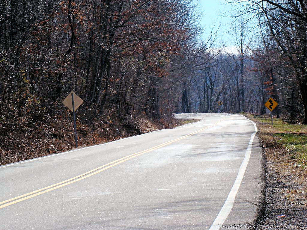
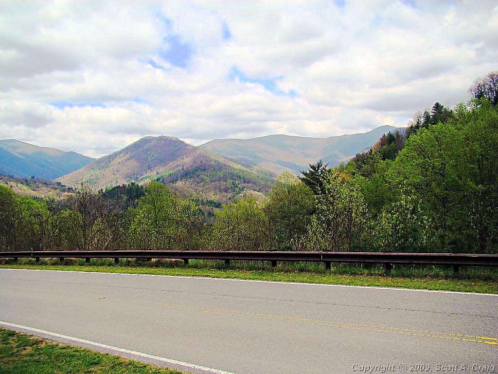
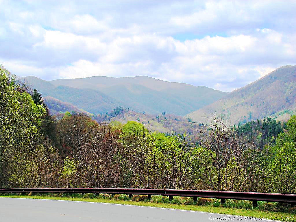
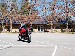
DAY RIDE -- February 2, 2008 -- Suzuki DL650K6 |
|
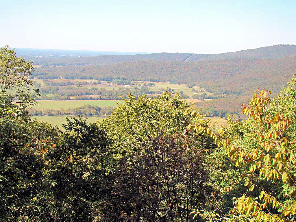
Too nice not to ride today! A little cool early and a good bit breezy, but it warmed up to 55° so
I had to get some miles in. In fact I put in about 215 of them.
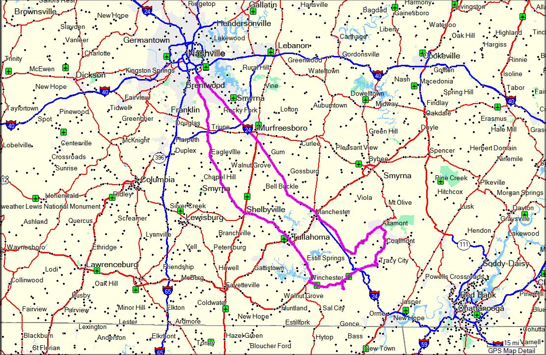
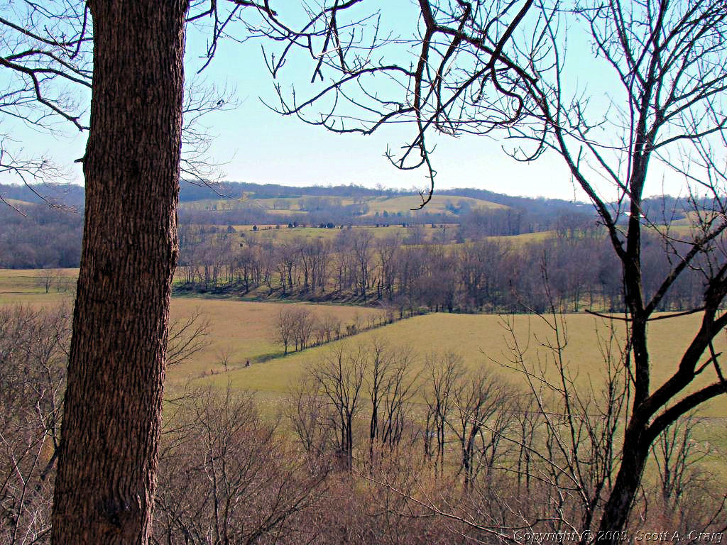
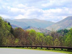
I left Nashville about 9:00 and headed east to Manchester, TN for some breakfast. After that it was over
to Monteagle, TN to see if there was any snow on the ground. We had flurries in Nashville yesterday and
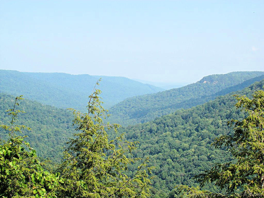
I thought there might be some in that area. No snow, but I found some great roads and some gorgeous
views of the hills.
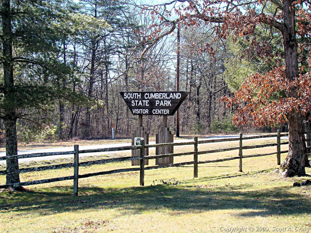
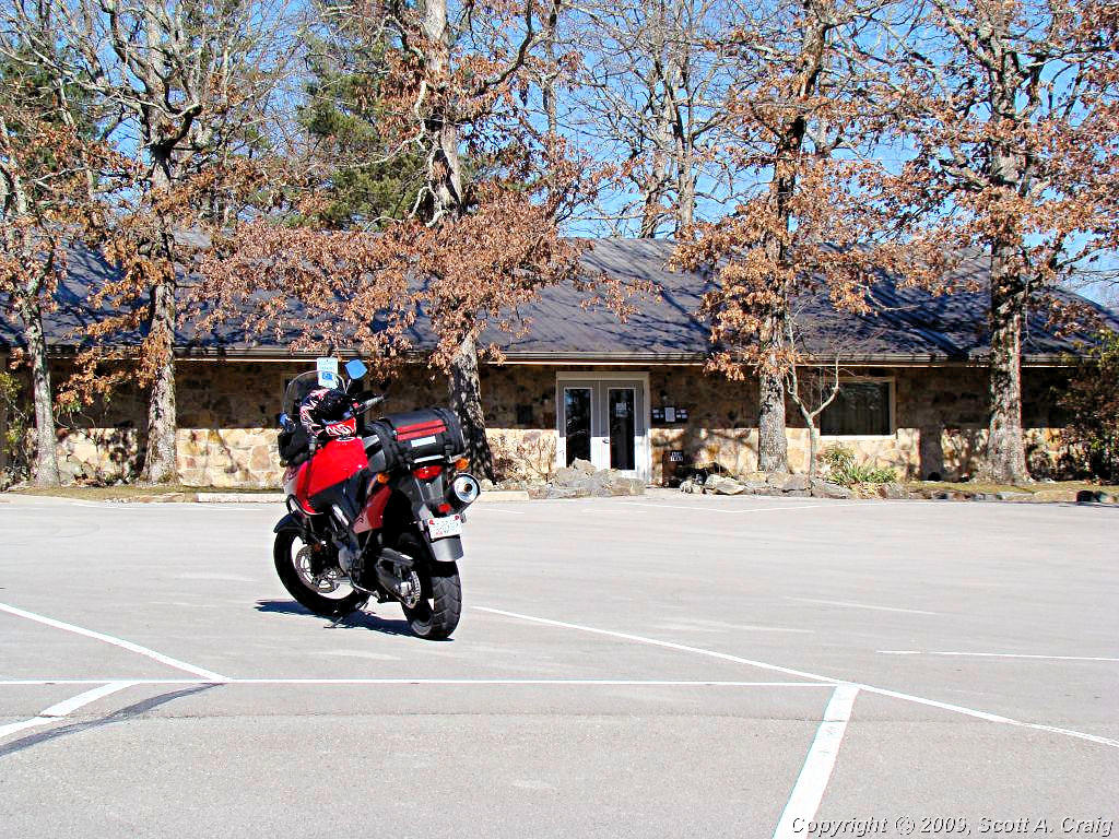
Needless to say the trip to Monteagle wasn't via the straight and narrow interstate either. From
Manchester I headed up Highway 41-A over to Highway 50 and then north to Altamont. From there down
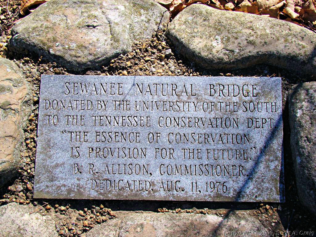
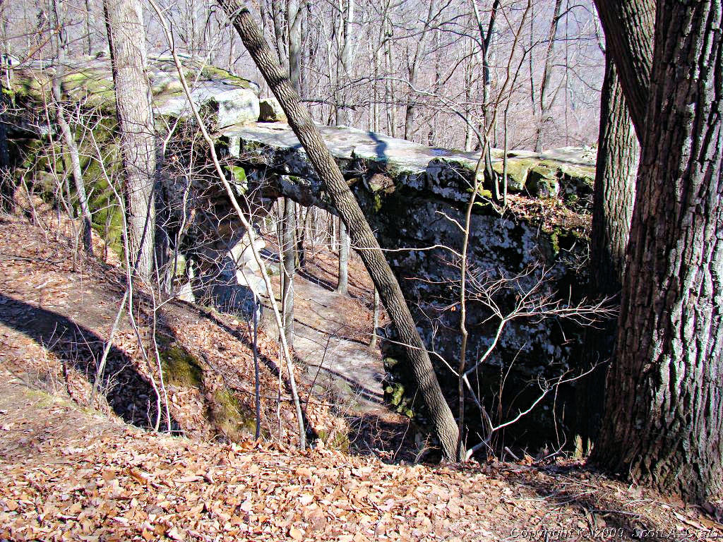
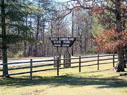
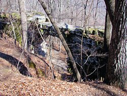
Highway 56 through Tracy City to Monteagle. I stopped at the South Cumberland State Park Visitor's Center
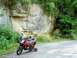
in Monteagle and the lady I talked to mentioned that there was a natural stone arch bridge in Sewanee, TN so
it only seemed natural to stop there for a couple of photos.
From Sewanee it was back to Nashville via Highway 41-A through Winchester, Tullahoma, Shelbyville, and
Nolensville. All told 215 miles door to door. I could have done without the wind but other
than that it was a perfect day to get out and ride some.
|
|
|
|
|
|

|
|
GPS Track Log - 02/02/2008 |
|
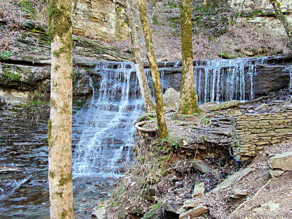
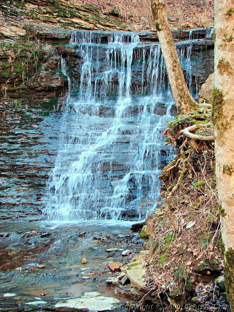
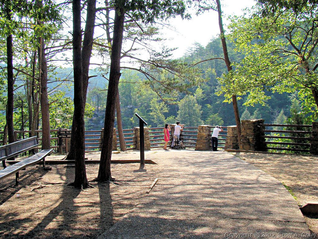
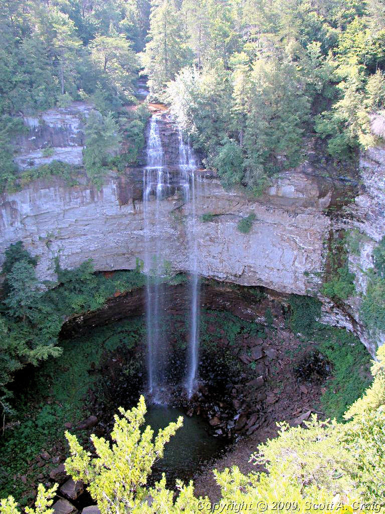
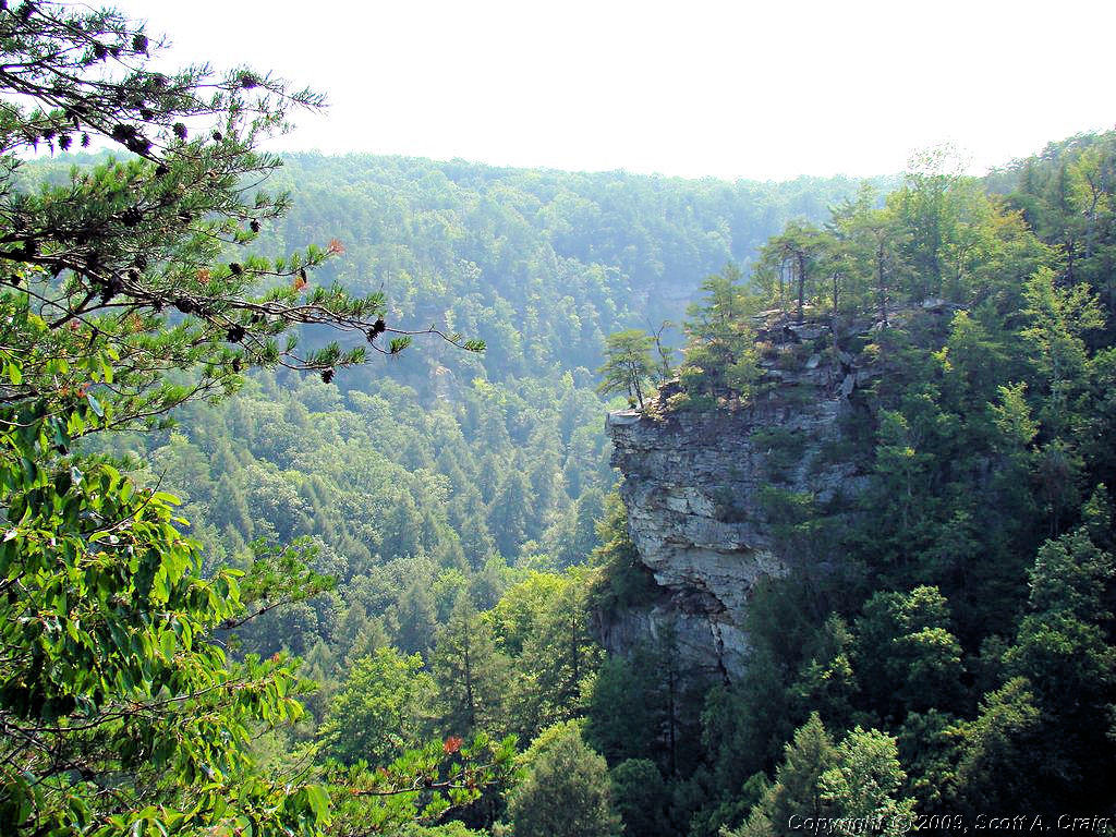
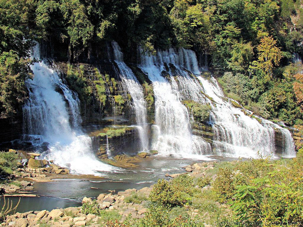
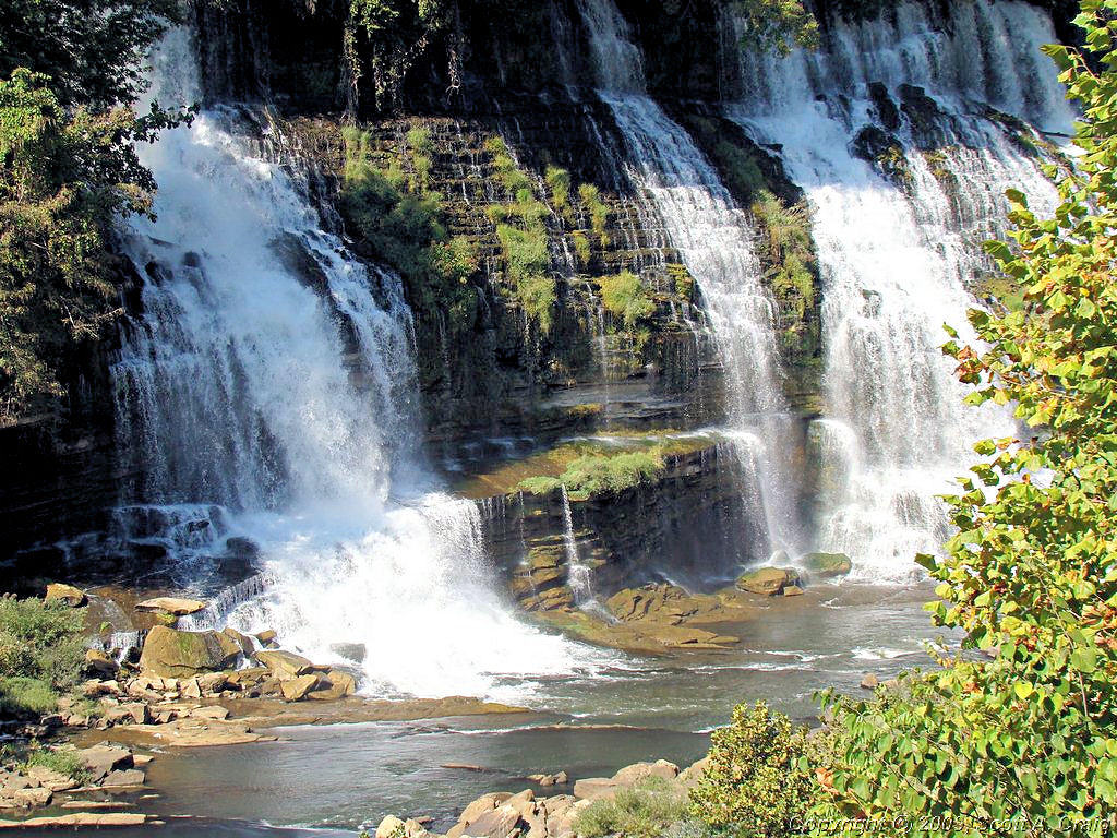
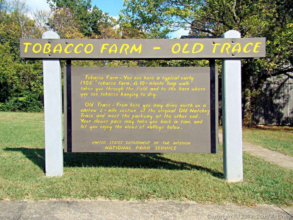
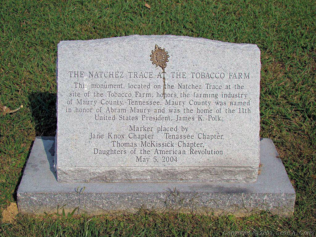
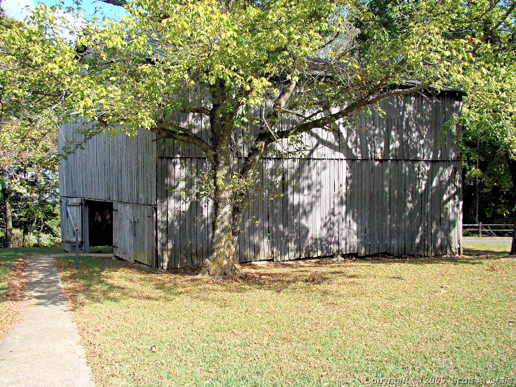
JACKSON FALLS - NATCHEZ TRACE PARKWAY - February 9, 2008
GPS Coordinates: N35.69687 W87.29396 -- Honda VFR800 |
|
Like last weekend today was just too nice not to ride today! A little cool early but it warmed up to 55° so
I had to get some miles in.
I left Nashville about 8:00 and stopped for some breakfast at a local Shoneys restaurant. I had no real destination
in mind and while I was eating I decided to ride down to Jackson Falls to see if there was some water there now. I
rode down there last summer (photos are
Here) and it was just a dry mudhole. Things were much nicer today as the photos below will bear out.
The Trace is always a good place to ride and today was no exception. Bright blue sky, decent temperature, and no
traffic to speak of. What more can one ask for?
|
|

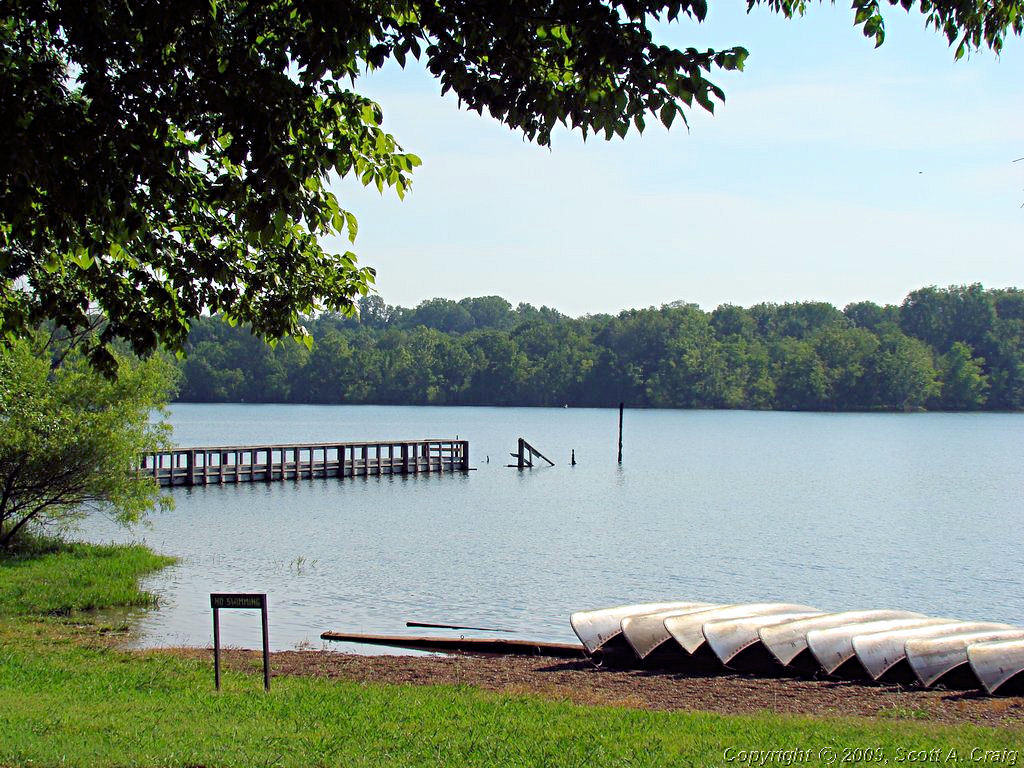
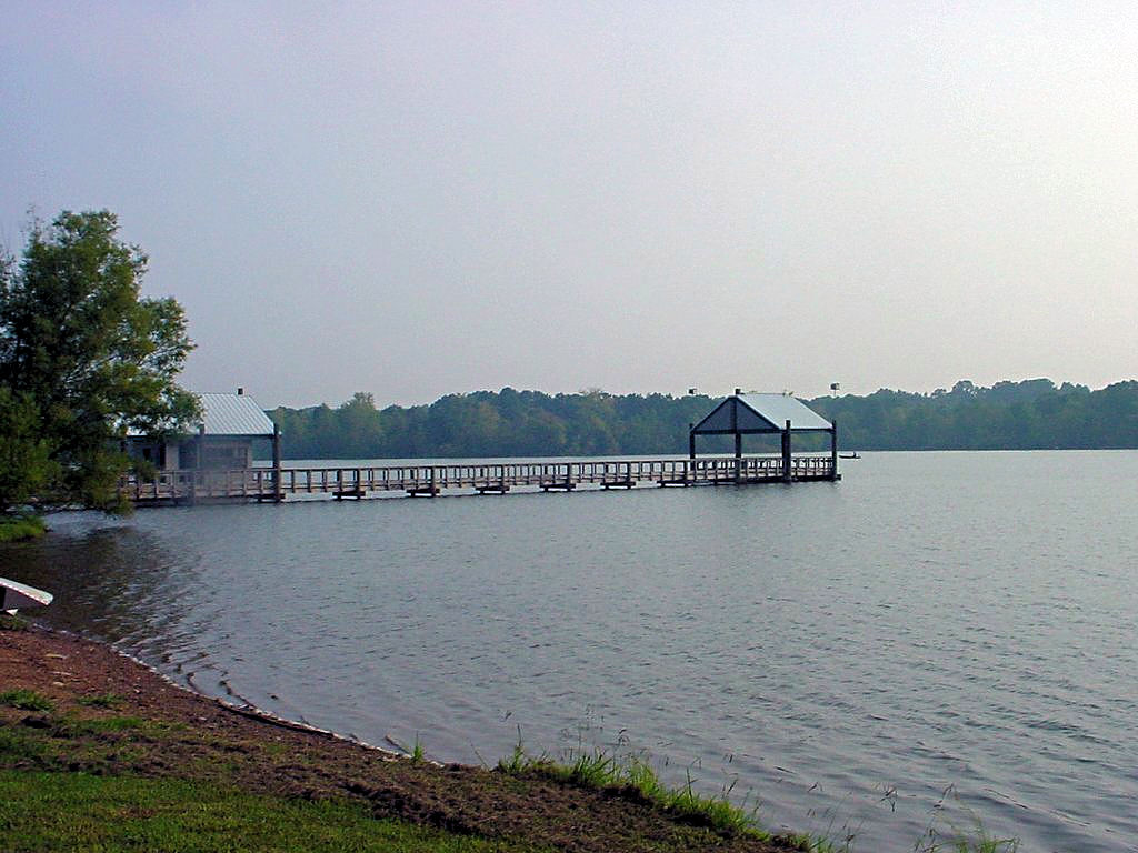
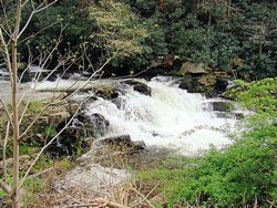
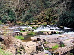
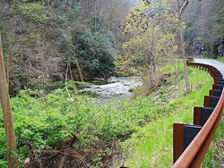
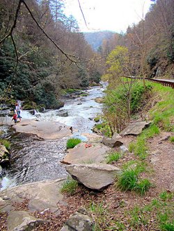
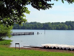
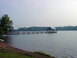
Looking East from the Jackson Falls Overlook |
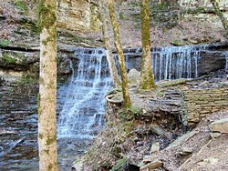
Jackson Falls on the Natchez Trace Parkway |
 |

GPS Track Log - 02/09/2008 |
|
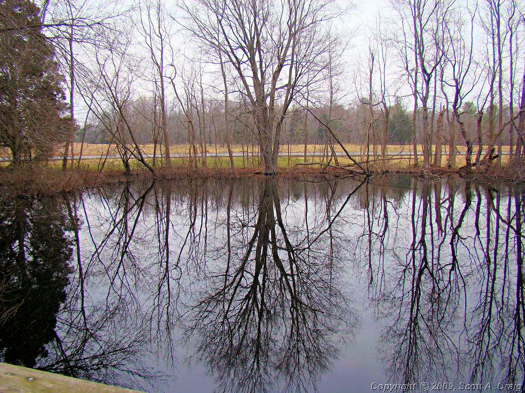
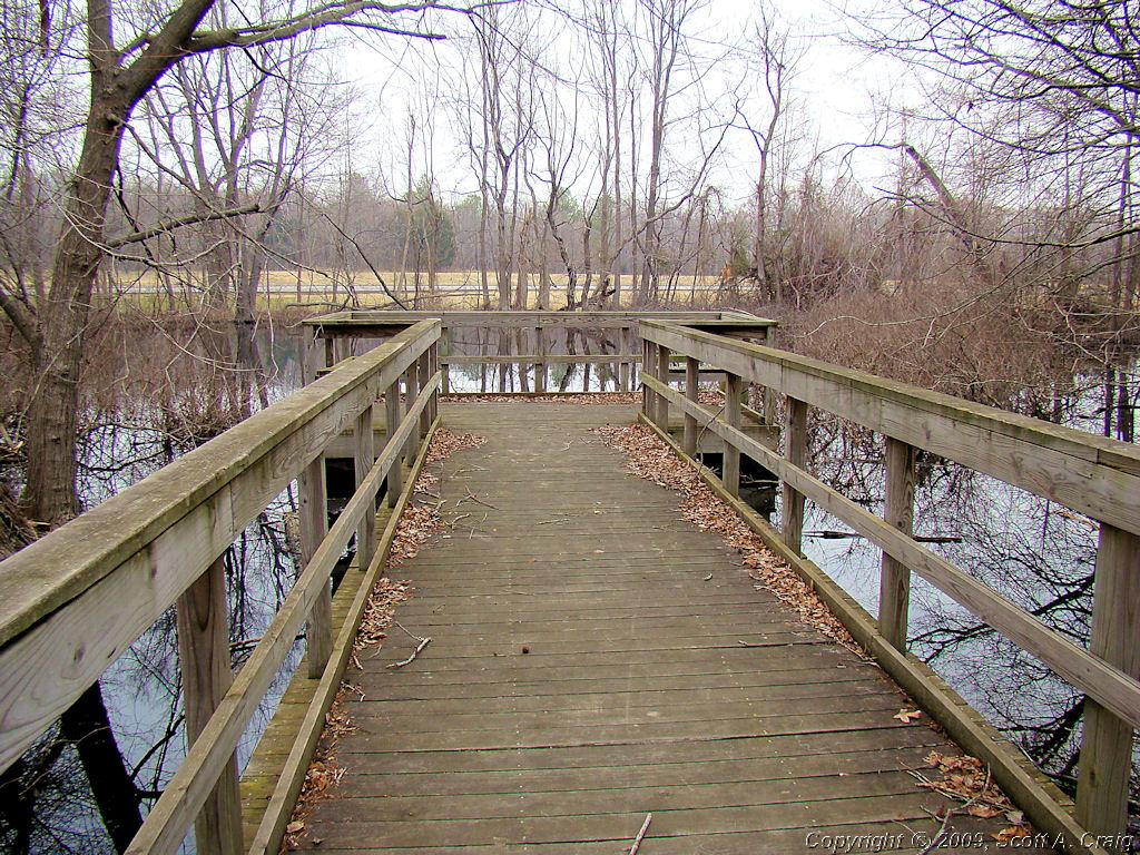
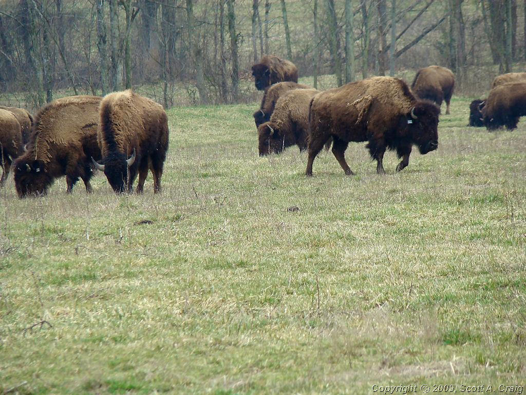
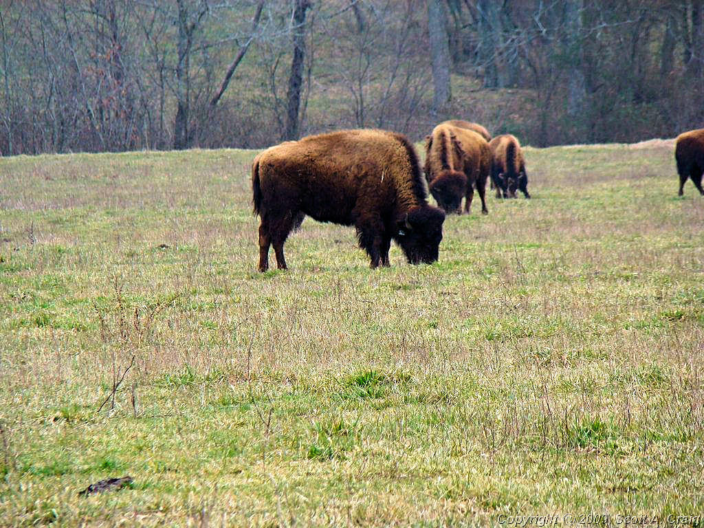
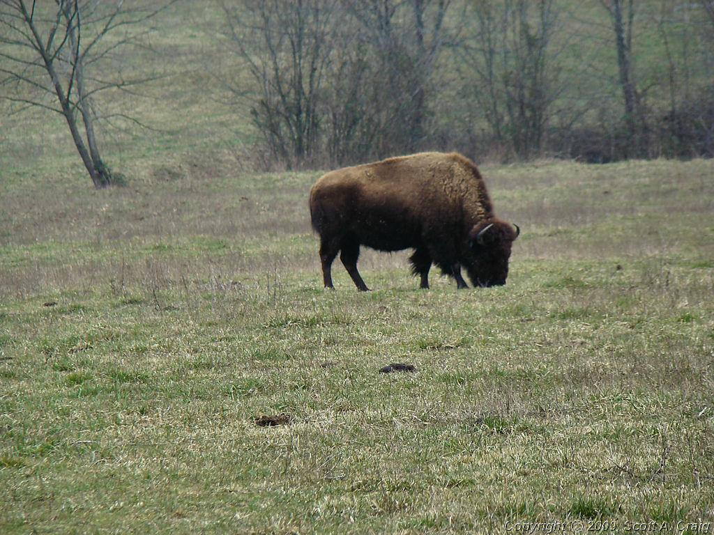
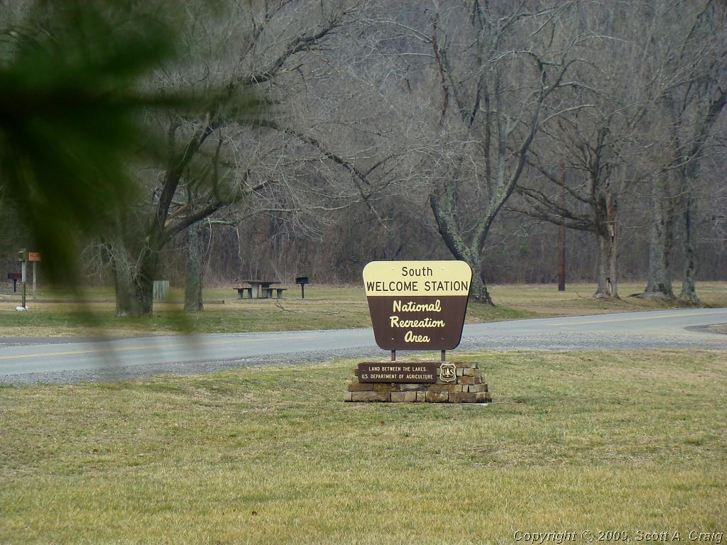
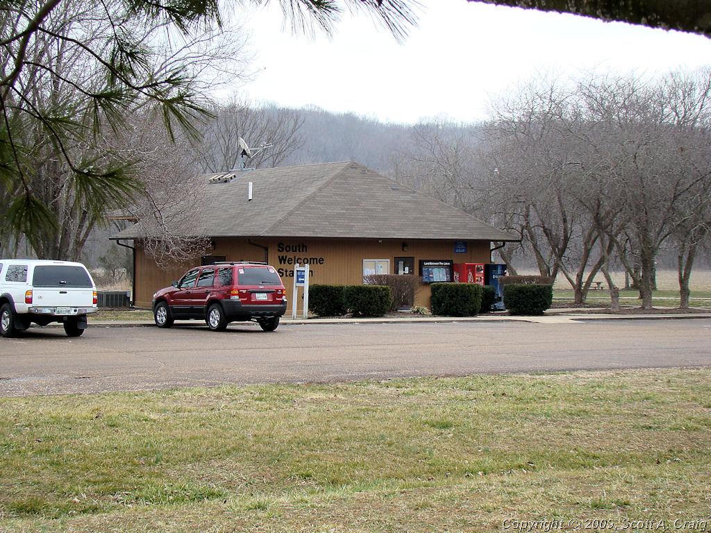
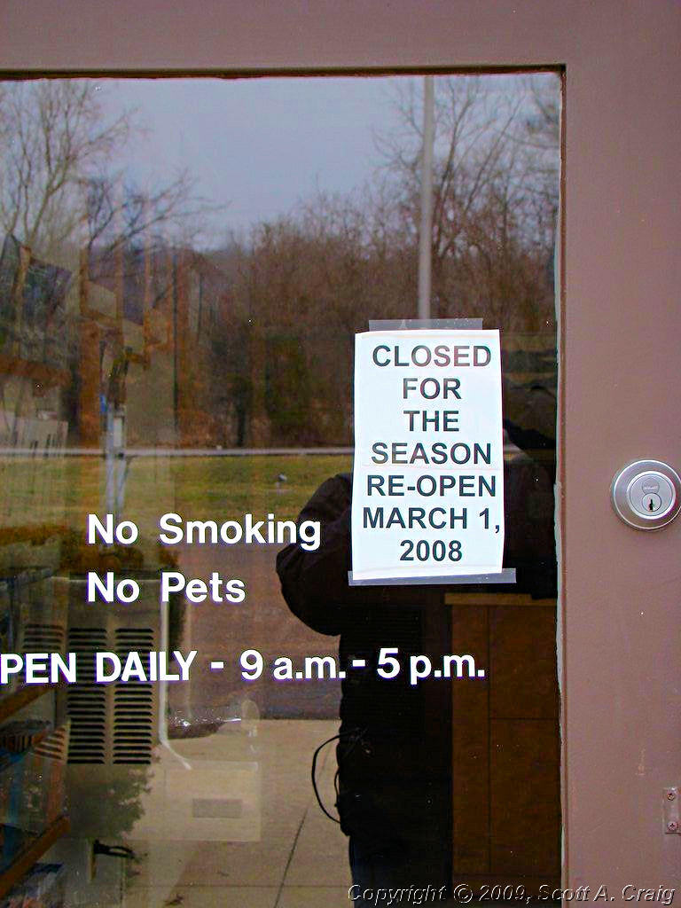
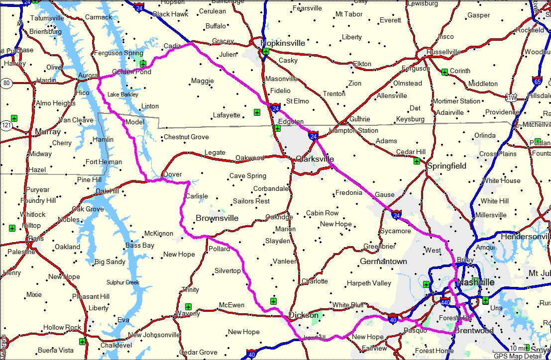
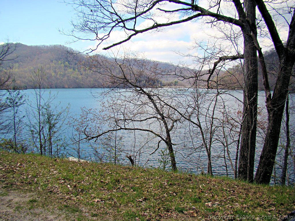
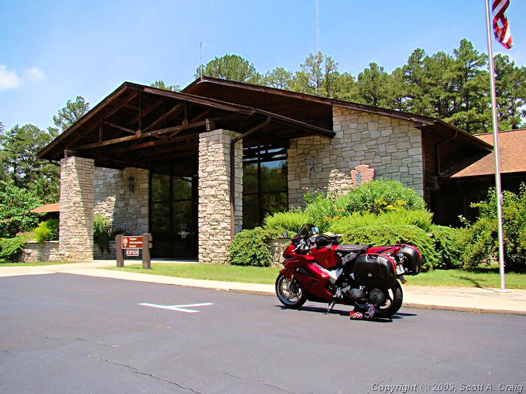
LAND BETWEEN THE LAKES - February 16, 2008 -- Suzuki DL650 |
|
It was "Supposed" to be nice today. Partly cloudy and a high of 53°. Sometimes things just don't quite
work out as planned!
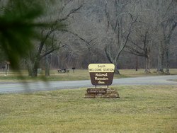
I headed out early for Land Between The Lakes National Recreation Area. I used
to spend some time there when I lived closer but haven't been back in many years. LBL is 170,000 acres of land
located between Kentucky Lake and Lake Barkley, crossing the Kentucky and Tennessee state line. The area is
completely undeveloped and there is not a single commercial establishment anywhere within the boundary of the
area. When you live in a large metropolitan city it is such a treat to be away from traffic, businesses, signs,
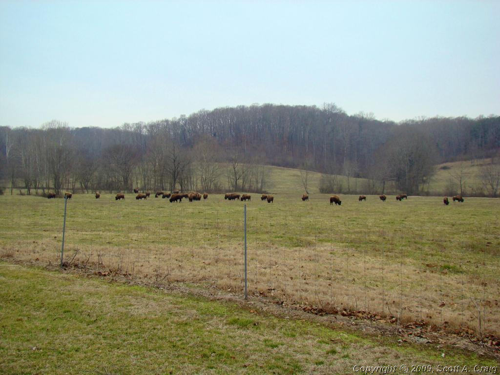
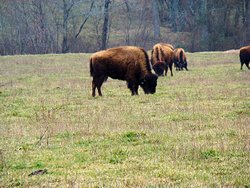
billboards, interstates, people, etc. LBL also has a large population of Elk and Bison that can be seen from
"The Trace". The Trace, not to be confused with the Natchez Trace Parkway, is a state highway that runs through
the area. It is a low-traffic highway and a great place to ride. The biggest problem are the deer which
are everywhere!
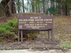
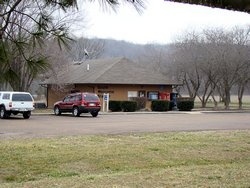
I stopped at the Golden Pond Visitor Center because I head been told that they have a dated stamp there that I could
add to my Passport Stamp collection and sure enough they
did. This Visitor Center is roughly in the center of the area, and I had planned to head north on The Trace to
view the Elk and Bison on the north side. But, as I said, plans change and I was COLD! Even though the
actual temperature there was much the same as in Nashville it felt much, much colder than 41° because of all the
lake moisture around. It was also sprinkling rain and I didn't want to push my luck. I didn't know at the
time that it was 41°, all I knew was that it felt much colder than Nashville and I was concerned about it being
close to freezing.
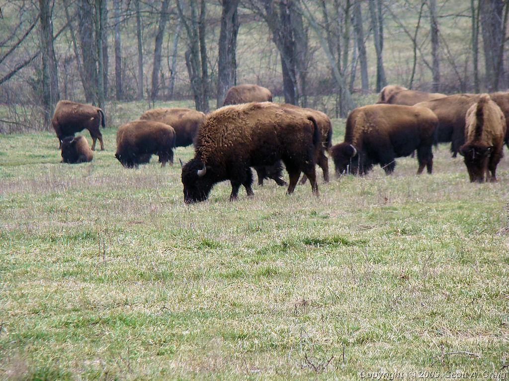
I was surprised to find that there were Bison ranges on the south end as well, and even more surprised to see a small
heard of them garzing beside the road. I had to stop and take a few photos of them since that isn't something
that I get to see every day. Photos of these huge monsters are below. The cold didn't seem to bother
them at all, but they appear to have pretty good fur coats to!
It was 39° when I left Nashville and I was actually comfortable heading northwest on I-24. That changed as I
got closer to LBL though. I was grateful for my Gerbing heated gloves, and almost wished I had brought my heated
socks (which I consider to be the ultimate source of pain in the universe. I'd rather be cold than put those
bear traps on my feet!). A few miles down The Trace it started to warm up though and by the time I got to the
south end at Dover, TN it was nice and warm again.
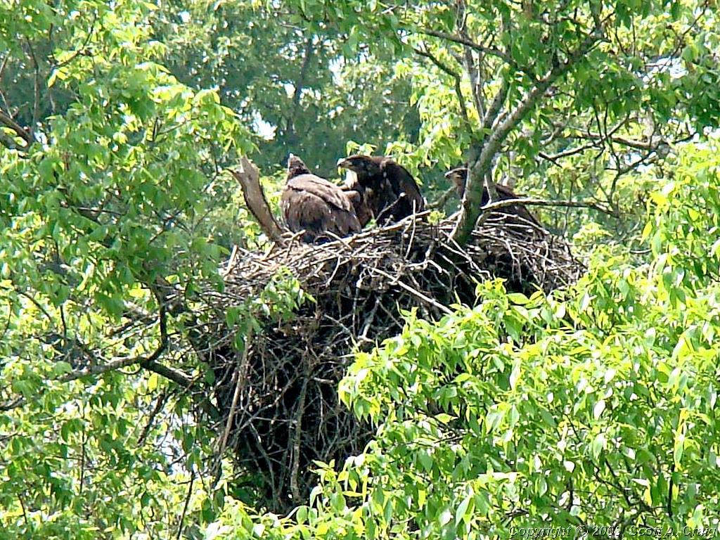
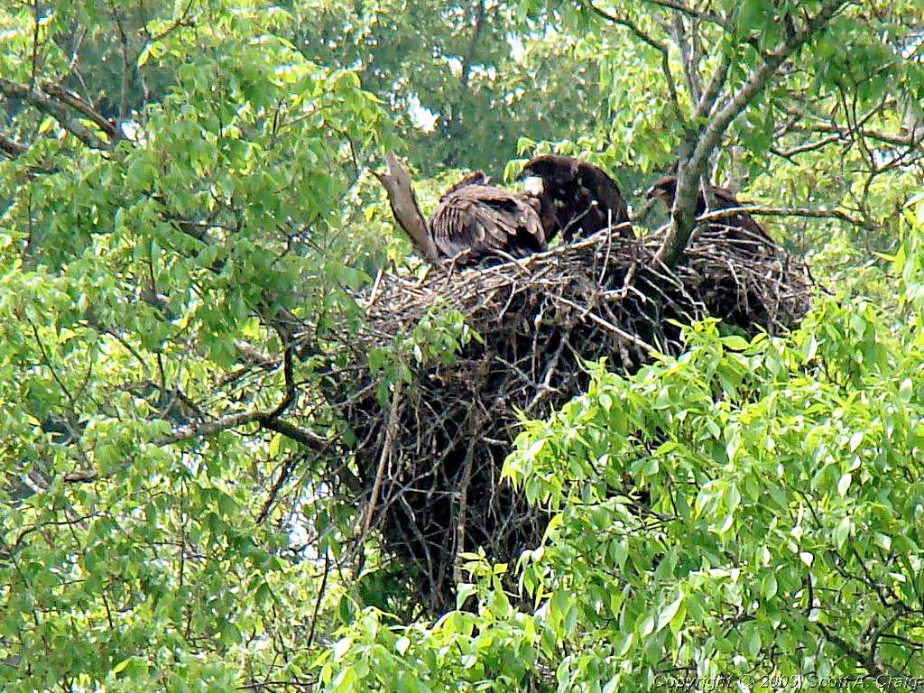
I stopped at Ft. Donelson to see if the eagles were around (I was told by a Ranger that they were nesting at this time)
and lo and behold they had a new Passport Stamp that I hadn't gotten the last time I was there. I didn't see the
eagles but I scored another stamp so it was worth the stop.
All in all a good ride. Cold up north for a while but other than that a great ride. 237 more miles on the
odometer and a visit to places I haven't seen in a long while.
|
|
 |
 |
 |
 |
 |
 |
 |
 |
 |
 |
 |
 |
 |
 |

GPS Track Log - 02/16/2008 |
|
|
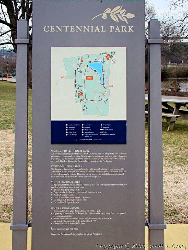
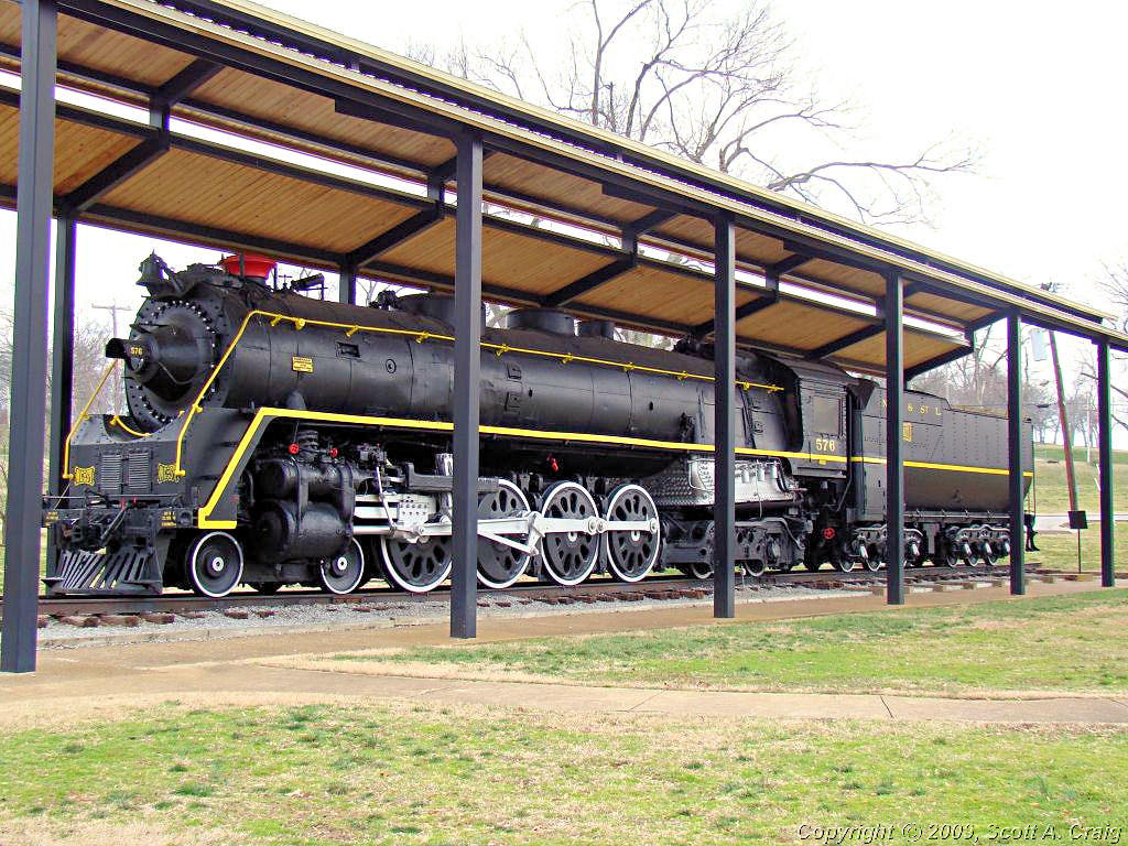
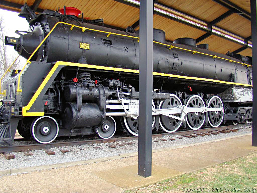
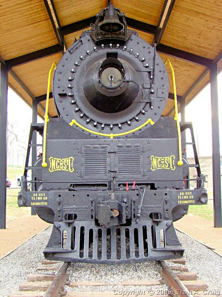
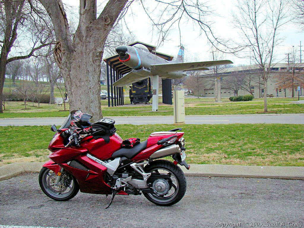
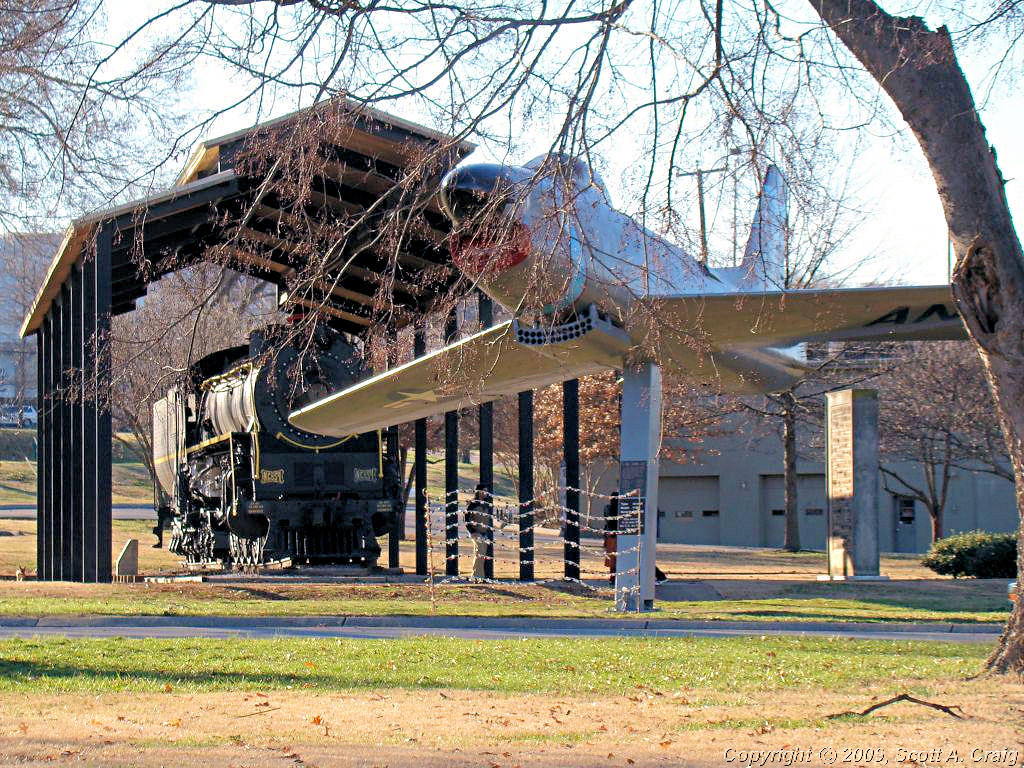
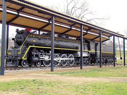
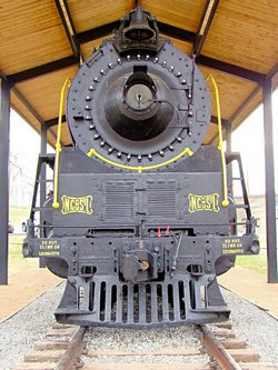
ANOTHER GLOOMY WEEKEND - FEBRUARY 23 & 24, 2008 -- Honda VFR800 |
|
Yet another gloomy weekend. You'd think I would be getting used to these by now. All I can remember
for the past few weeks is clouds, rain, and cold weather. I can usually deal with the cold OK but when it's
cloudy and damp the cold goes right through all of my heavy winter gear. At least this is the last weekend
in February and things should start to look up a little bit now.
Centennial Park - 02/23/08
Planes, Trains, and, well, "Bikes", I guess. Sorry, no automobiles. I was going to ride to Clarksville
today but when I got up there was a little snow on the ground and it was 30°. I don't mind riding when it's
cold but I draw the line at snow. So, I drove to Clarksville. The roads were dry but sometimes I just
don't trust the weather around here in the winter. It's always a bit colder in Clarksville than in Nashville so
I just didn't want to take the chance. When I got back home it had warmed up a little so I decided to ride
somewhere. As a "Trip" this one is a complete flop since it was only 22 miles door to door, but since these were
the first miles I've put on a bike this week it felt good to get out some. Besides, I have a new Metzeler Z6 on
the rear of my VFR that needed a couple of heat cycles put into it.
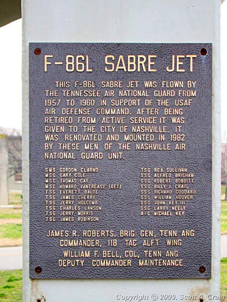
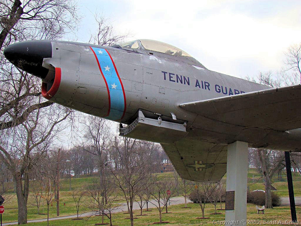
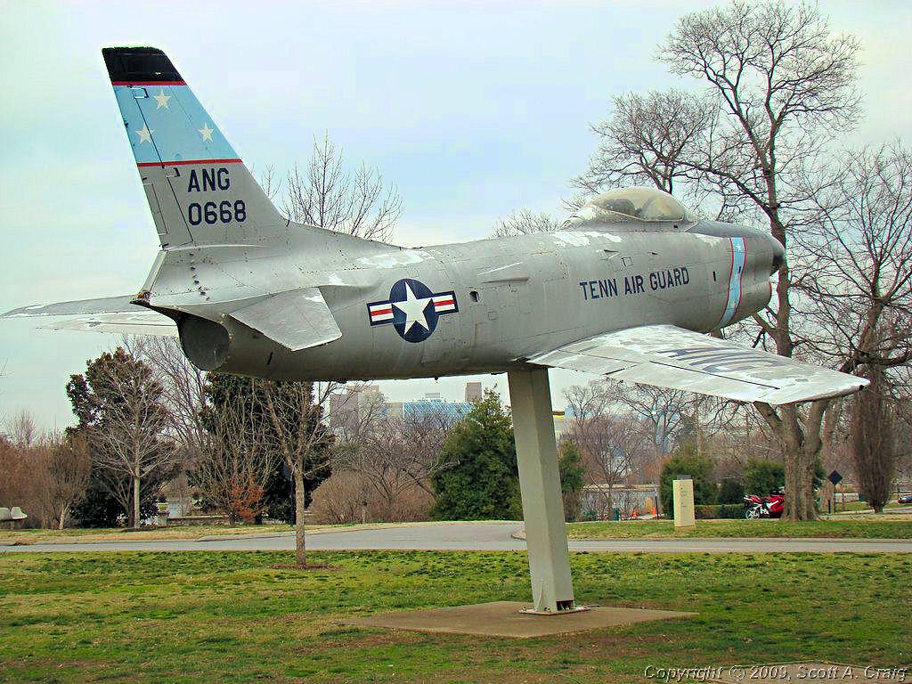
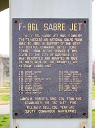
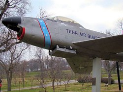
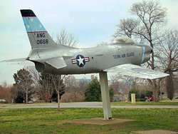
I rode to Centennial Park just outside downtown Nashville to take a few photos of the North American F-86L that I knew
was on display there (GPS coordinates: N36.15056 W86.81566). It was cloudy, damp, and cool (about 37°) or in
other words a lousy day to do anything. The photos below show a few breaks in the clouds but they didn't last long.
Oh well, at least I got a few miles in. Next week looks a little bit better but not a whole lot. I'll sure be
glad when spring gets here, I am tired of cold weather and gray skies.
Natchez Trace Parkway - 02/24/08
Well as usual the weather guessers completely missed today. The forecast was for 52° and I
think it topped out at 42° They started with a 60% chance of rain and then went to a 30% chance of rain. 52°
with a slight chance of rain is good enough for me so I headed out. It was 39° when I left and I kept telling
myself, "It's gonna get warmer ... it's gonna get warmer ... it's gonna get warmer." Then I changed to, "That's not
rain on my face shield ... that's not rain on my face shield ... that's not rain on my face shield." I finally
quit kidding myself. "It is in fact 39° and isn't going to get much warmer and it is raining all over
me. I'm cold, I'm wet, and I'm going back home." I need a good "Disgusted Smilie" because I am disgusted with
this weather and I'm not a real big fan of weather guessers right now. The forecast for tomorrow is 59° with a 20%
chance of rain. That means it will probably be sleeting when I head home from work ;(
I rode down the Natchez Trace Parkway to scuff in the new Metzeler Z6 on my VFR, and admittedly I did get about 50 miles
on it before the rain started up. It was cold though! The kind of damp cold that this part of the country is
known for in the winter. When it started raining I was about 35 miles from home and ready to be someplace warm for
a while. I finally got home and sucked down a couple of cups of hot chocolate and got my blood trudging around the
arteries again. Oh well, as I keep telling myself .. Spring is coming!
|
|
 |
 |
 |
 |
 |
 |
 |
 |
 |
 |
 |
 |
|
EAST AND WEST - MARCH 1 & 2, 2008 - HONDA VFR800 |
|
Finally! A decent weekend is in the works! Cloudless skies and decent temperatures for a change, and I
really needed some. I was really getting tired of gray skies, rain, and cold. With a bit of luck this
weekend will be a 2-parter 'cause I plan on hitting the road both days!
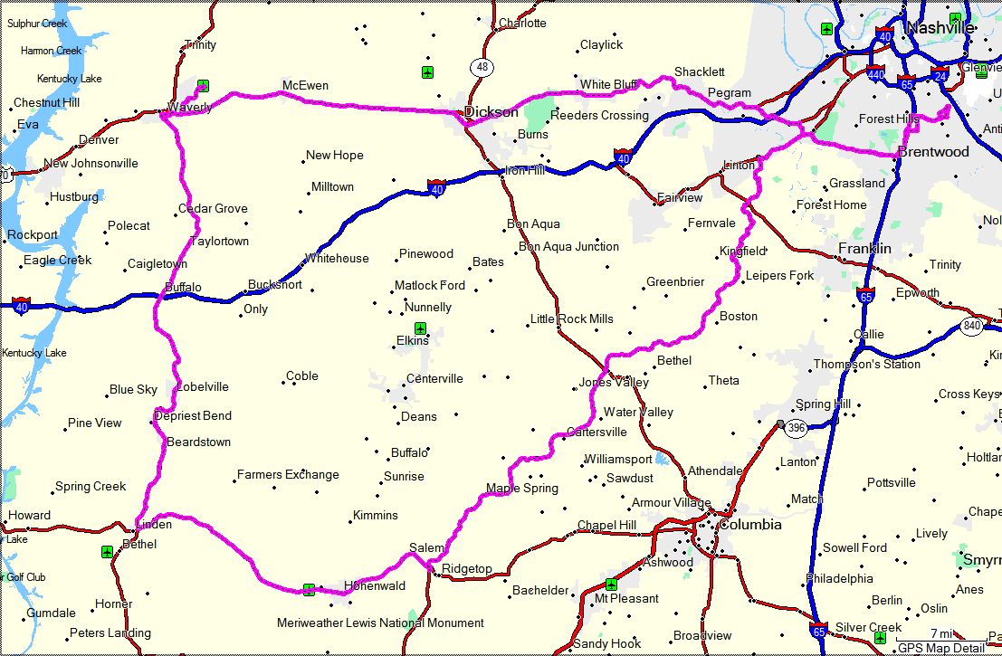
PART I - Saturday, March 1, 2008
The VFR and I headed west today. I didn't really have a destination in mind when I left home, so I just
headed west. I stopped for some breakfast near the interstate and thought I might head west. Just
riding down the slab didn't seem like much fun so I headed west on Highway 70. When I got to Dickson, TN
I decided to head for Waverly, TN since I have been wanting to get by the airport there for a couple of years.
The engineering company I used to work for designed a runway and taxiway improvement for them and I did a lot
of the design. I changed companies while the project was under construction and never got to see what it
looked like when it was finished. That's one more of the places I wanted to visit on a bike off the
list. It's getting pretty bare now since I've manage to hit most of them. Guess I'll have to add a
few more new ones.
I took Highwy 70 all the way to Waverly. Coming back to Nashville I took Highway 13 south to Linden
and picked up Highway 412 east to Hohenwald. There I picked up the Natchez Trace Parkway about 75 miles
south of Nashville and rode it up to the northern end. Finally a run down Highway 100 back home. All
told about 212 miles in absolutely perfect weather for a change!
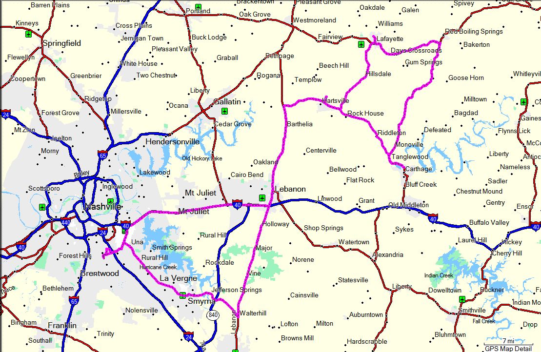
PART II - Sunday, March 2, 2008
I was invited to ride with a friend from the
VFR World forum so I took him up on it. I met him in Lebanon at noon and we rode to Hartsville to meet
up with a couple of his other friends. His friends brought some other friends and by the time we left there
were a dozen bikes. Big groups are normally not the way I ride, but this was a lot of fun and I had a great
time. I appreciate the invitation and look forward to doing it again!
Other than the wind, which was pretty stiff, the weather was great! It topped out at about 74° and I
didn't see a cloud anywhere. Great weather and a great day of riding. What more could one ask for?
|
|
 |
 |
GPS Track Log - 03/01/2008 |
GPS Track Log - 03/02/2008 |
|
I AM SICK OF WINTER! - MARCH 8 & 9, 2008 |
|
Doesn't look like there will be much riding this weekend! As I write this on Friday night it is a
blizzard outside. The forecast is for 3" to 6" of snow tonight and tomorrow so it's pretty unlikely
that either bike is going to get out of the house this weekend. After tomorrow it warms up to the
50's again so I might get a few miles in on Sunday. Just have to wait and see I guess. The
long-range forecast for next weekend is rainy and warm but that will certainly change between now and
then. Hopefully the warm part will stay and the rainy part will go away.
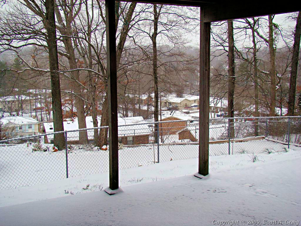
Update - 03/08/08 - We got between 2" & 3" of the white stuff. The sun came out about mid morning and the streets
cleared off and dried up but it stayed pretty cold all day. I did go for a short "Ride", about 1 foot out of my
basement. That was just to say I have "Ridden" on snow ;) The basement door is partially covered by my deck
above so there was less than 1/4" of snow there.
Update - 03/09/08 - I did get out and ride a little today. It warmed up to about 52° so it felt pretty
decent. I just rode down the Natchez Trace Parkway a little (as in about 40 miles) and got some fresh
air. As can be seen by the photos in the second row the snow was pretty much gone by today. There was
some on the east side of the road and hills where it doesn't get a lot of sunshine but not a lot.
|
|
 |
 |
 |
 |
 |
 |
 |
|
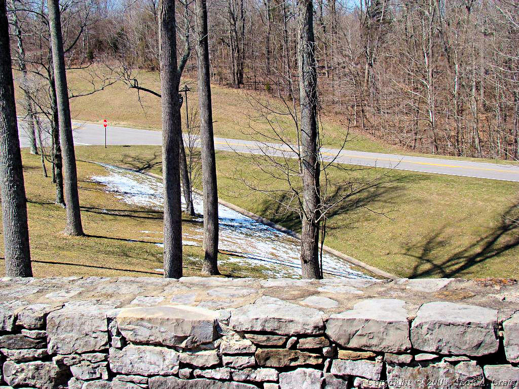
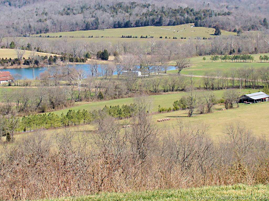
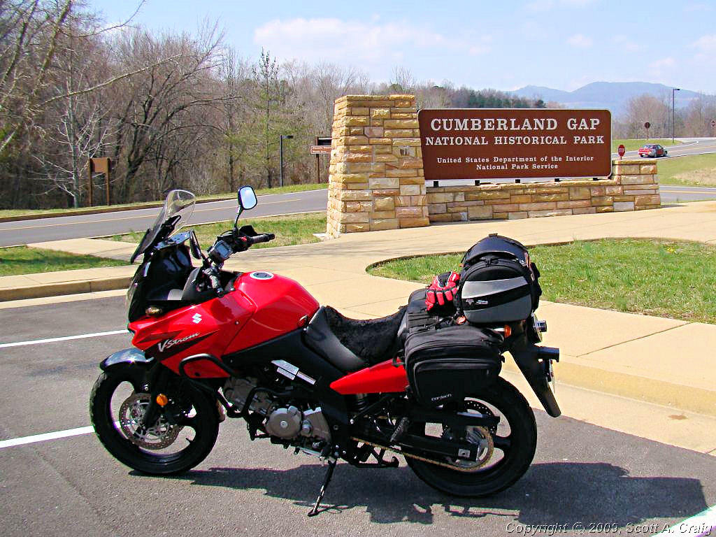
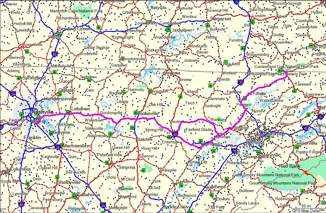
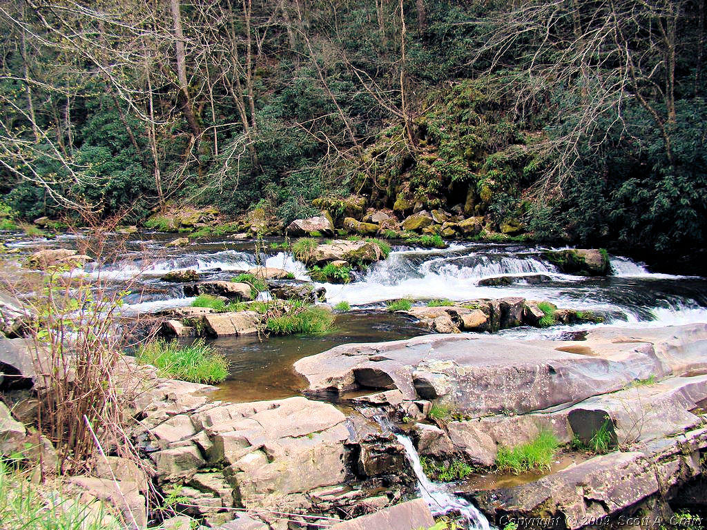
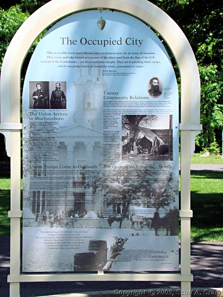
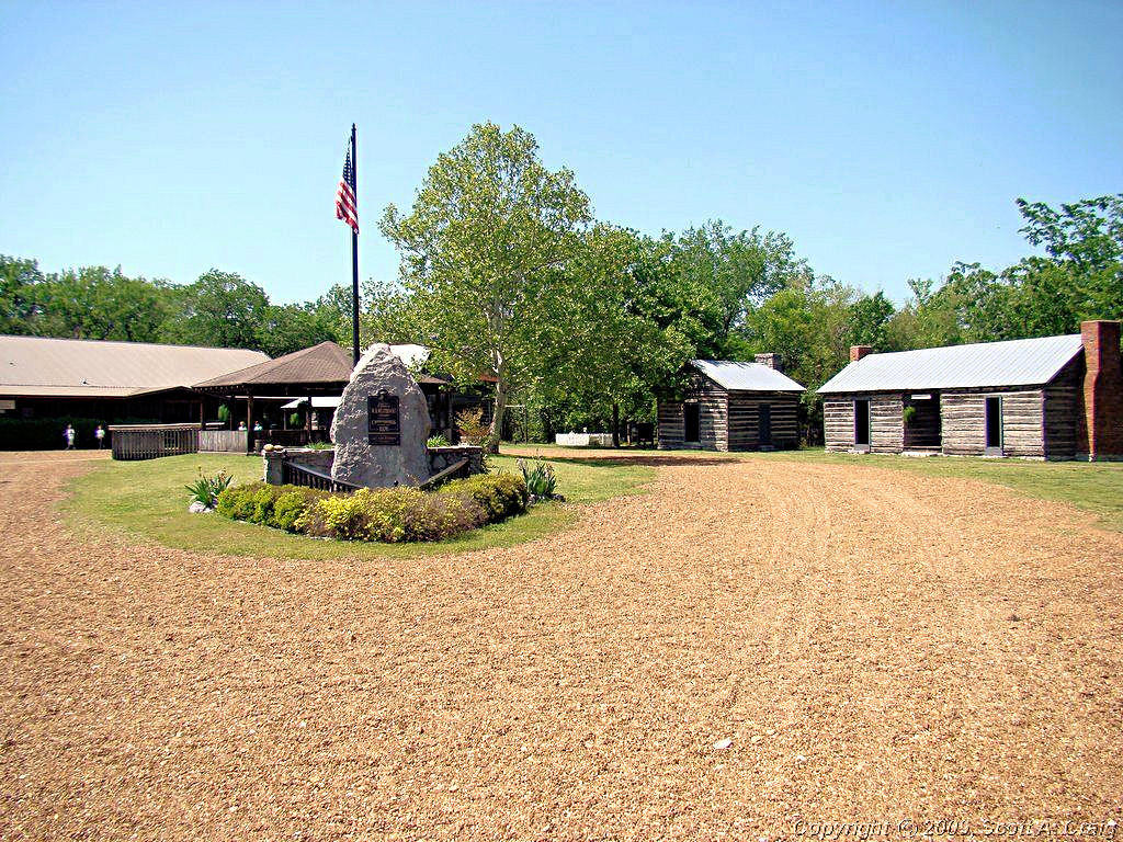
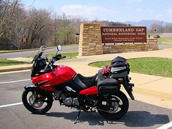
CUMBERLAND GAP NATIONAL HISTORICAL SITE - March 22, 2008
GPS Coordinates: N36.60250 W83.69582 -- 2006 Suzuki DL650 |
|
A relatively decent day for riding, albeit a bit on the windy side and a little bit chilly at times. Regardless
I rode to Cumberland Gap National Historical Site with a friend to pick up some
National Park Passport Stamps that I have been meaning to get for the past year. They have five stamps
there so even though it was a 475 mile round trip that works out to only 95 miles a stamp! I've ridden much
farther than that for a stamp!
Cumberland Gap was the site of one of the major crossings of the Appalachian
Mountains in the mid-18th century. There were few easy (easy being a relative term!) ways to cross the spine
of mountains that range from Alabama to Canada on horseback or with a wagon, and Cumberland Gap was one of those
crossings. Hunters, traders, pioneers, and even buffalo used the gap as a means for crossing from the east to
the west side of the mountain range.
I left Nashville at 6:00. As usual when heading east on I-40 I stopped at the Waffle House in Gordonsville, TN
and then met David in Crossville at 8:30. We took the back roads to Middlesboro, KY, of course, and got there
about noon Nashville time. We didn't stick around very long because I still had a pretty good ride to get back
to Nashville. I got home about 6:45pm so it made for a long day. I wish I had had more time to spend at
the park, David really wanted to see parts of it, but I'm not a big fan of interstates around Nashville at night on
a motorcycle. They are bad enough during the day but get even worse at night, and Saturday is the worst of
all!. As it was I beat sunset by less than 30 minutes.
The weather wasn't too bad. It started out a good bit warmer than it was supposed to. The forecast low was
49° but when I got up it was 58°. I didn't complain much about that, but the wind did pick up some after
about mid-morning. Coming home it was windy and the temperature dropped dramatically. When I got home the
thermometer was showing 43°! Still, all it all, it was a great ride and a lot of fun. I also picked up
5 passport stamps and took another one off the list of places I have been wanting to visit on my bike.
|
|
 |
 |
GPS Track Log - 03/22/2008 |
|
|
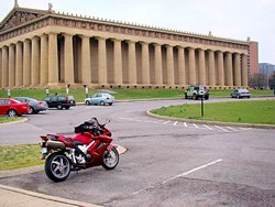
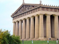
STAMPS AND THE TRACE - April 5 & 6, 2008 - 2007 Honda VFR800 |
|
Last weekend was absolute junk as far as riding goes. Rainy and windy and gray and cold. I spent most of
Saturday working on my bikes and most of Sunday on the couch. This weekend was a bit better and I got out and
played with my VFR.
Saturday - 04/05/08
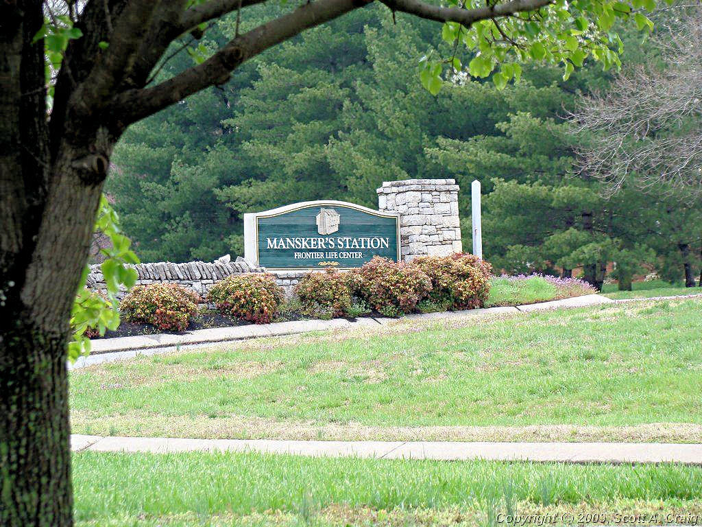
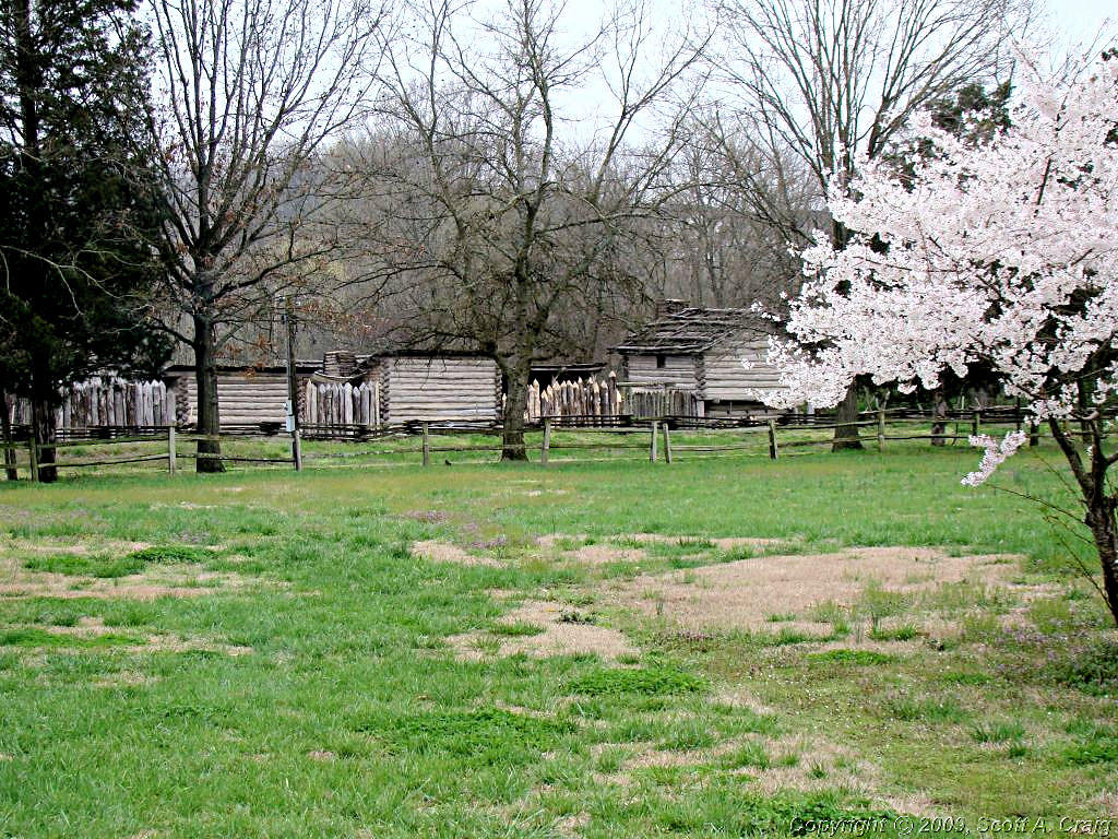
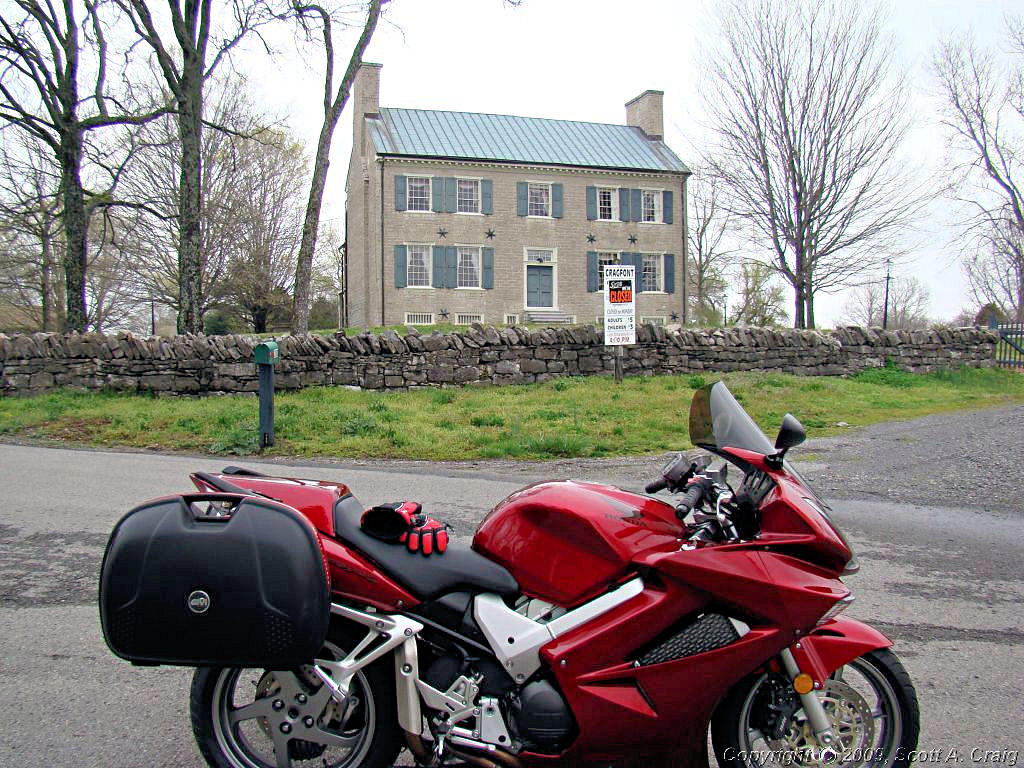
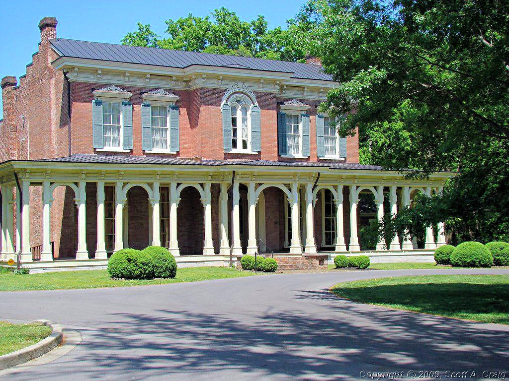
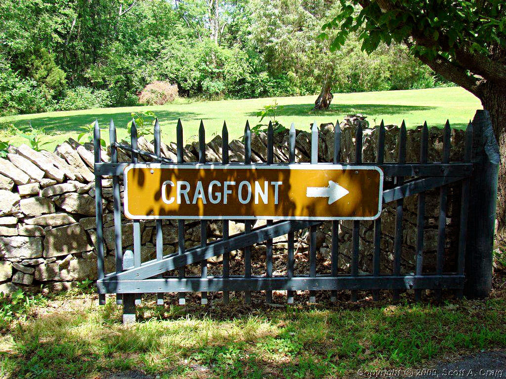
I recently got a line on some Tennessee Historical Commission stamps that are similar in nature to the
National Park Passport Stamps that I collect. There
are a number of them located in close proximity to Nashville so today I decided to get out and try to collect some of
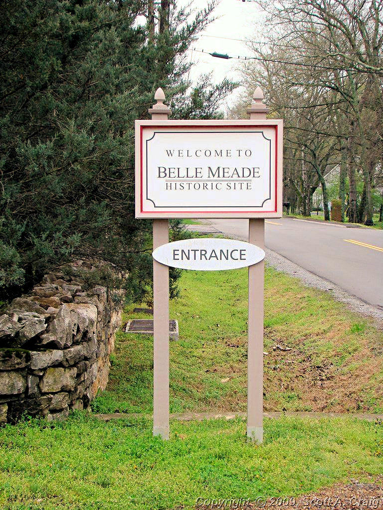
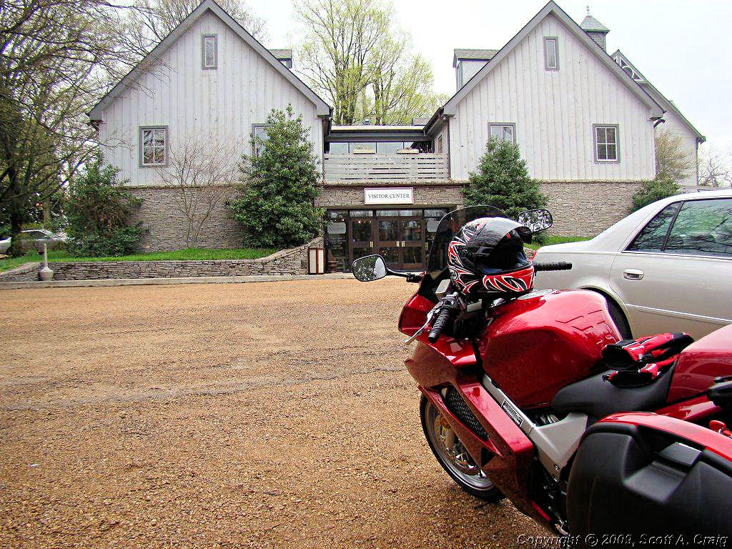
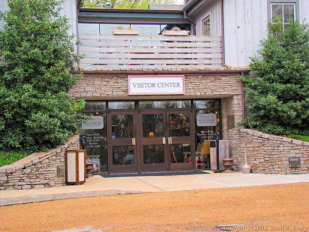
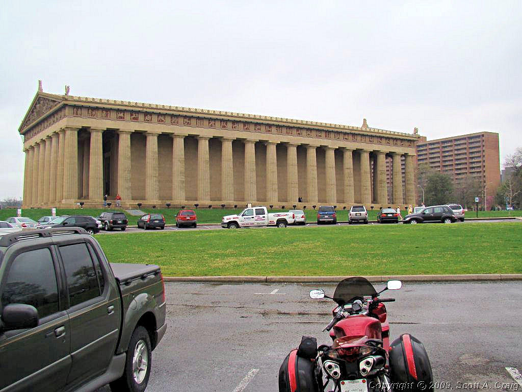
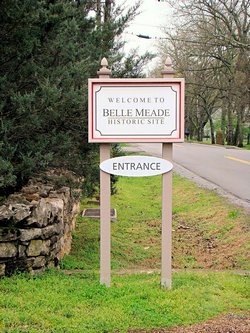
them. I got five stamps (Belle Meade Plantation,
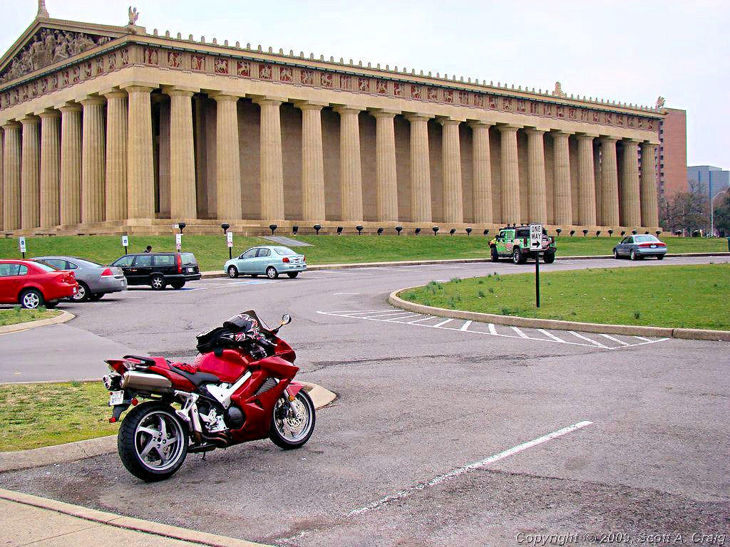
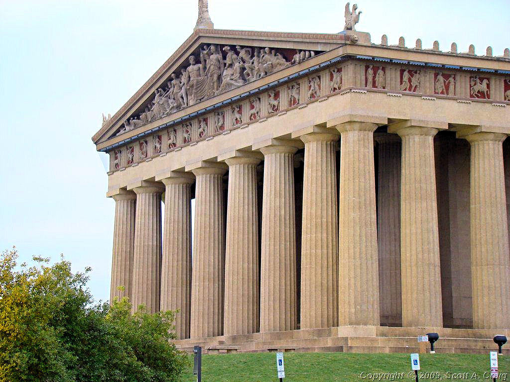
The Parthenon,
Manskers Station (2 stamps),
and the Sam Davis Home)
and got skunked on three more (Cragfont, Rock Castle, and Wynnewood) because they were closed. Two of the sites that
were closed were supposed to be open but most assuredly were not (see the photos below). The third looked like a
tornado went through it, and in reality I'm pretty sure that one did. It is under reconstruction so I have no idea
when (or even if!) I'll ever get a stamp from that site.
All in all a good day for riding. Not great, not even as warm as it was supposed to be, but compared to some of
our recent weather it was still a good one. It was in the mid 40's when I left home with a high of 61°
forecast. It appears to have topped out at about 53° so once again the weather guessers missed by a mile. Oh
well, at least it wasn't raining and it wasn't windy so those were good things. We never did see the sun but it
is supposed to be sunny and 74° tomorrow. Guess we'll have to see whether they get anywhere close to being
right. I'm meeting a friend at noon to ride the Natchez Trace Parkway and it would be nice to see some sunshine
for a change.
Sunday - 04/06/08
Well the weather guessers were pretty close today. It actually felt warm for a change and when I got home I was
actually sweating a little. I rode a bit over 100 miles around the Natchez Trace Parkway and around and about. No
particular direction, just out riding with a friend and it really felt great. Bright blue skies and right at
70° for a change. Wish it would stay like this, but it won't and I'll be griping about the heat pretty soon.
|
|
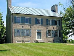
Belle Meade Plantation |
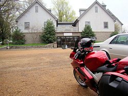
Belle Meade Plantation |
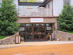
Belle Meade Plantation |
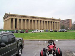
The Parthenon |
Centennial Park outside The Parthenon |
Centennial Park outside The Parthenon |
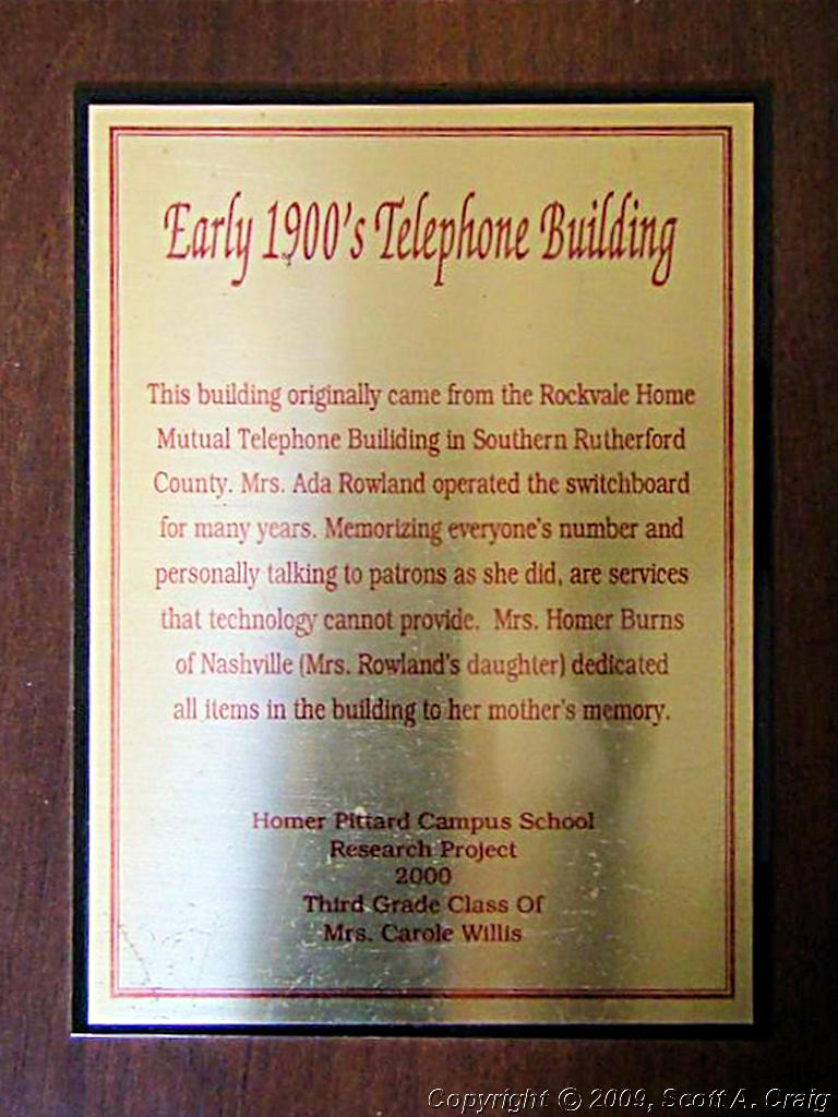
Manskers Station |
Manskers Station |
Manskers Station |
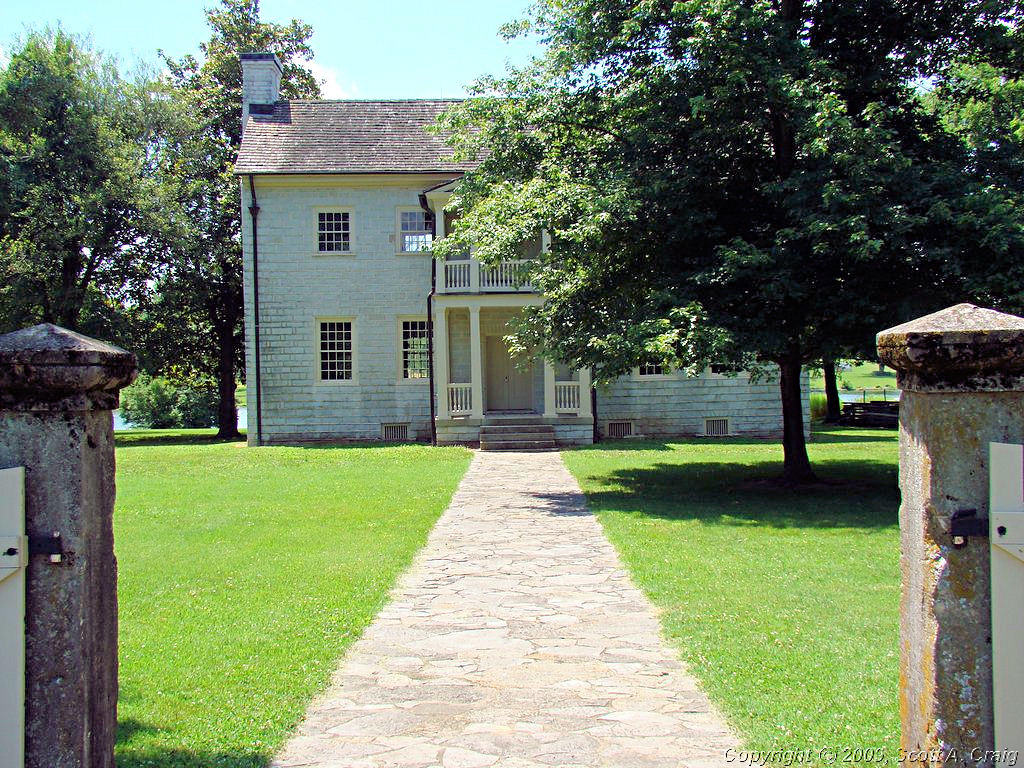
Cragfont - Closed for some reason! |
Rock Castle - Closed for some reason! |
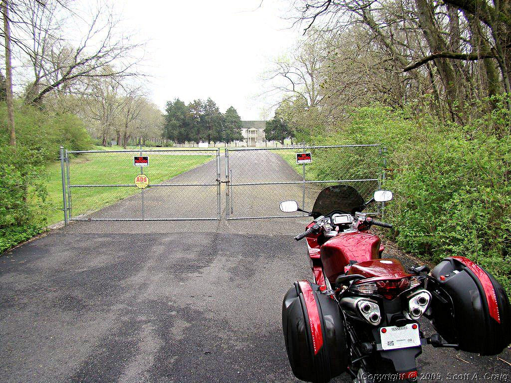
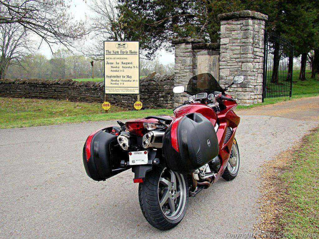
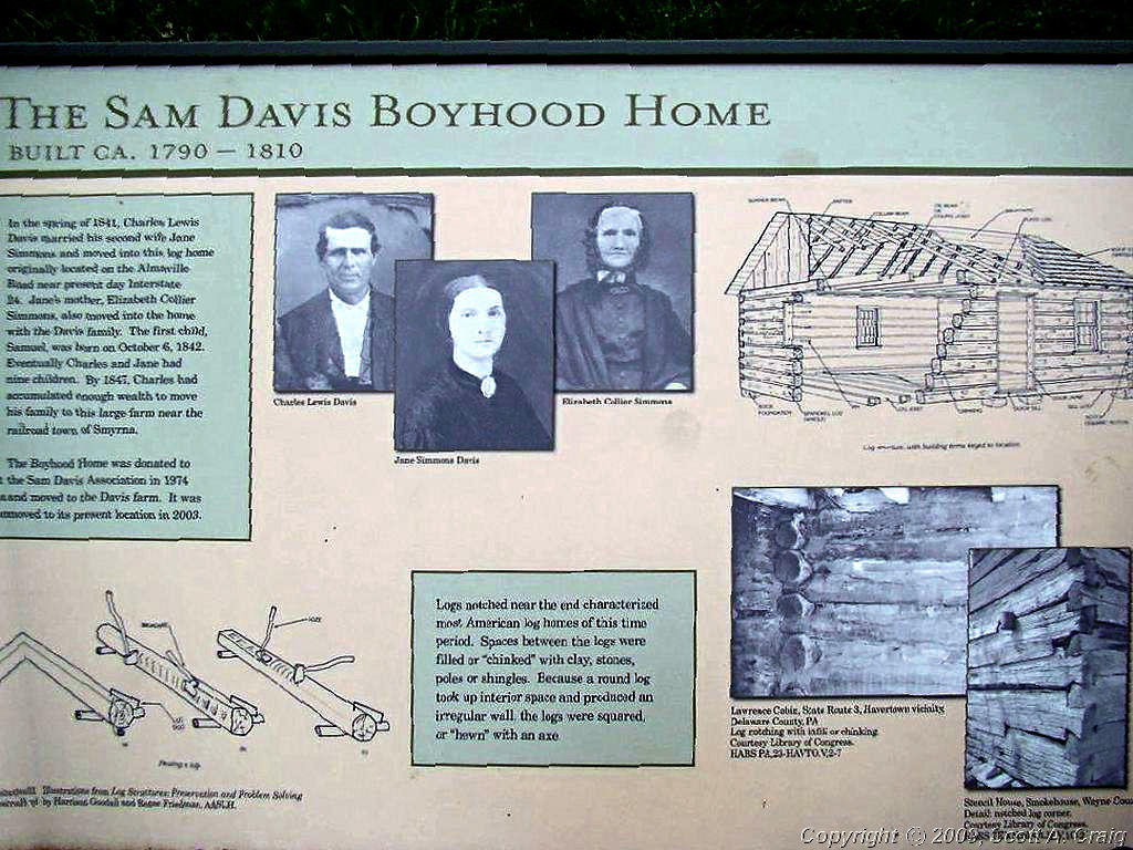
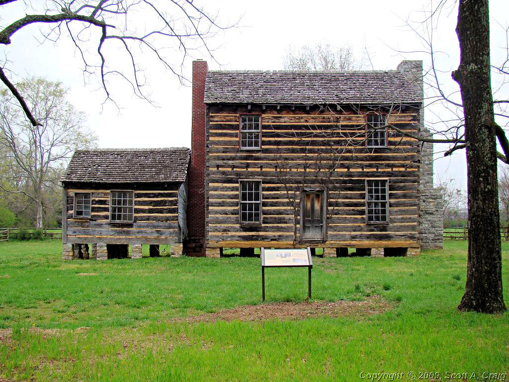
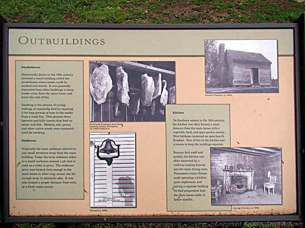
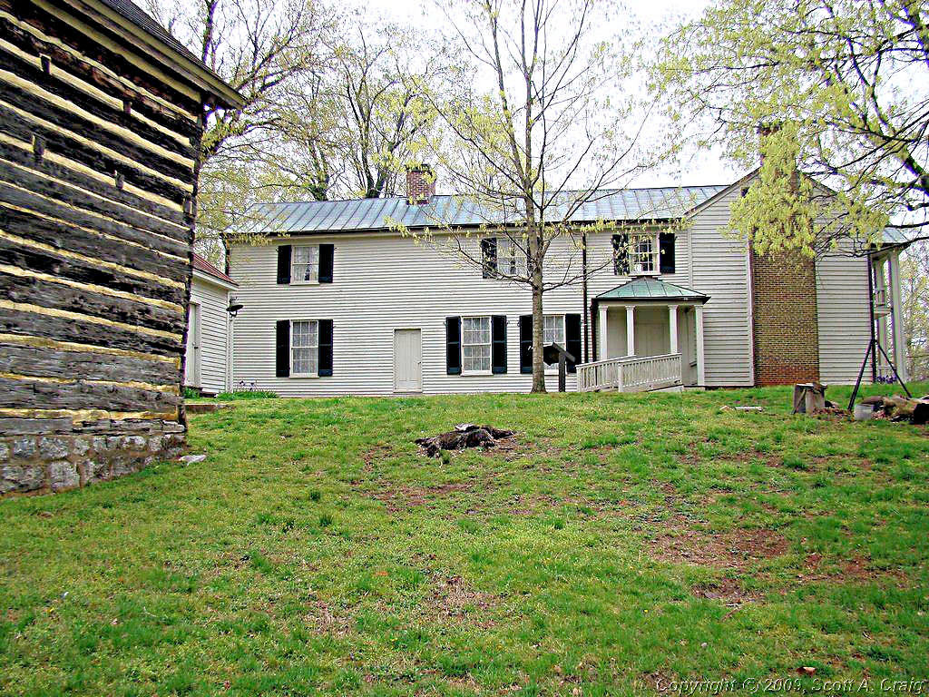
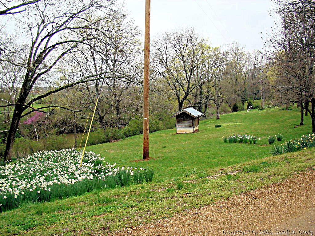
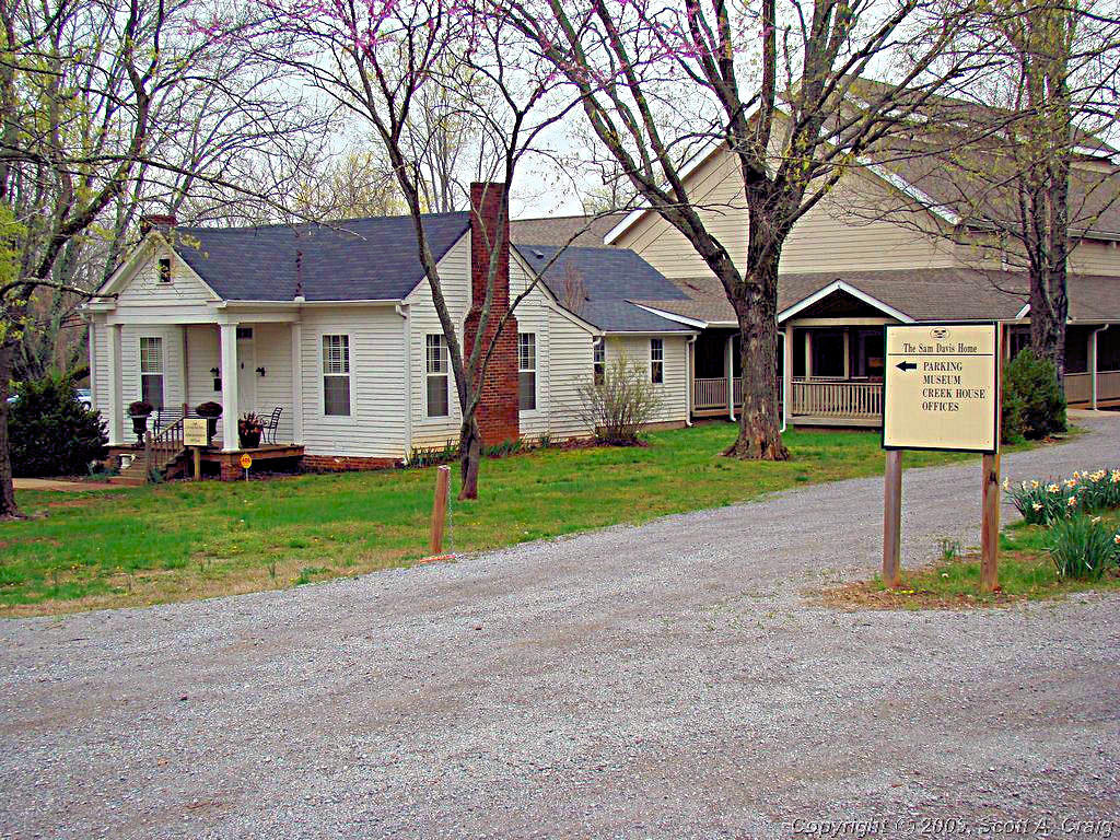
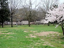
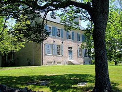
the Sam Davis Home |
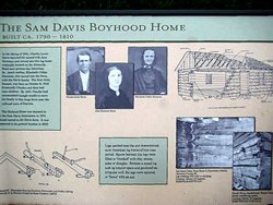
the Sam Davis Home |
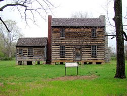
the Sam Davis Home |
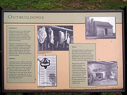
the Sam Davis Home |
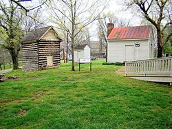
the Sam Davis Home |
the Sam Davis Home |

the Sam Davis Home |
the Sam Davis Home |

GPS Track Log - 04/05/2008 |
|
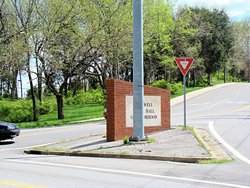
AROUND TOWN - April 12 & 13, 2008 - 2006 Suzuki DL650 |
|
I didn't get out and ride much this weekend. I managed to do something to my back earlier in the week and it
has had me tied up in knots for the past few days. I did get out and ride around town a bit and managed to
take some photos of something that has been annoying the hell out of me for the past year.
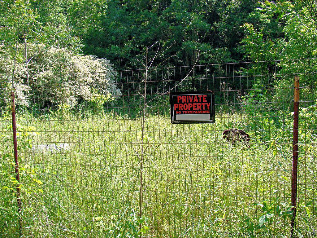
This backwater burg is governed by people whose credentials to manage a water fountain in the middle of a desert
would be questionable. It's amazing to me that in the 21st century we still manage to put people in positions
of making decisions that affect other people's lives when they don't have the apparent intelligence to get in out of the
rain! To back these statements up I offer the following photographic evidence:
|
This nice brick sign is one of three that I am aware of that were constructed last year. Looks like a good idea,
doesn't it? Nice quiet suburban area, nice brick sign to welcome people. Looks nice, great idea, spend a
bit of the taxpayers money for something useful for a change.
|

|
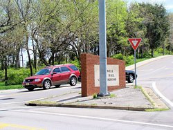
But let's take a closer look at things .....
Here's another view that shows where the sign is actually located. Huh, you ask! Surely that solid brick,
8 foot tall sign isn't located right smack dab in the middle of the intersection!
|
|
It certainly is! I told you we had a bunch of really bright people doing the planning around here! Someone
in the government of this town approved the construction of a solid brick sign right smack in the middle of the
intersection of Trousdale Road and Elysian Fields Road. And believe me there is no way whatsoever to see through it!
But surely, you say, it isn't large enough to hide a vehicle behind!
|
|
Well, let's see ... How about a Ford Freestar SUV? No, not the black car at the left of the photo, look
closer. Click the image to the left and look right at the edge of the sign.
|
|
Oh, wait! There it comes!
|
I only hope the person that approved this construction reads this. Better yet I hope he has the opportunity
to damn near get mashed while riding a motorcycle and turning onto Elysian Fields at the same time as someone else decides
to turn left on Elysian Fields from the opposite direction. Neither of us saw the other because of that damn brick
sign stuck in the middle of the intersection but we nearly gave Southern Hills Medical Center some business! Neither
of us would have been at fault because there is so much traffic at that intersection at certain times of the day it is
difficult to watch everything. I was in a Yield lane so technically I would have been at fault, however there was a
car behind me that went straight when I turned, and I didn't think the turning vehicle would try to beat him. He tried,
I couldn't see him, he couldn't see me, and we nearly met at the back of that damn sign. Luckily I had enough power to
get away from him so nobody got hurt. This time! I was lucky.
The person that allowed this sign to be constructed in this location is going to be the cause of someone getting hurt or
killed. There is no telling now many traffic laws, construction guidelines, roadway design criteria, and other
regulations this thing violates yet we still allow people to approve and build them. Think this is the only
one? It isn't! There is another one constructed just like this about a mile away at the intersection of
Trousdale Road and Blackman Road. Your tax dollars at work hiring the mentally incompetent.
|
|
|
GREAT RIDE, LOUSY ENDING - April 20 & 21, 2008 - 2006 Suzuki DL650 |
|
My friend and riding buddy David asked me to take an overnight ride with him from Crossville, TN to visit his
daughter in Highlands, NC. Needless to say I jumped on that in a hurry. I met David in Crossville
at 8:00 Saturday morning and we headed east by the backroads. We headed through Sweetwater and Spring City
to Tellico Plains. From there we headed across the Cherohala Skyway into North Carolina.
|
 |
 |
 |
 |
|
From there we headed further east in a roundabout manner towards Highlands, NC. We rode alongside Fontana Lake
for a long distance and some of the views of the lake and river are just fantastic.
|
 |
 |
 |
 |
 |
 |
 |
|
|
We spent the night at the home of David's daughter. The scenery around Highlands lives up to it's name. The
town is 4,100' above sea level and nestled in the mountains. Just a beautiful spot. I didn't get any photos
of the mountains but here are a few from the driveway.
|
 |
 |
 |
|
|
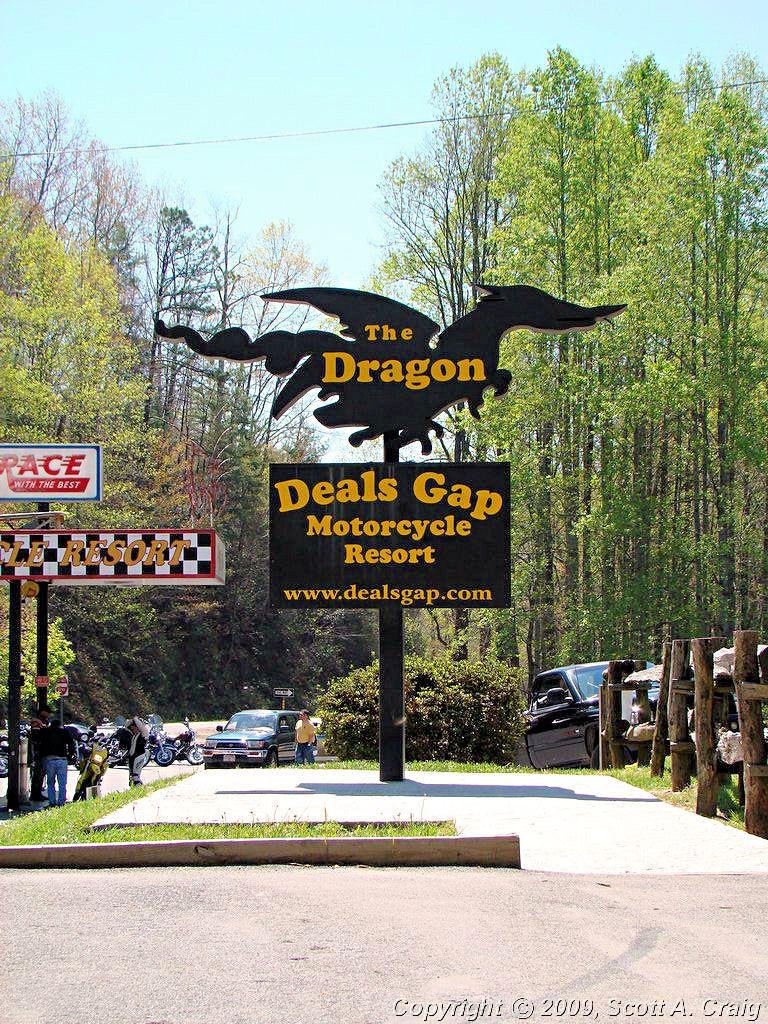
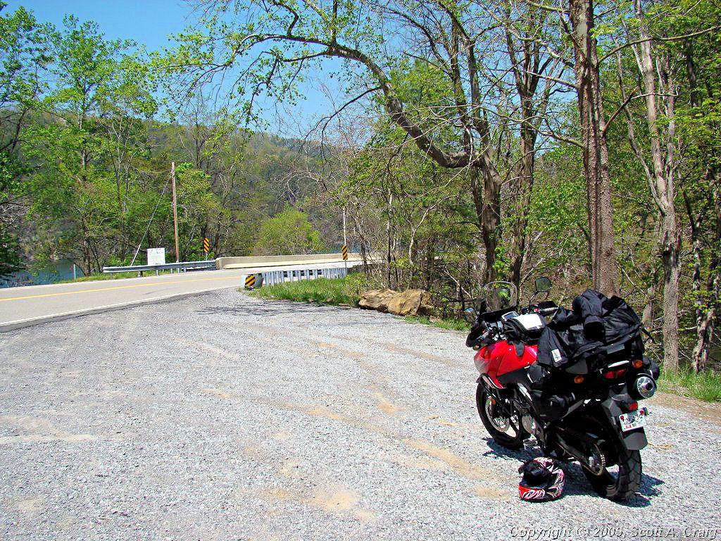
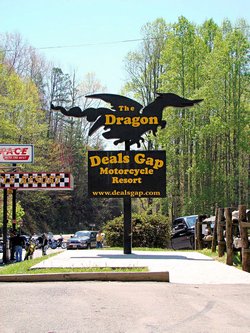
Monday we headed back in the general direction of home, but we went by way of The Dragon. The Dragon is a section
of highway 129 that runs along the west edge of the Great Smoky Mountains State Park and it is a very popular motorcycle
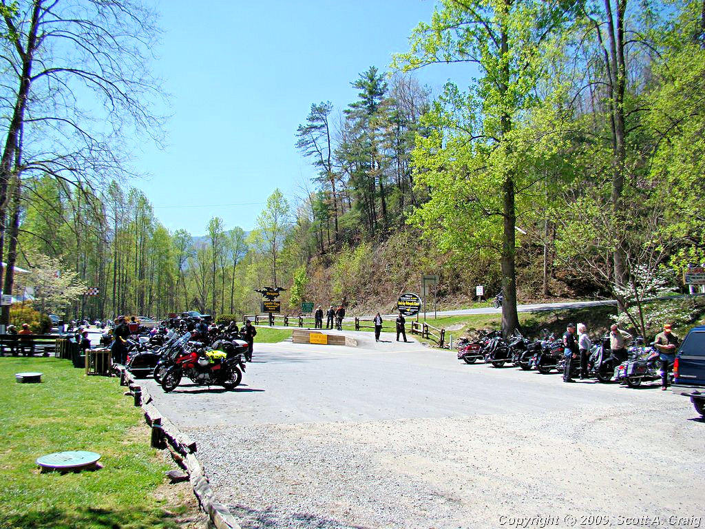
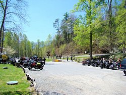
road in this area. The Tail of the Dragon at Deals Gap is at the south end
of The Dragon and is the staging area for the road. On weekends in the summer it is wall-to-wall motorcycles, but
this early in the year, and on a Monday, there were not a lot of people there. The Dragon itself was actually
deserted and we rode nearly the entire 11 miles
all alone.
|
 |
 |
 |
|
|
I didn't take any photos along The Dragon since there are not a lot of good places to stop. If you want to see photos of
the activity along The Dragon check out KillBoy.Com or
US129Photos.com. They are there just about every weekend and have many, many photos of the motorcycles, cars, and
the area in general.
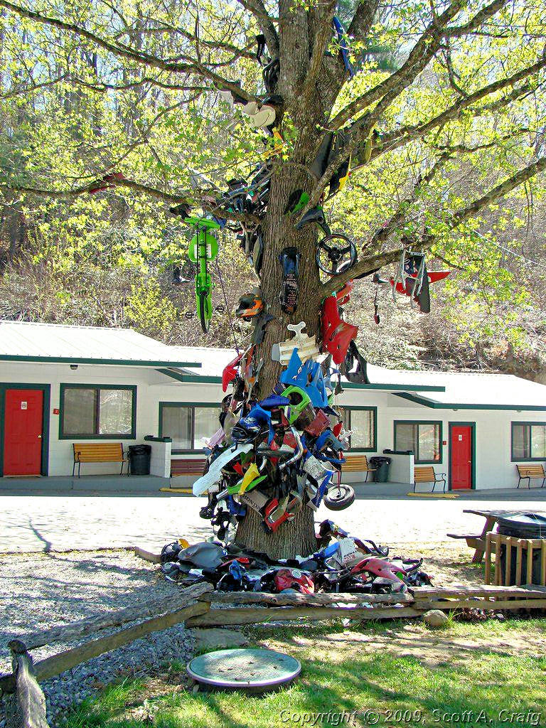
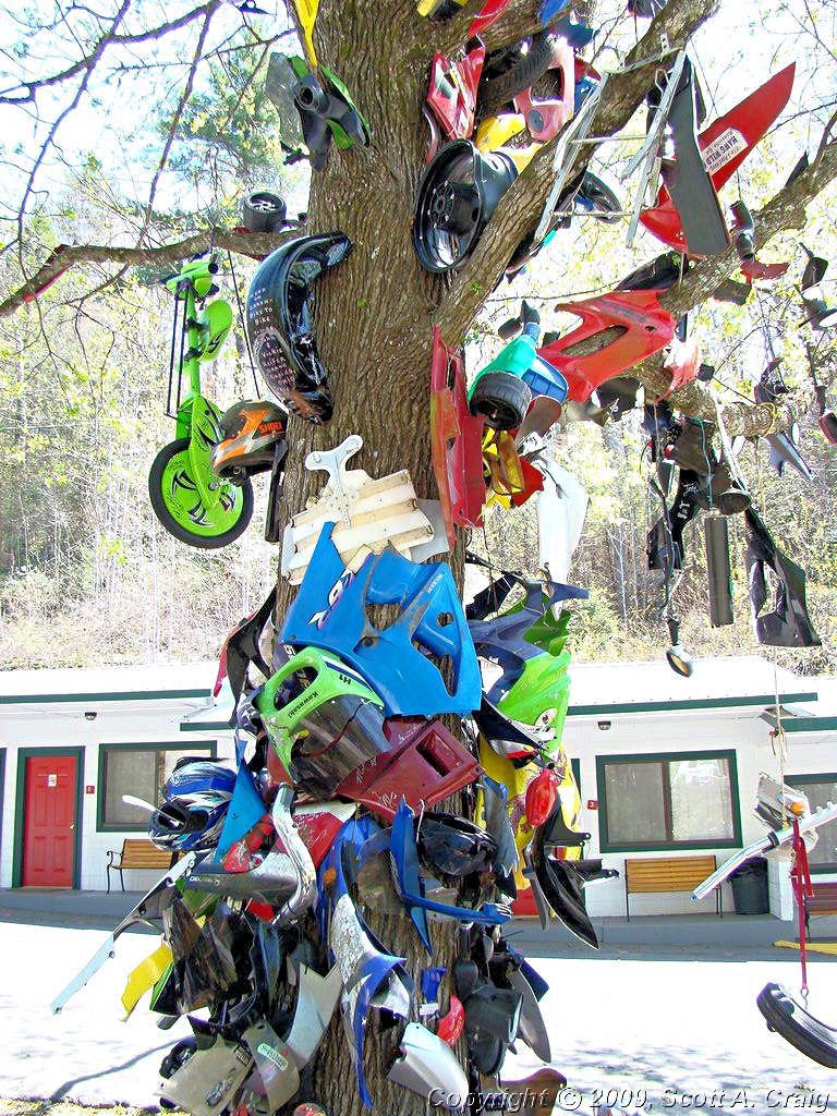
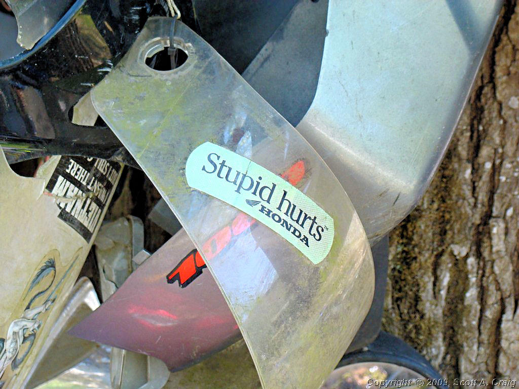
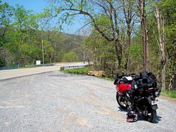
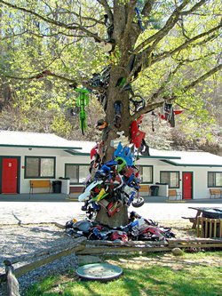
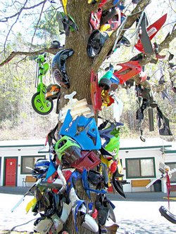
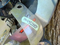
One prominent feature of The Tail of The Dragon at Deals Gap is the Tree of Shame. This tree contains bits and pieces
of motorcycles that did not manage to "Tame The Dragon". While I suspect it is meant as a joke it has a true purpose
as well since it tends to remind those who are willing to see that The Dragon is not a road to be taken lightly. It
is a twisty, curvy, narrow mountain road and those who turn their backs on it can be bitten quite easily.
|
 |
 |
 |
|
|
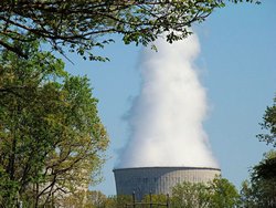
After The Dragon we headed back west toward Crossville. Just west of Watts Bar Lake and the Watts Bar Nuclear
Facility we were stopped in some roadway construction. When the flagman let us go, I got about 1/4 mile or less
and my bike died. Literally. It chugged a couple of times like it was out of gas, and that was it. I
knew it wasn't really out of gas since I had filled it up about 100 miles previously. I pretty much ran the battery
down trying to get it to run before finally giving up. Luckily David had a motorcycle trailer at home so he rode home,
got his trailer, and came back for me. Right now it's still sitting in Crossville waiting for me to get it back
home and to the shop.
While waiting for David I noticed the steam coming off the cooling tower at the nuclear facility, and realized how closely
that steaming monolith resembled my own state of mind at the moment.
|
 |
|
|
|
|
Oh well. I'll get it home, and I'll get it fixed, and we'll ride some more. 503 miles from the time
I left home to when it croaked.
Thanks to everyone for a great weekend. Rachel, Christopher, and Oliver for the hospitality and a soft bed to
sleep in. David and Susan for letting me park my broken bike in their garage until I can get it back to Nahsville,
and of course for the trailer ride back to Crossville. It was a ton of fun right up the point that my bike broke!
|
GPS Track Log - 04/20/2008 - 04/21/2008 |
|
|
|
|
|
CLOSE TO HOME - MAY 4, 2008 - 2007 Honda VFR800 |
|
|
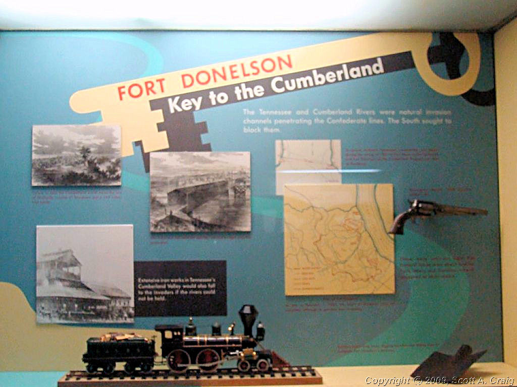
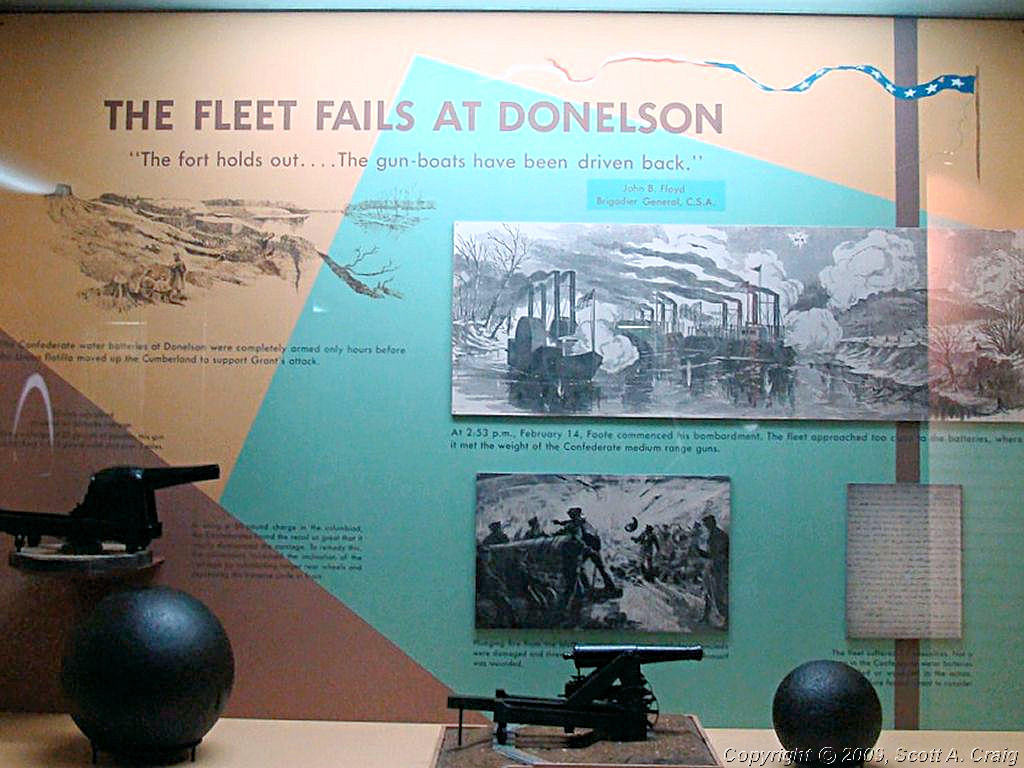
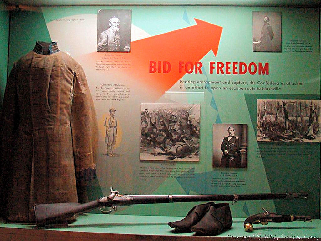
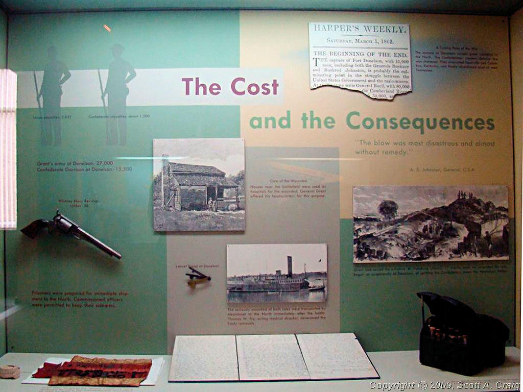
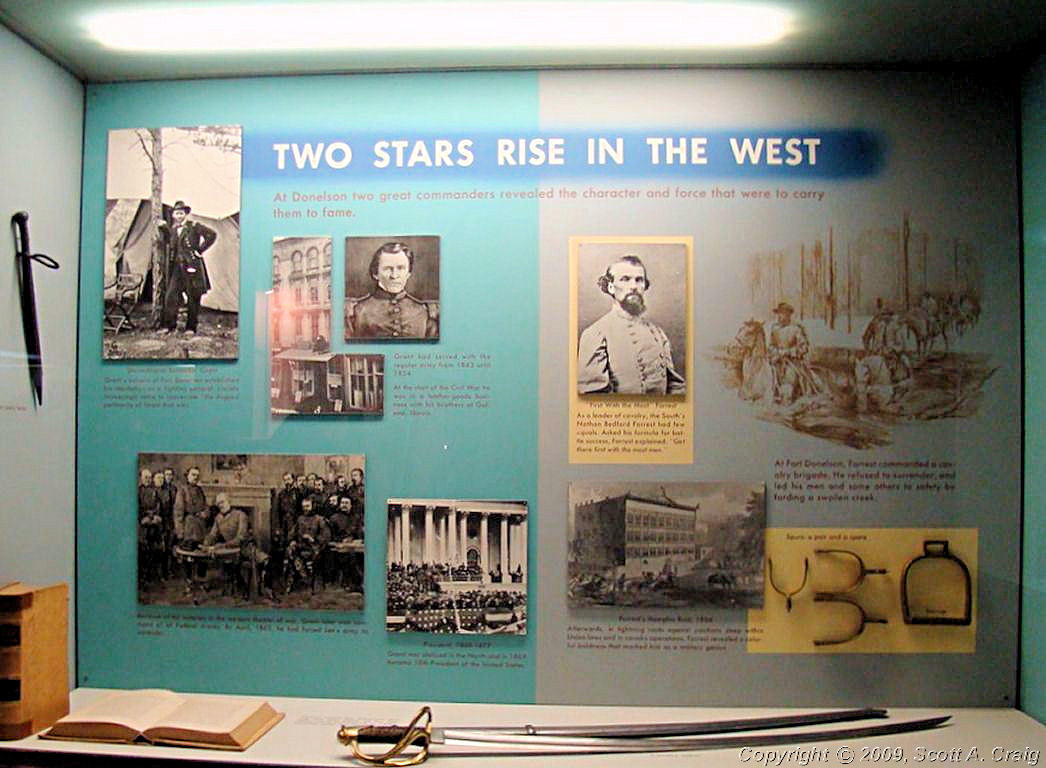
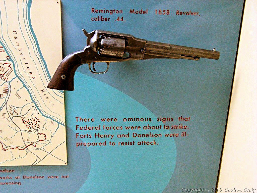
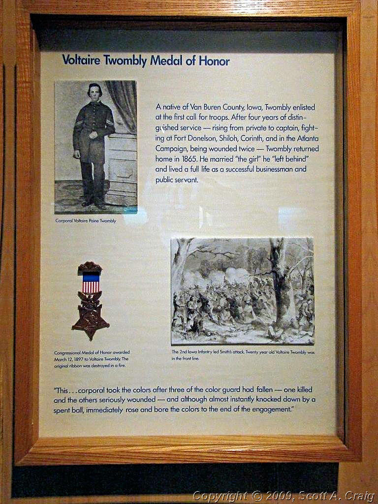
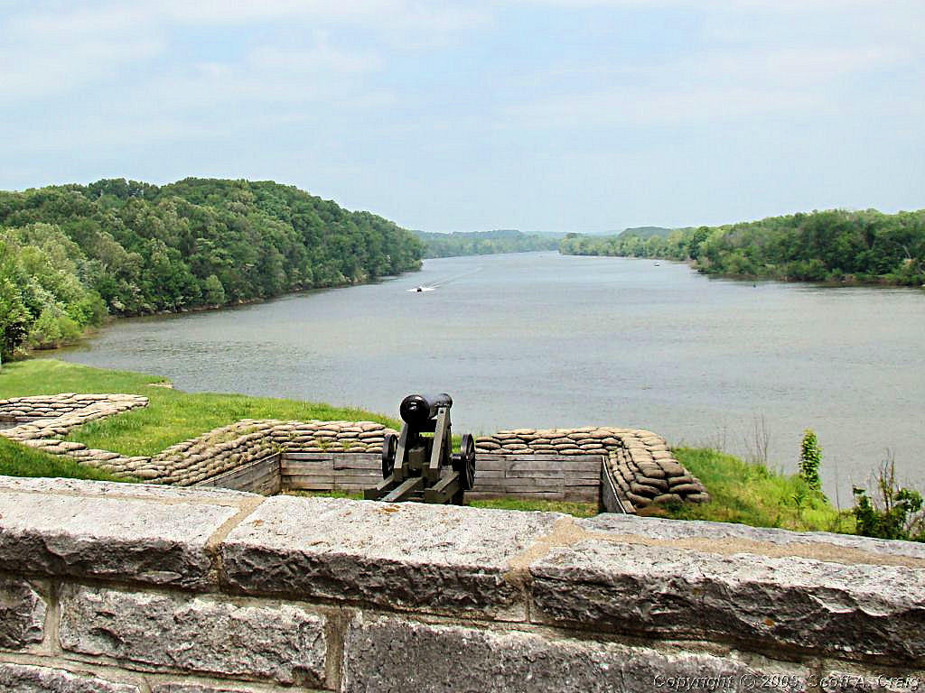
FORT DONELSON NATIONAL MILITARY PARK - MAY 10, 2008
GPS Coordinates: N36.48283 W87.86301 -- Honda VFR800 |
|
|
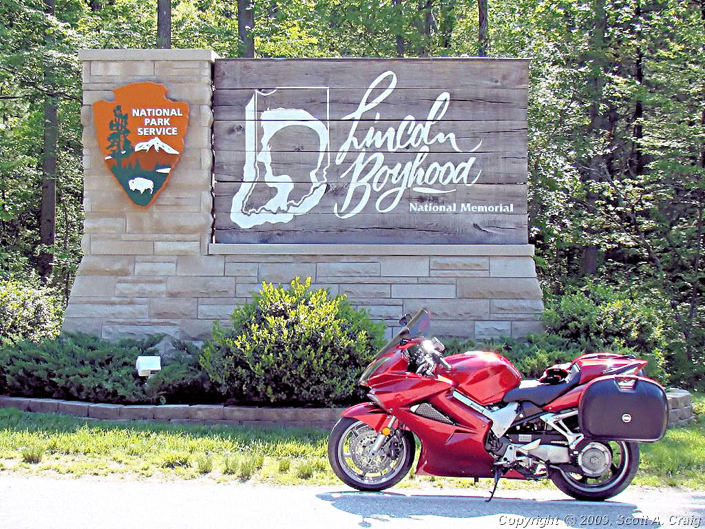
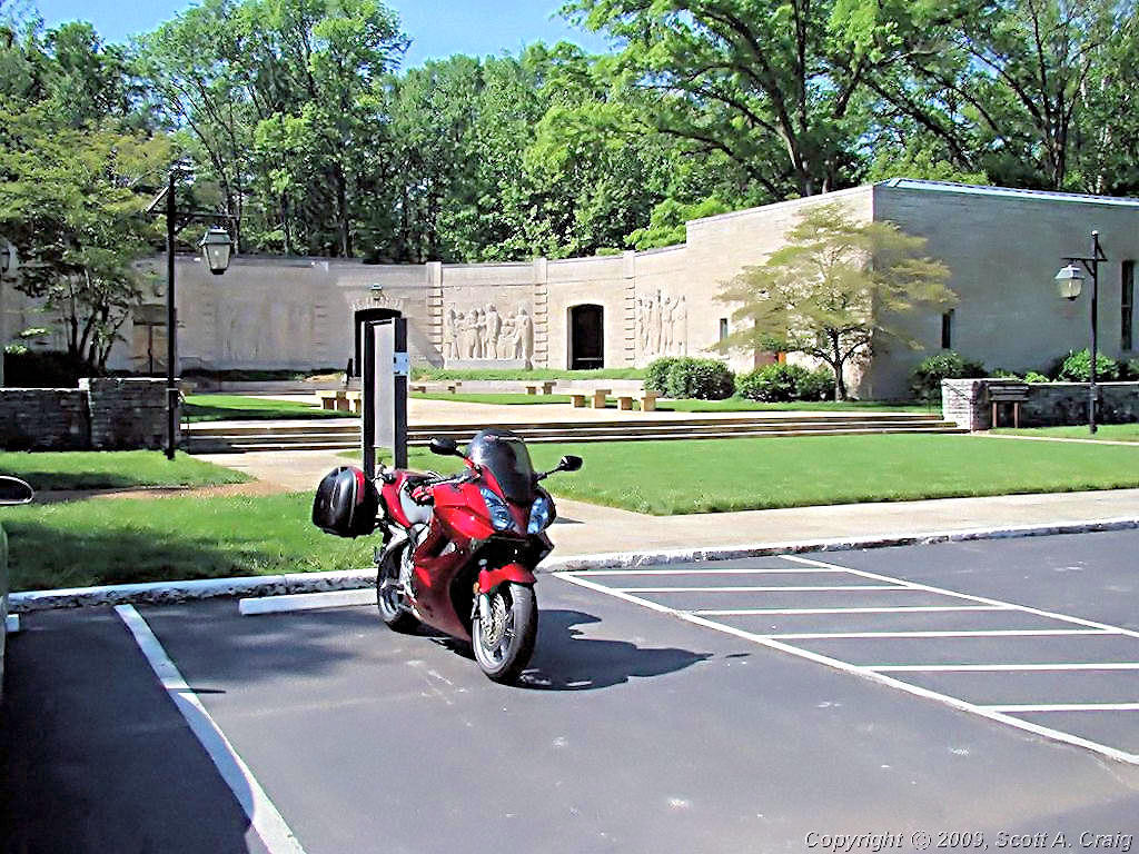
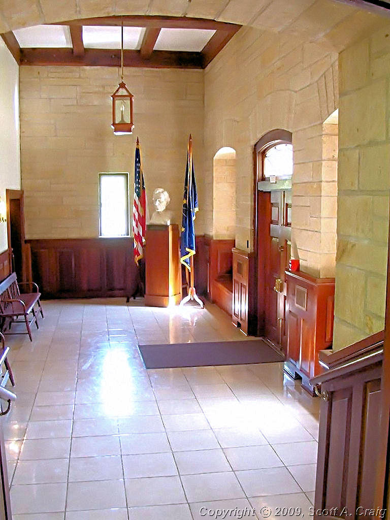
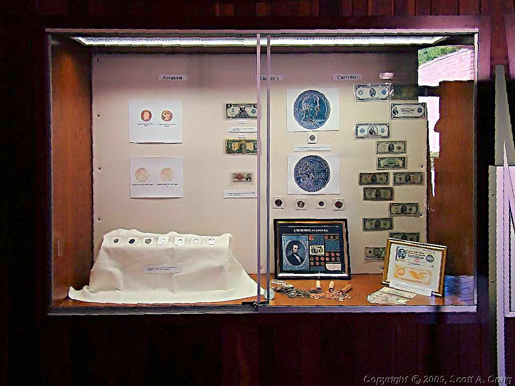
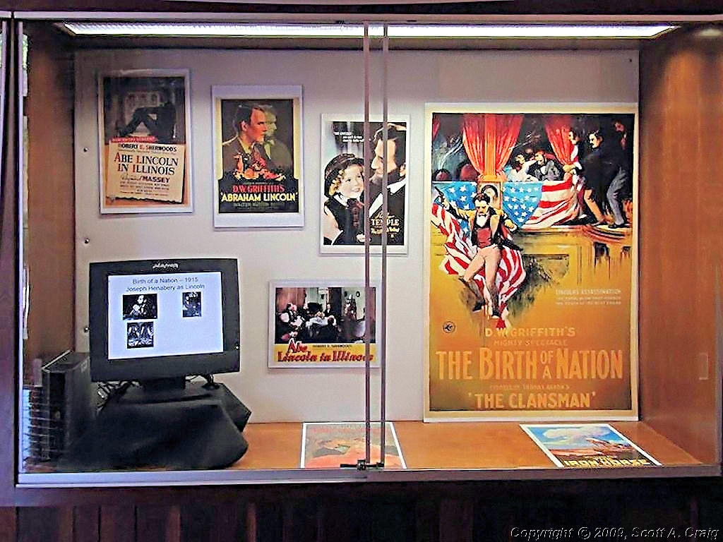
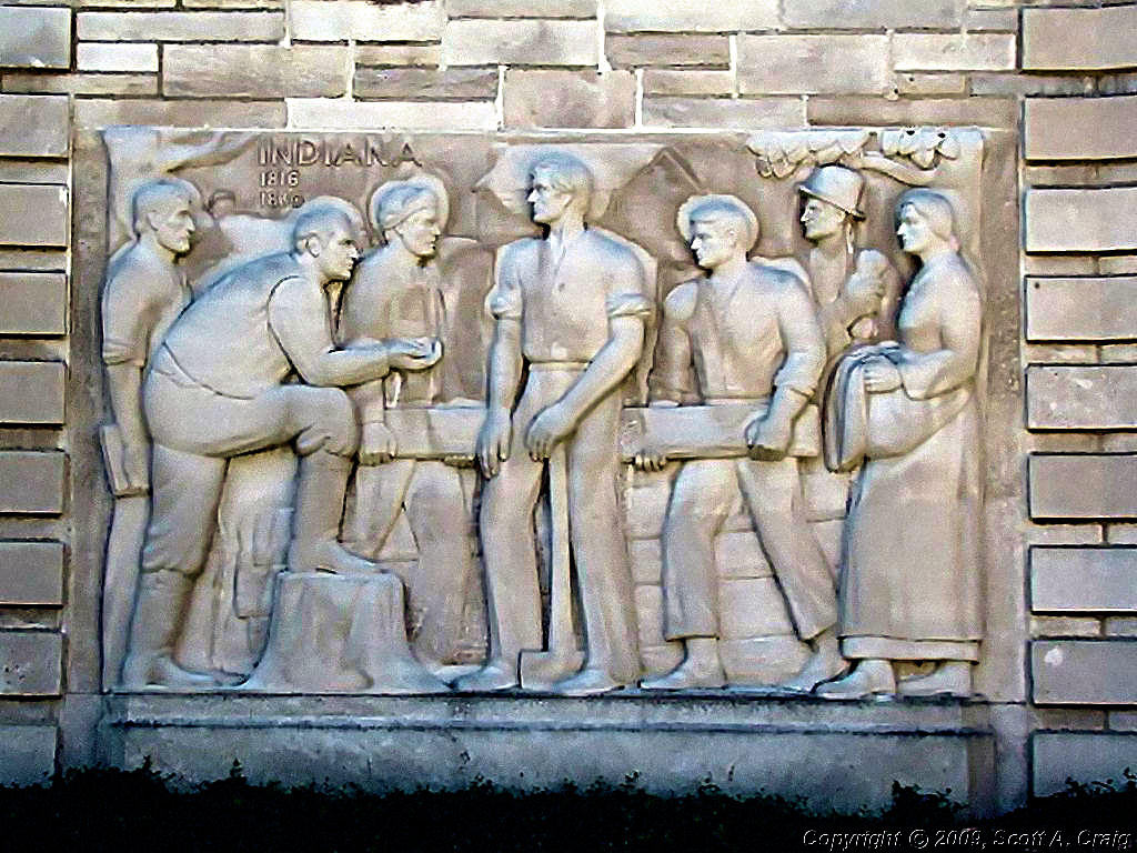
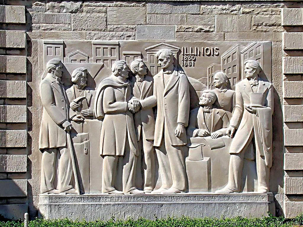
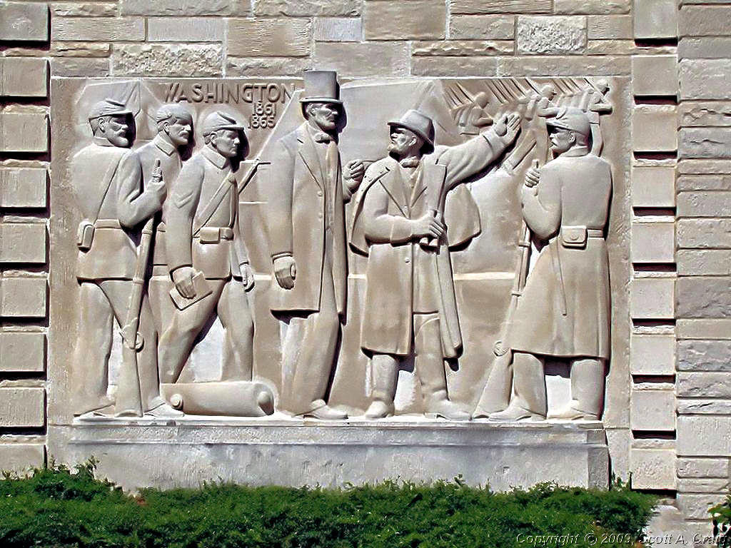
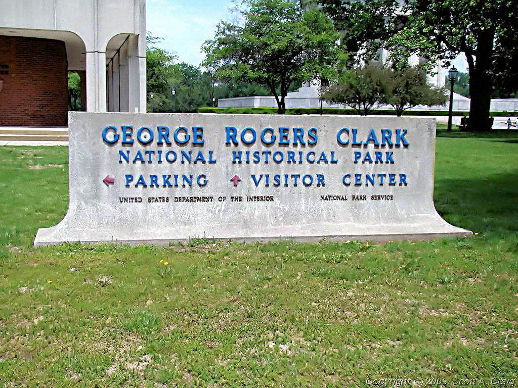
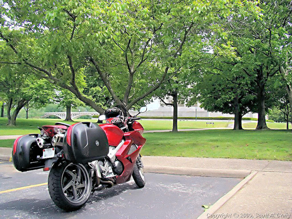
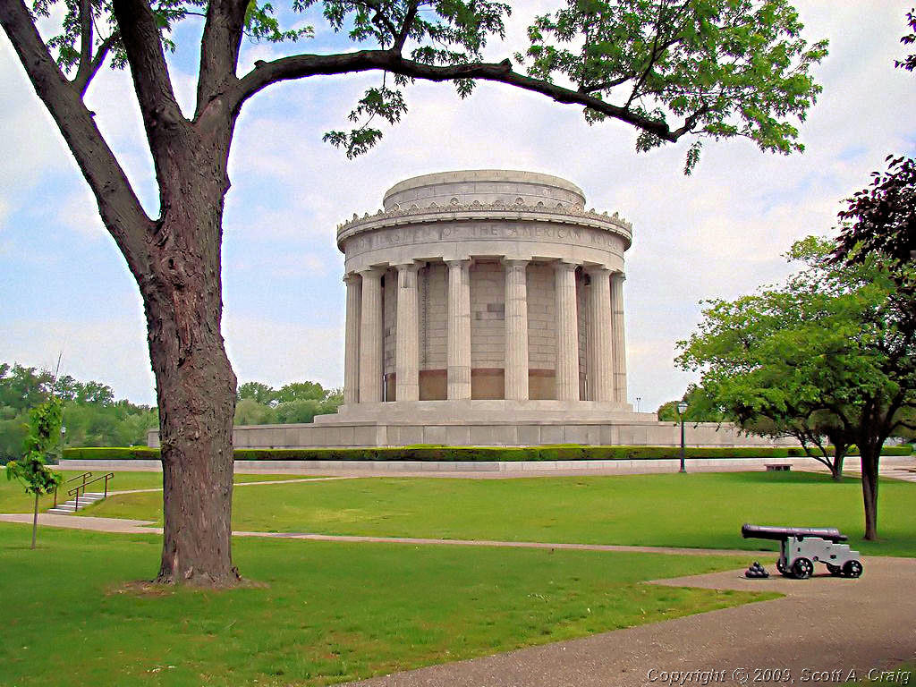
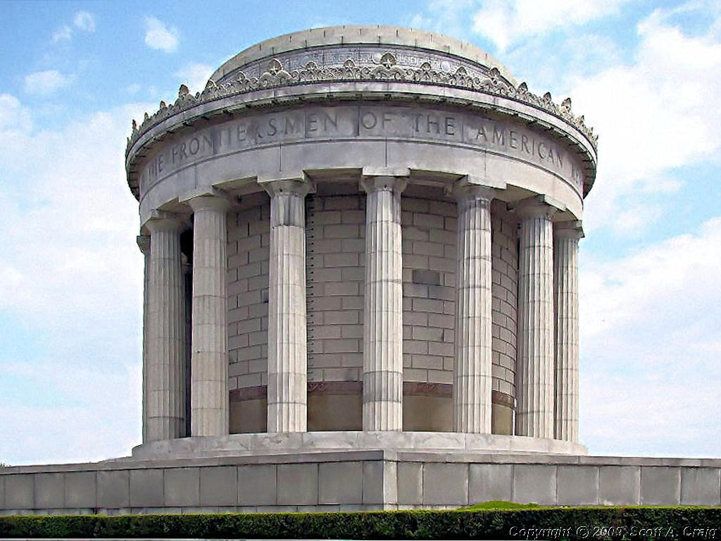
LINCOLN CITY & VINCENNES, IN - MAY 17, 2008
GPS Coordinates: See Below -- Honda VFR800 |
|
|
MEMORIAL DAY WEEKEND - MAY 24-26, 2008
2007 Honda VFR800
|
This weekend means something special to me because I have a very high regard for everyone who serves in the
military. I respect everything they do and I'm very grateful for everything they give up so that those
of us here at home can live a free life. Memorial Day is a date set aside to remember those who have given
their lives in the service of our country. I urge everyone to stop and take a moment during their weekend
to think about that. It is not the traditional start of summer as many think and it is far more than just
a day off of work. Take the time to thank those who gave their lives for us because that is all that they ask.
I actually started this weekend early and took off Friday to make it a long 4-day weekend. Friday I needed to
cut my grass and run some errands because I don't plan on sticking around home this weekend. OK, I'll be here
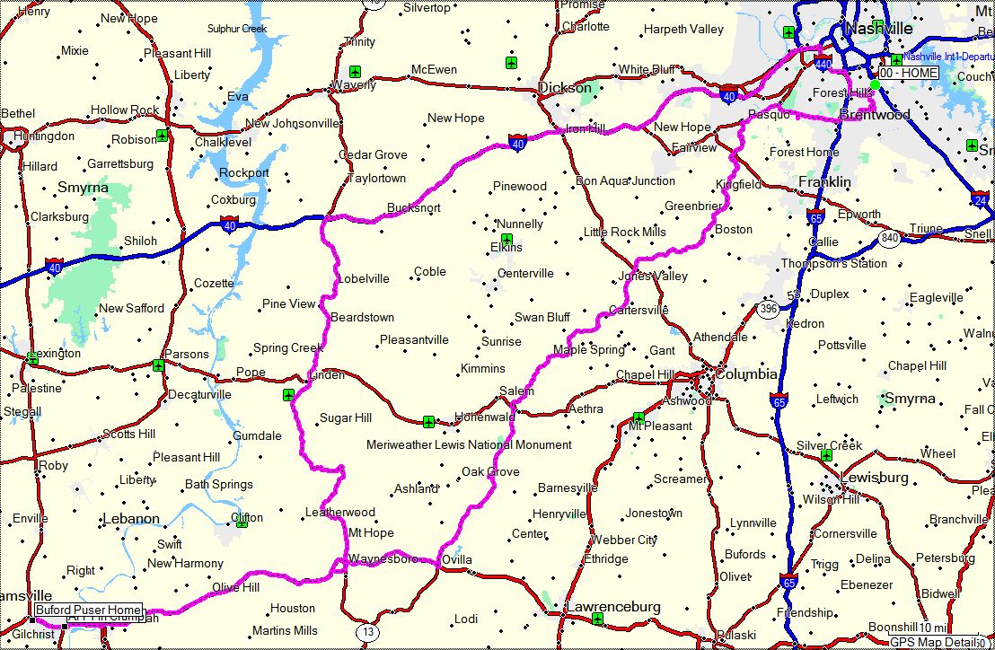
Sunday for the Indy 500 but that's about all! Saturday I'm heading for Adamsville, TN to visit the home of
legendary sheriff Buford Pusser to try and collect another Tennessee
Historical Commission stamp for my collection. Monday I'm not sure where I'll go but I am
going to ride somewhere, you can count on that.
For anyone wondering about the status of my V-Strom after it
Stranded Me a month ago, it is back home and appears to be fixed. Turns out that one of
the wiring harnesses got pinched by a clip on the bottom of the air filter box. Over time the clip
cut its way into the harness and would intermittently ground out one of the wires going to the ECU. When
it did the fuel injection, the ignition, everything was dead. The guy who fixed it (thanks, Ray!) is a
very, very good tech and it took him 6 hours to find and fix the problem. I'd still be down there looking
for it. It's still relegated to trips pretty close to the shop (close enough that my AMA MoTow service will
get it there without me having to push it!) until I get some confidence in it again, but I suspect it's
fixed. Truth be told, I'm just having a great time riding my VFR!
Weekend photos to come. Check back on Saturday!
Saturday - 05/24/2008
Today was a bust in some ways and interesting in others. I rode to Adamsville, TN to visit the
Home and Museum of former sheriff
Buford Pusser (GPS coordinates N35.23176 W88.38346) and try to obtain a Tennessee Historical Commission stamp
for my Passport Stamp Collection. That was the part that
was a bust. There was some sort of celebration or something going on and the place was a madhouse as can be
seen by the two photos below.
|
Buford Pusser Home and Museum |

Buford Pusser Home and Museum |
|
|
|
I talked with the curator of the museum and while she said that she recalled seeing the stamp on some documents there
she had no idea where it was. Since the place was packed wall to wall with people I didn't feel like I could ask
her to look for it.
I was also a bit disappointed with the museum itself. While it does document the life of Buford Pusser it is just
a regular suburban house in a regular suburban neighborhood. I knew that before I went but I guess I expected
more. Oh well, it was a fun trip regardless.
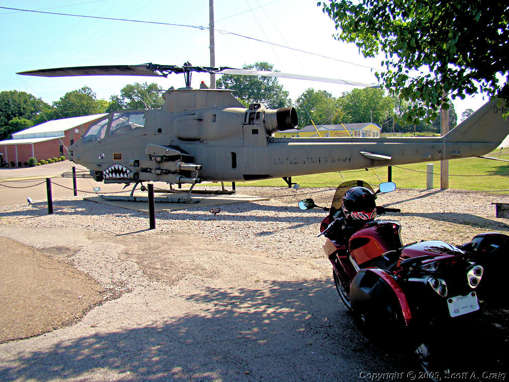
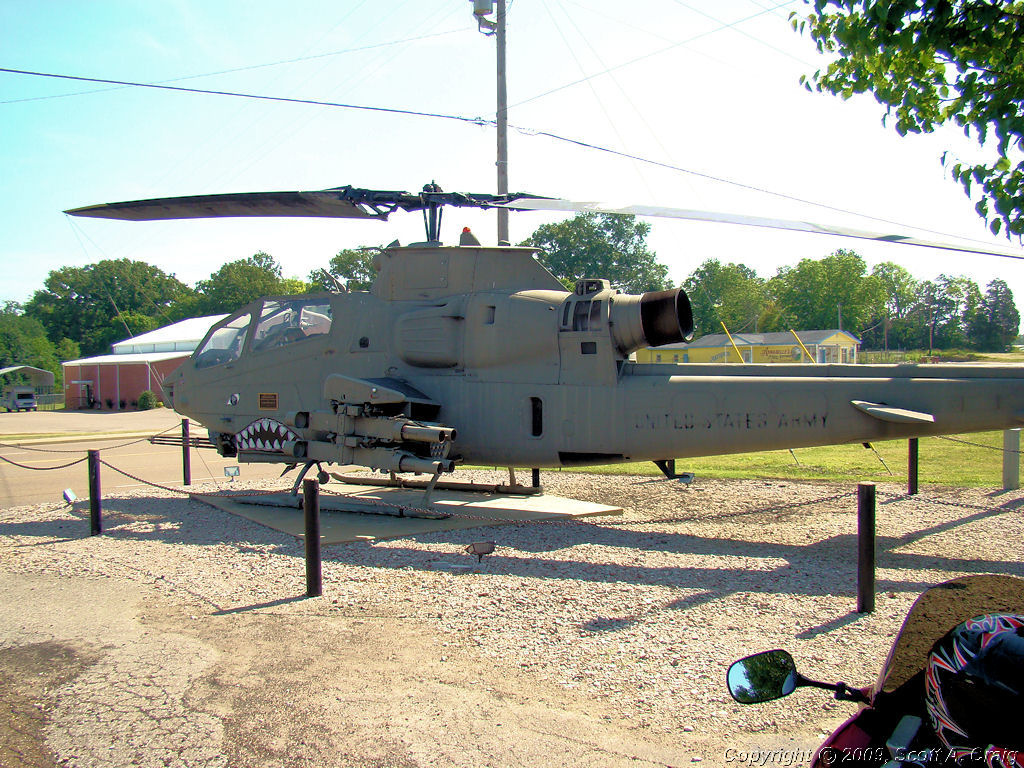
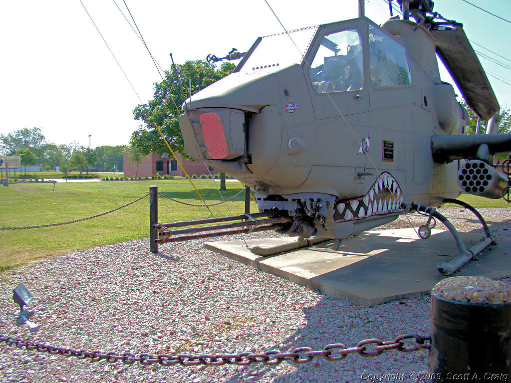
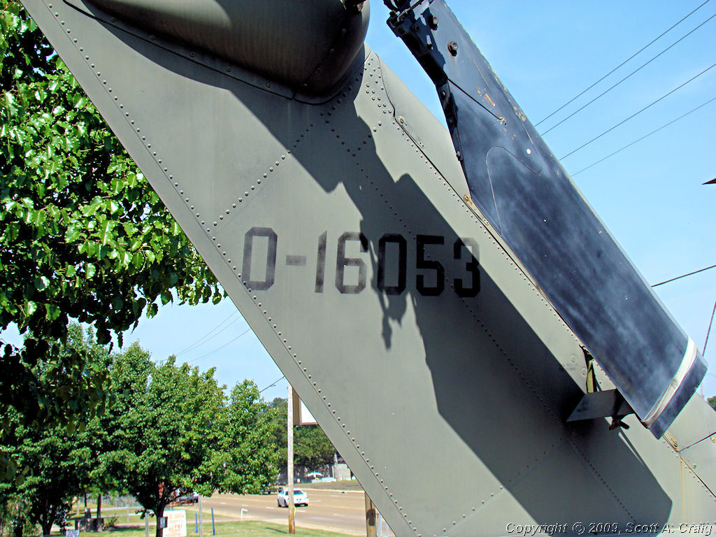
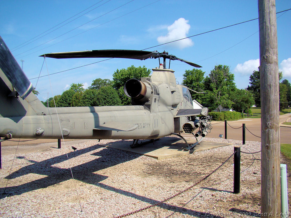
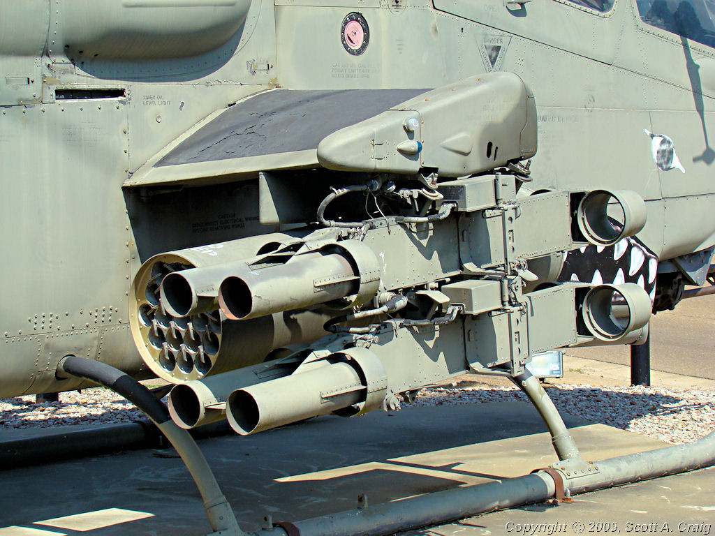
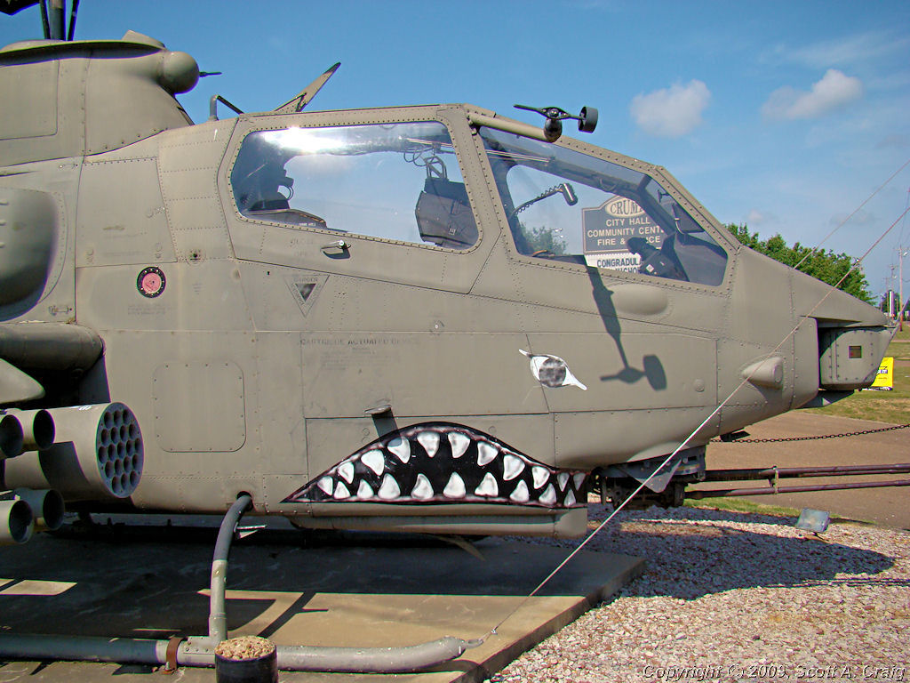
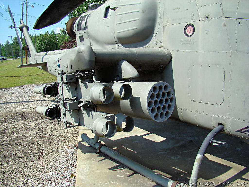
Heading back east for Nashville I stopped in Crump, TN and took a few photos. Those who know me well will have
no difficulty at all understanding the subject of the photos. Heading through Crump for Adamsville I noticed a
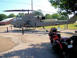
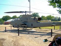
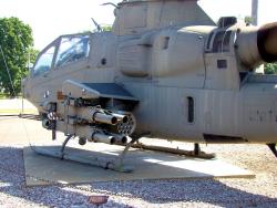
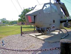
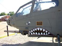
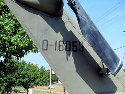
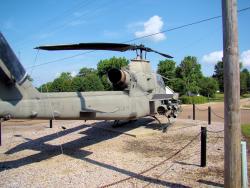
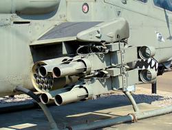
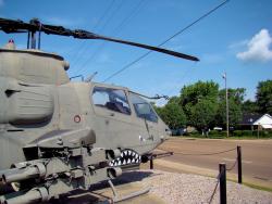
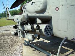
lonely AH-1F Cobra helicopter gunship (serial number 70-16053) parked beside the highway on static display. I
heard it call out to me as I went by and promised that I'd stop and take some photos on the way back.
Aircraft are machines, just like any other machine, but to some of us they are so much more. They are a part of
someone's life. The pilots who fly them, the maintainers who keep them flying, even the staff who keeps up
with where they are at all times. I looked at the cockpit and I could almost sense a phantom pilot checking
his instruments as he brought the machine to life and a phantom gunner checking his armament. I could sense
the vibrations in the airframe and the banshee howl of the turboshaft engine as the helo became a living, breathing
entity once again. I could see the airplane rock slightly on its skids as the rotor brake was released and the
rotors began to turn. I could see the 20mm M197 cannon on its chin turret start to elevate and train as if it
had a life of its own as the gunner exercised it and checked its operation prior to takeoff. I could see the
Crew Chief salute the pilot and release the airplane to him. I could feel the thunder in the ground as the rotor
bit the air, the pilot increased collective, and the monster lifted into the air, tucked its nose and lifted its tail
to go Fly The Friendly Skies like the great bird of prey that it is.
Yeah, they are just machines but to some of us they are so much more. This one will be junk someday but for
now it is safe and on display for people who understand to appreciate. Perhaps it will live a little longer
in some of these photos as well. Besides it is the Memorial Day weekend and to me this machine is a true
veteran as well. Stop by sometime and give him a salute. He is right on Highway 64 in Crump, TN at the
GPS coordinates N35.22210 W88.31971. He sits in front of the Crump City Hall and could use a visitor from time to time.
|
Bell AH-1F Cobra gunship |
Bell AH-1F Cobra gunship |
Bell AH-1F Cobra gunship |
Bell AH-1F Cobra gunship |
Bell AH-1F Cobra gunship |
Bell AH-1F Cobra gunship |
Bell AH-1F Cobra gunship |
Bell AH-1F Cobra gunship |
Bell AH-1F Cobra gunship |
Bell AH-1F Cobra gunship |

Bell AH-1F Cobra gunship |
Bell AH-1F Cobra gunship |
I took Highway 64 east to Ovilla and picked up the Natchez Trace Parkway. Since I went right by it I had to stop at
the Metal Ford which, in my personal opinion, is the nicest place on the north end of the parkway. The spot is right
beside the Buffalo River and today there were a number of people swimming and enjoying the cool water.
|
Metal Ford on the Natchez Trace Parkway |

Metal Ford on the Natchez Trace Parkway |

Metal Ford on the Natchez Trace Parkway |
|
I stopped further north on the trace at Garrison Creek, another of my favorite stopping places, and there were a couple of
people sitting there talking. As I walked toward them I had the feeling that one of them looked very familiar, and as
I got closer I realized it was someone I knew from an engineering company I used to work for. Not only that, it was
someone I haven't seen in about 15 years since I left that company. We caught up on events for an hour or so, and he
headed south to ride down toward the state line and I headed north for home. Robert, great to see you again, buddy!
All in all a good day riding even if I didn't get the stamp. 311 miles door to door and some airplane pix! I
also passed 5,000 miles for the year so far, and it's still only May!
|

GPS Track Log - 05/24/2008 |
|
|
|
|
Sunday - 05/25/2008
Not going to be a lot of riding today since it is the Indianapolis 500 race is today. I've only missed watching this
race a handful of times since I was a kid and today is not going to be one of them! I may get out for a little while but
most of the day I'll be prone on the couch watching the race.
Monday - 05/26/2008
I got a little riding in today, not much but a little. At most 100 miles but better than nothing. I was going to
ride down toward Monteagle and then cut over toward Fall Creek Falls and hit Highway 30 through Spencer, TN. That's one
of my favorite roads in this area and it's relatively close. Unfortunately the weather was uncooperative.
When I got up there was a big blob of red on the radar moving in this direction so I decided to forego a distant trip
for today. I sulked around the house for a while, checked the radar again, got my V-Strom out and rode to my office
for a little while, came home, checked the radar again, sulked around the house for a while, and checked the radar
again. The movement of that big blob of red was so slight that I was certain that I had about 4 hours before it got
to Nashville. I hopped on the VFR and headed for the Natchez Trace Parkway to annoy the bicyclists. Fair is
fair; they annoy me by not adhering to the Parkway rules for bicycles so I don't see why I can't annoy them with my
motorcycles. Anyway my 4-hour forecast was off by about an hour and I got soaked. Naturally, since I was
confident I had 4 hours to play, I didn't take my rain gear. Oh well, my bike has been cleaned up, my gear is drying
out, and I've had a shower so everything is fine. I actually enjoy riding in the rain sometimes. I don't like
it when I leave my rain gear at home though.
|
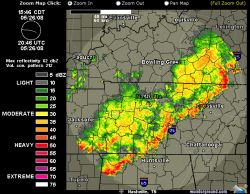
3:45pm Radar - 05/26/2008 |
The radar image to the left shows what it looked like after I got home and cleaned everything up. About an hour ago
I rode right through all that red junk! The rain was coming down in buckets and the wind was really evil. Not
a good place to be on a motorcycle. I was coming up I-65 and saw it just ahead so I jumped off the interstate and
took Franklin Road to the north. Wet is one thing, but wet in heavy wind on the interstate in traffic is quite
different and I chose to take the slower and easier route (it was still a 55mph speed zone). And for anyone who
might be interested, it took my leather gloves 2 days to dry out!
|
|
This kind of weather gives me concern for those who have never ridden in rain or on wet streets. They have absolutely
no idea what to expect, how their motorcycles are going to behave, how little they will be able to see, or anything
else. I'm lucky enough to have a close friend who is a very experienced rider that made me aware that knowing
how things are going to be in the rain is important to a rider. Sooner or later everyone gets caught in the rain,
and it is far better to learn what to expect under circumstances we can control than it is in the middle of rush hour
in an unfamiliar town or some other poor situation. The best advice I can give is to get it wet. Put on
your rain gear, get your bike out in your own neighborhood, and get it wet where circumstances are in your favor. It's
your choice, and I'm just passing along good advice that was passed on to me.
|
|
FORMER TDPC PISTOL RANGE - MAY 31, 2008
2007 Honda VFR800
|
|
I rode down to near Smithville, TN today to visit an old friend. No, not a human friend but a "Place" friend,
one that I haven't seen in a good while. I was down there a couple of years ago and if anything it looks
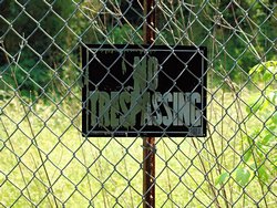
even worse now. This site is a former pistol range and I was a member of a club that held IDPA pistol
matches there a couple of times a month. Even when there were no matches scheduled a bunch of us normally
got together there on the weekends and had our own impromptu matches or just practice. For several years, hot
or cold, we shot down there. There is no telling how many rounds of pistol ammo I fired at that range, but
it was a lot.
The club was the Tennessee Defensive Pistol Club, and we had some pretty good matches at that range. We were
more than just a group of friends, we were also competitors with a great deal of respect for one another. But
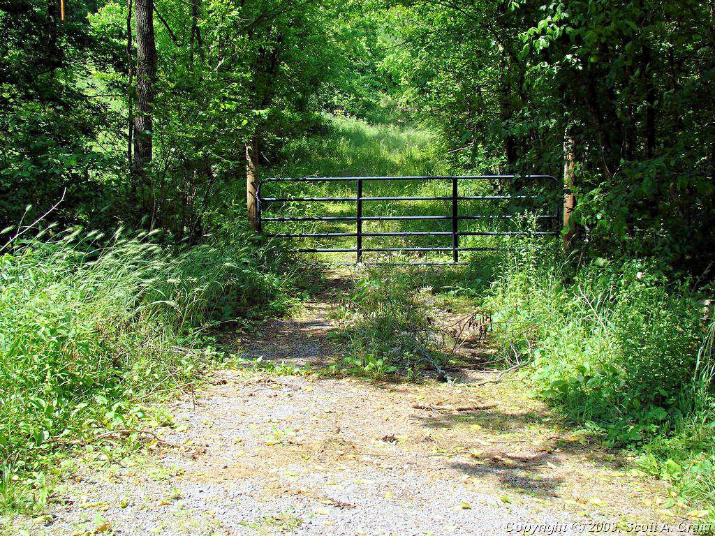
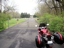
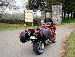
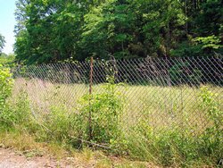
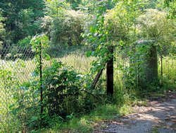
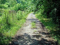
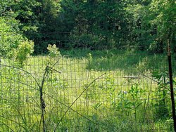
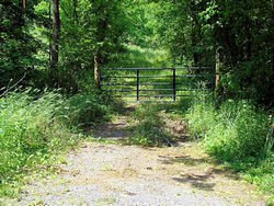
it all came to a screeching halt. In the photos below you will see a "Road". It's actually just a path
that is grown up. At the end of this "Road" are the remains of an old house. I say "Remains" because there
is virtually nothing left except rotted wood, a sort of foundation, and an uncovered well just waiting for someone
to fall into it. The owners of the property claim that it is the birthplace or childhood home of some minor
politician, and as such is a "Historic Landmark". We used to have a gate at the main road, just to the left of
where my motorcycle is parked, to keep people from getting into the range, but the owners of this cheesy "Historic
Landmark" decided that this was unacceptable since it prevented people from being able to "Visit" their "Historic
Site". Keep in mind that this is a weed infested, junkyard with absolutely nothing resembling anything
"Historic". But small-town politics talk and we had to take the gate down.
The board of directors of the club unilaterally decided that this was unacceptable and we moved the range. All
we had to do was put up a fence, which is there now and was put up after we left, but to the club's BOD this was not
acceptable. Can you say stupid? After that everything started falling apart, the "New Range" was a joke,
the BOD started making decisions as to the club's direction without consulting the club membership, the officers
resigned, and eventually everything fell apart. All that is left now is some weed infested pistol bays and a few
rotting benches and target stands. Oh, and a "Porta Potty" that hasn't been pumped out in over 5 years.
One of the photos below shows a gated road. After the pistol club moved out the owners of the "Historic Landmark"
put up a gate to prevent people from getting to their "Historic Site". Did I mention anything about small-town
politics? It's all about who you know and what you know about them. If you know somebody you can get
anything you want done.
There are a few more photos from when I was there in July, 2006 at
This Link.
It sickens me to see what has happened to this place because I have so many enjoyable memories from there. It
sickens me to know what happened to the club because it didn't have to happen. I sat there today and I saw a lot
of faces; some of which I barely remember now, some of which I haven't seen in years, some of which are now gone
forever. I wish we could all get together and do it again, but that can never happen. The best I can offer
is that fact that I still remember the good times we had.
|

TDPC Pistol Range |
Main Parking Lot |
TDPC Pistol Range |
Registration Area |
County Road |

Pistol Bay 1 |
Pistol Bay 2 |
Pistol Bay 3 |
Entrance to the "Historic Site" |
GPS Track Log - 05/31/2008 |
|
|
|
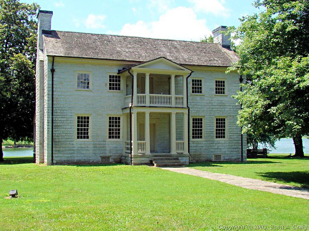
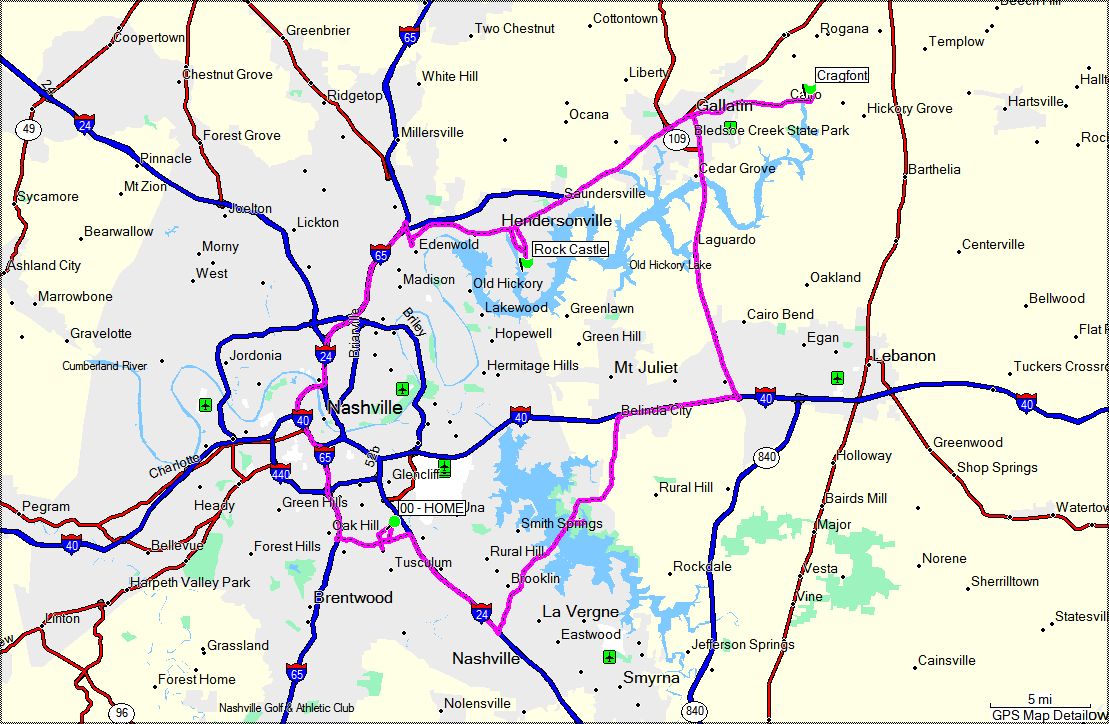
CRAGFONT AND ROCK CASTLE - June 7, 2008
2006 Suzuki DL650
|
|
Summer is here! No question about it. I occasionally enjoy looking back on this page to see where I've been
in the past few months and it amazes me how quickly my trips went from "Cold and Nasty" through "Nice" to "Already
Hot". Our average temperature this time of year is about 82°, and when I got home this afternoon is was
92° at 2:00pm. This does not bode well for the remainder of the summer, in fact it technically isn't even
summer yet.
Regardless of the temperature the V-Strom and I set of early this morning to try again to get a couple of Tennessee
Historic Commission stamps that I did not get in April. Both of the sites, Cragfont and Rock Castle, were closed
for some reason when I was there in April so with nothing better to do today I decided to try them again. I was
going to ride my VFR since my V-Strom is still on my Not-100%-Trusted list after it stranded me a few weeks ago, but
I'm pretty sure it's fixed and decided to take it instead. Every mile I put on it adds a little bit more to the
level of trust and I want to get back to trusting it completely.
I left early and stopped at a "Starbucks Of The South" (aka Waffle House) for some breakfast. After I ate I
realized it was far too early to head for those sites since they do not open until 10:00 so I decided to stop at
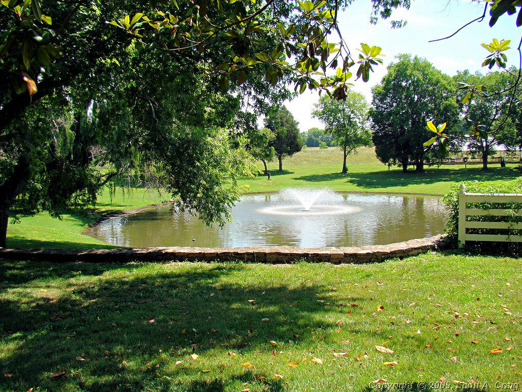
Couchville Lake for a while and see what was going on there. It is a great place for just taking it easy, so
take it easy I did.
Couchville Lake is part of Long Hunter State Park in eastern Davidson County. The lake itself is about 100 acres
in size, and power boats of any kind are prohibited. Even though the park adjoins Percy Priest Lake it is still
quiet and peaceful. I used to go there a lot just to unwind but during the past few years my visits have
dwindled. It hasn't changed much though and I still enjoy stopping by from time to time just to get away from
the city.
|
|
If you compare the photo on the left that I took today to the one on the right that I took last year you'll see something
is missing. The covered pavilion that was at the end of the pier is now in the lake, or what is left of it is in
the lake. Last time I was there I didn't see any signs whatsoever of deterioration so I have no idea what made it
fall, but it appears to have done just that.
|
|
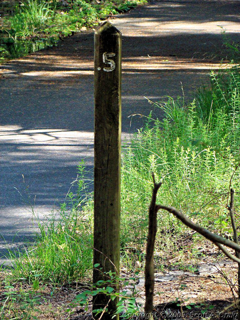
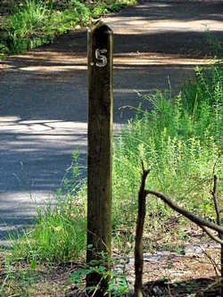
There is a 2-mile paved loop around the lake that crosses a bridge on one end. I headed out along the loop with no
intention whatsoever of going all the way around. I walked and walked for what seemed like hours and finally came
across this milepost. I'm not THAT badly out of shape, but motorcycle gear was not meant for walking very far
in. My Sidi boots hurt my feet, my Kevlar-lined jeans were hot as hell, and even my t-shirt (I did leave my jacket
and helmet at my bike) was soaked. I finally decided enough was enough, chucked my cigarette in the lake, and headed
back the other direction (hmmm ... maybe I AM that badly out of shape!).
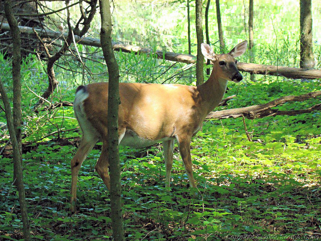
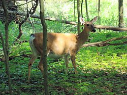
I am glad I decided to head back the way I came rather than going on around the lake because on the way back I ran across
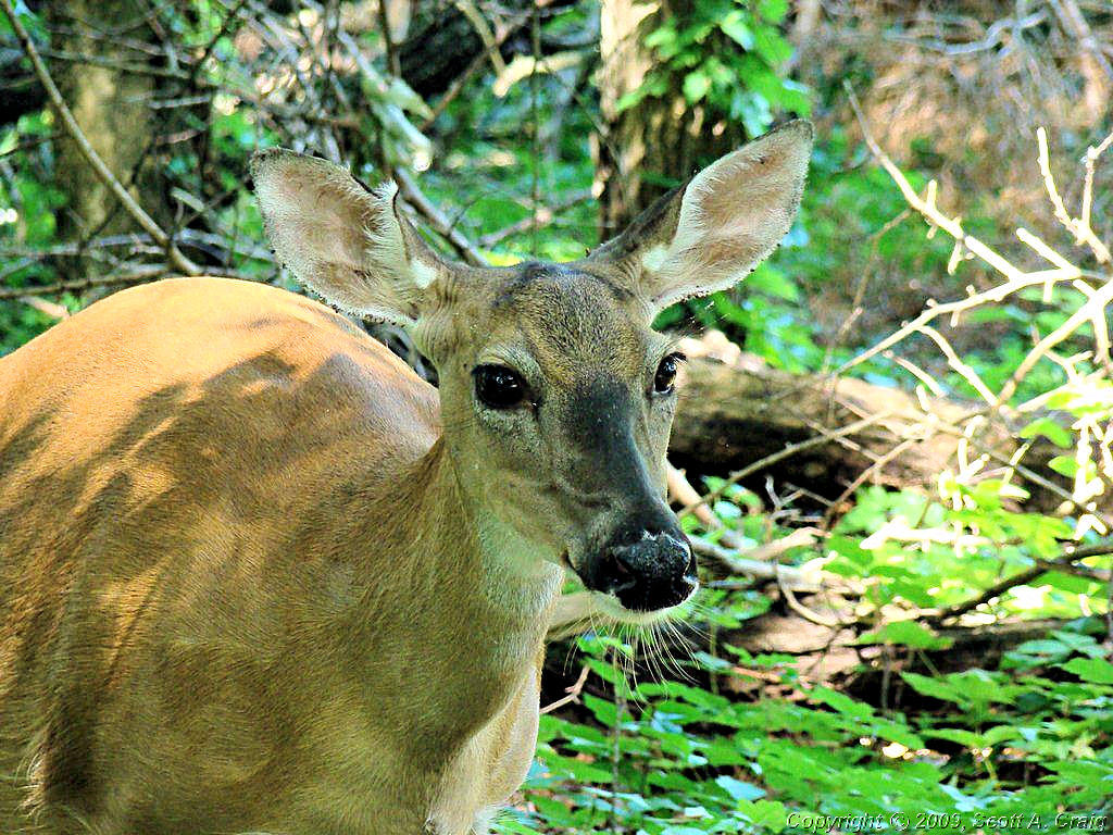
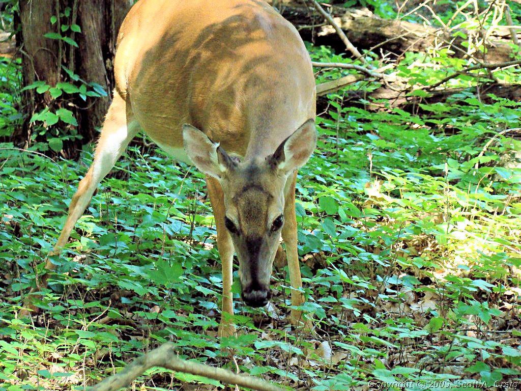
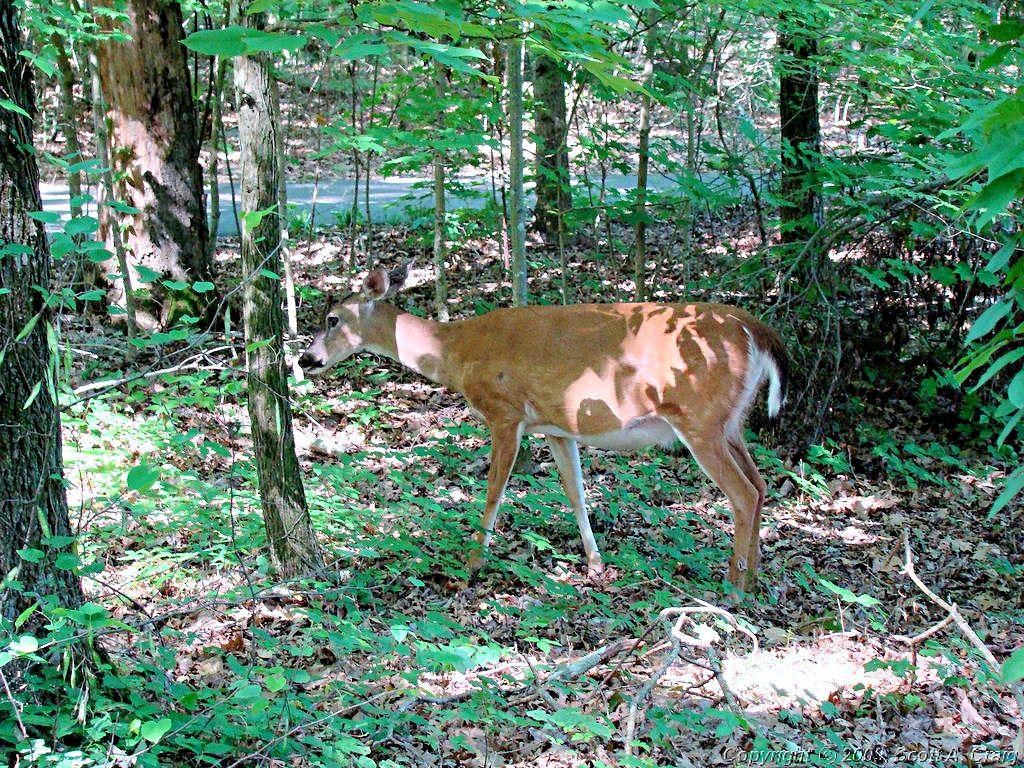
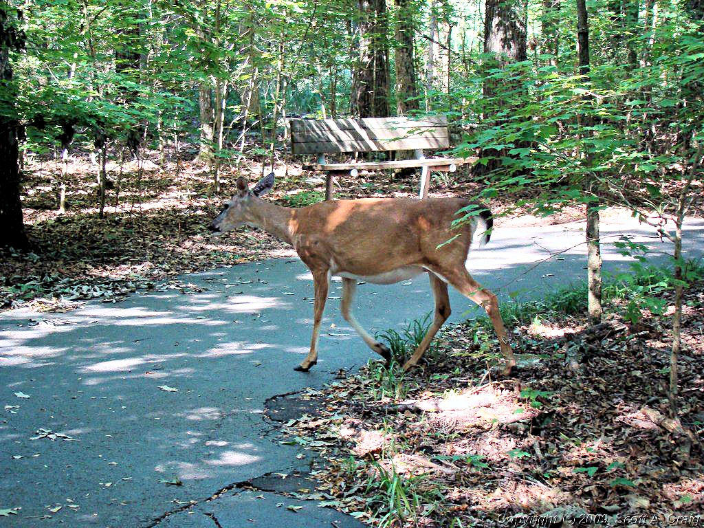
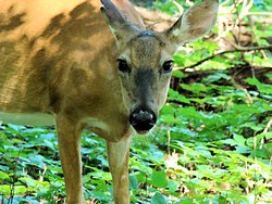
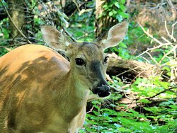
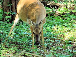
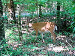
this chubby little girl grabbing a bite to eat. She really is chubby, and since I know nothing whatsoever about
deer anatomy, it's quite possible she is pregnant. I think they give birth around this time of year, maybe?
Update: According to my resident expert:
Fawns usually show up May to early July. The pregnant ones separate from the herd and stay in wooded areas to
birth their 1-3 fawns.
So she probably is fixing to give birth.
|
|
Couchville Lake |
Couchville Lake |
Couchville Lake |
Couchville Lake |
Couchville Lake |

Couchville Lake |
|
|
|
She was completely unafraid of me; not surprising since anyone foolish to hunt deer in that area would find themselves buried
under the jail. Some of those photos were taken from less than 10' away. I watched her for about 10 minutes before
she dediced enough was enough and sauntered over into the woods.
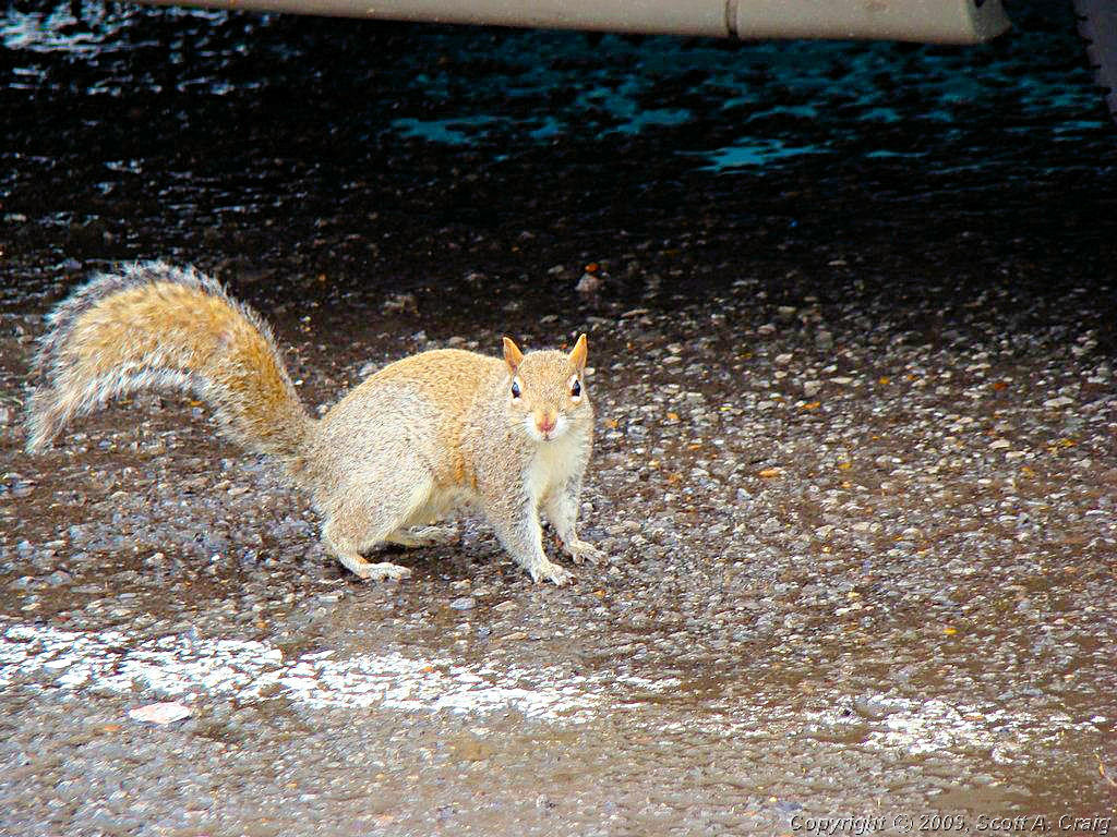
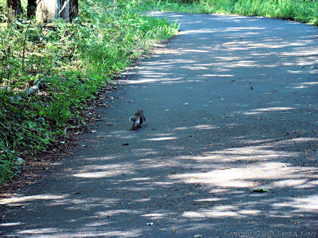
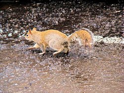
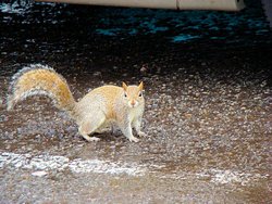
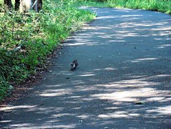
I also ran across a chubby little squirrel out for a morning jaunt along the paved pathways. He
stayed right in front of me for a while, occasionally looking back over his shoulder to make sure I wasn't getting too
close, but he stayed right on the path. Everything was fine until a couple of people came along the path in the
opposite direction. He sat up, thought about it for a second, and decided to hightail it back into the woods.
|
|
|
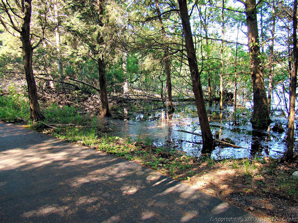
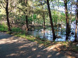
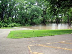
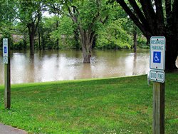
We've had a relatively wet spring, and unlike Early Last Year
when the water was so low, it is quite high right now. As can be seen in the photo to the left it is up level with
the walking path. Although the photo doesn't show it the water was recently over the path since it was still damp.
|
|
|
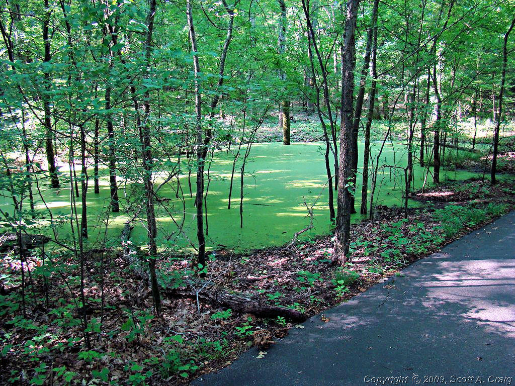
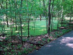
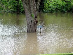
One drawback to ponds in hot weather around here can be seen in the photo to the left. When it gets warm the water
in smaller ponds gets warm as well. This causes algae to bloom and coats them with a green scum that makes them
look like ponds of split pea soup. Really nasty looking sometimes.
|
|
|
I huffed and puffed my way back to the beginning and got ready to head for Cragfont and Rock Castle. Surprisingly
it hadn't taken me a week to walk that mile, but only about an hour. And a good part of that time was watching the
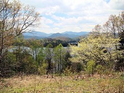
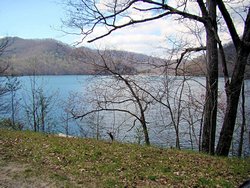
deer and taking photos.
A few more scenics of Couchville Lake and we're off to Gallatin, TN and Cragfont.
|
Couchville Lake |
Couchville Lake |
Couchville Lake |
Couchville Lake |
|
I rode to Cragfont east of Gallatin, TN back in April to try to obtain a Tennessee Historical Commission stamp for
my Passport Stamp Collection but for some
reason the site was closed at that time. It wasn't supposed to be, but it was. Regardless, they were open
today and I got my stamp.
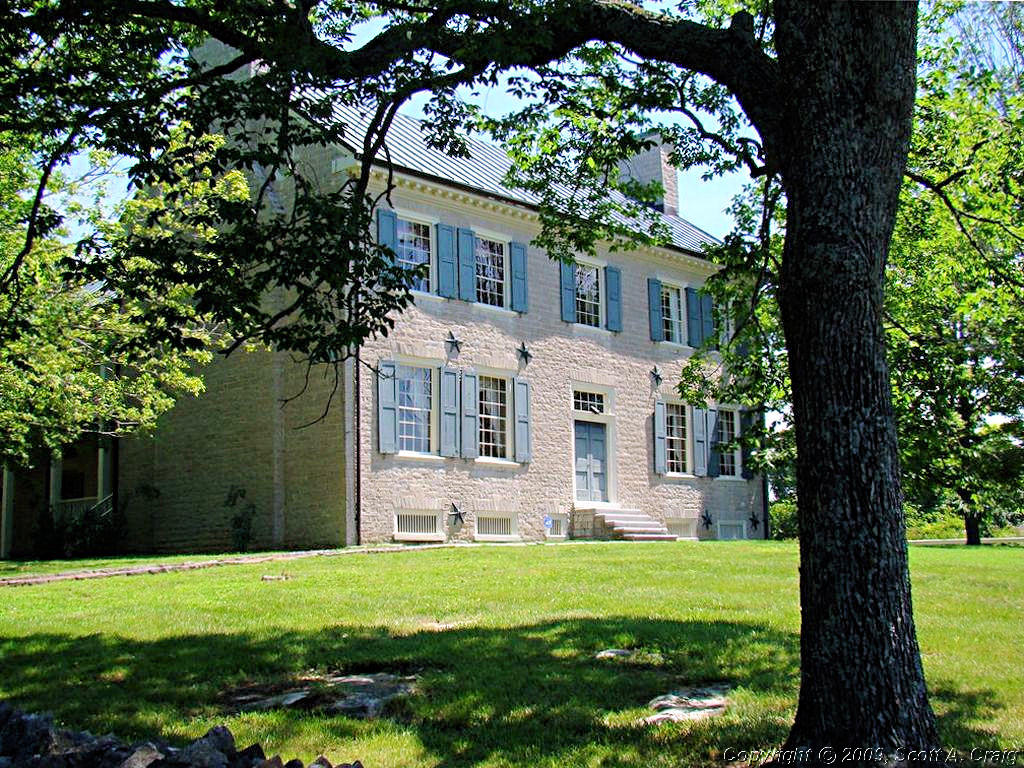
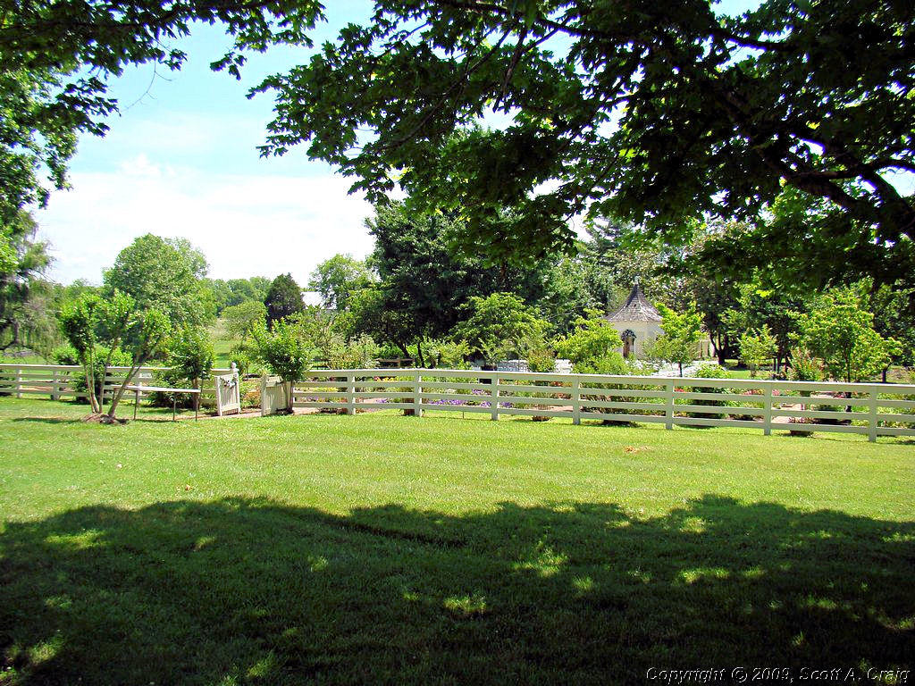
Built between 1798 and 1802 Cragfont was the home of James Winchester and typifies late Georgian period homes. It
is built of limestone quarried on the site and trees cut from the surrounding forests. Today it is a well-maintained
tribute to the early 19th century. More information about the site can be found at
This Web Site.
|

Cragfont |
Cragfont |
Cragfont |
Cragfont |

Cragfont |
Cragfont |
|
|
|
I made another stop at Rock Castle in Hendersonville, TN to try and get another Tennessee Historical Commission stamp
that I missed in April. Like Cragfont, Rock Castle was closed the day I was there in April but also like Cragfont
they were open today and I got my stamp.
Rock Castle was the home of Daniel Smith, a late 18th century surveyor who surveyed much of Tennessee, including Davidson
County. More information about the site may be obtained from
This Web Site.
|
Rock Castle |
Rock Castle |
Rock Castle |
Rock Castle |
|
All in all a good ride today. It was hot though and I only rode about 100 miles. I did manage to get two stamps
for my Passport stamp collection (unofficial since they aren't dated). My last stop before heading
home was the local Cycle Gear at Rivergate. I didn't need anything, but what the heck it was a good excuse to look
around the store.
|
GPS Track Log - 06/07/2008 |
|
|
|
|
DAY RIDES - June 14 & 15, 2008
2006 Suzuki DL650
|
|
Saturday - 06/14/2008
It rained off and on all morning, and I expected today to be a complete washout. About 1:30 the rain quit,
the clouds started breaking up, and the sun peeked out a few times. I checked the radar and it showed all
the rain to the east of Nashville so I decided to get the V-Strom out and ride a little while.
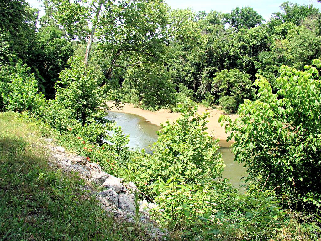
I didn't have any particular destination in mind so I headed over to the Narrows of the Harpeth State Park. I
was there Last August. There
really isn't much there unless you are into canoeing since the road runs along a shelf cut into the rock with a bluff
going up on one side and a bluff going down to the river on the other. There are places to launch canoes, but
that's really about all there is there. Personally I like it just because it's quiet and peaceful.
Not a long ride today by any means. I cut over to the Natchez Trace Parkway and rode it for a little while, then
headed back home. About 100 miles all told but it felt good to get out and ride for a while. Tomorrow the
VFR and I are going somewhere. I don't know where at this point, but I'm going somewhere!
|
 |
 |
 |
GPS Track Log - 06/14/2008 |
Sunday - 06/15/2008
I was going to head east toward Monteagle this morning but got sidetracked. I had breakfast with some other
riders who invited me to head west with them. They were heading for Clifton, TN and since Monteagle was just
someplace for me to go so I tagged along with them. We headed west in a roundabout way and wound up in Charlotte,
TN about noon. The rest of the group headed on west toward Clifton and I took the roundabout way back toward
Nashville. No photos this trip but I found some great roads and had a blast. Thanks for the invitation
guyes, it was great!
|
GPS Track Log - 06/15/2008 |
|
|
|
|
MISSOURI AND ILLINOIS - June 21 & 22, 2008
2007 Honda VFR800
|
|
What a trip! I headed out early Saturday morning toward the west to get a couple of stamps for my
Passport Stamp Collection. These
two were farther than I've ever ridden just for stamps. One was in Van Buren, MO and the other in Ellis
Grove, IL. I got them, I actually got 3, and crossed a number of personal milestones while doing so.
Personal milestones are just that, memorable events that only mean something to the person who does
them. In this instance there were four on this trip; I travelled in my 9th and 10th states on
a motorcycle (11 if you include Hawaii back in the 70's), this was my longest trip on my VFR, I eclipsed my longest
trip in a single day (592.7 miles by GPS), and somewhere about where I crossed into Missouri I crossed 30,000 miles
on motorcycles since I got my V-Strom in May, 2006.
But, back to the trip itself.
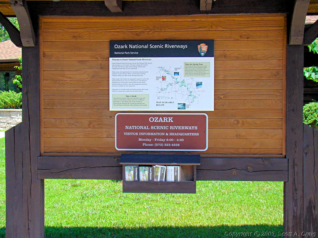
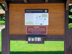
My first stop was in Van Buren, MO to get a stamp for the
Ozark National Scenic River. The GPS coordinates at the site are: N36.99990 W91.01460. I got
the stamp for Van Buren and also for the Big Spring unit so I did pretty good! Emily, thanks for all of
your help and the offer to take my picture, I really appreciate it.
Photos of the Visitor Center are below. I was pressed for time and didn't get a chance to go to Big
Spring, and that is something I regret. As it turned out time-wise it was a good thing, but that is
in the paragraphs below.
|
Ozark NSR - Van Buren, MO Visitor Center |
Ozark NSR - Van Buren, MO Visitor Center |
Ozark NSR - Van Buren, MO Visitor Center |
|
|
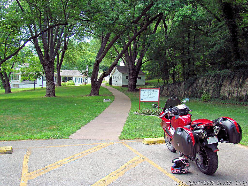
From Van Buren, MO I headed northeast for Ellis Grove, IL to get a stamp for the
Lewis & Clark Expedition.
Getting this stamp was a bit unusual. I took the advice of my close friend
"AGirl" (whose expeditions to get Passport Stamps are, to
say the least, legendary!) and called the site the day before to insure that they did in fact have the stamp and that
someone would be there on Saturday. The gentleman I talked to at Fort Kaskaskia State Park was very helpful, he
said that they do indeed have the stamp there, but unfortnately he would not be there on Saturday. He said that
normally someone is there on Saturday but that on the weekend I was planning to be there the site would be
closed. OK, this is a problem. The next nearest stamp in Illinois is about 75 miles north in St. Louis, and
that would tack 150 miles onto an already long 2-day trip. Also, when reading the paragraphs below, keep in mind
that St. Louis is to the north! But then he said, "Oh, wait. There is a copy of the stamp at the Pierre
Menard Home just down the road and he will be there tomorrow!" I may be back in business!
I found a phone number for the Pierre
Menard Home on the Illinois Historic Preservation web site and gave them a call. I got their voice mail so
I left a message explaining who I was and why I was calling. To my surprise the curator called me back in about
30 minutes. He said that they did have a copy of the Lewis & Clark stamp there and that he would be there on
Saturday from 9:00 to 5:00. I AM back in business!
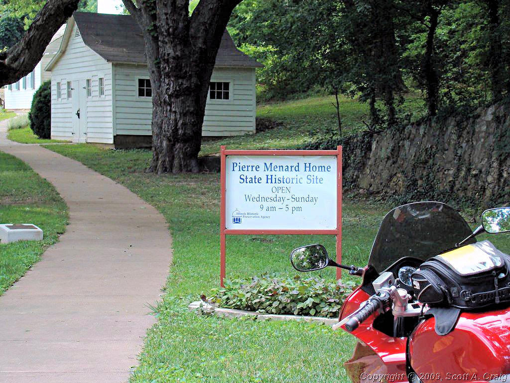
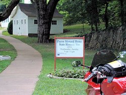
Pierre Menard was the first Lieutenant Governor of the State of Illinois, and this site is a semi-restoration of his
home. I say "Semi" restoration since parts of the structure are original. It is a magnificent example of
19th century architecture, and kept in immaculate condition.
I got my Passport book stamped thanks to Andrew, had a glass of ice water also thanks to Andrew, and chatted for a few
minutes. Then I had to get headed back to the south! Andrew, thank you so much for your help and hospitality. It
was greatly appreciated!
GPS coordinates of the Pierre Menard home are: N37.96072 W89.90469. That is in the parking lot, right where my
motorcycle is parked.
|
Pierre Menard Home - Ellis Grove, IL |
Pierre Menard Home - Ellis Grove, IL |
Pierre Menard Home - Ellis Grove, IL |
|
|
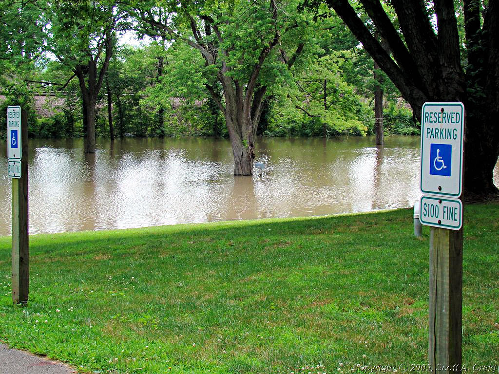
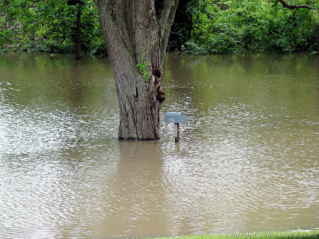
Andrew mentioned when I talked to him on the telephone that they had been having "Some flooding problems." He
was NOT kidding! The photos below show what he was talking about, and the photo on the right shows their mailbox
nearly underwater. Just beyond that row of trees is the Mississippi River. Luckily the home sits on a rather
high rise and the flood waters are supposed to crest in the next 24 hours so there should not be any damage to the site.
|
Pierre Menard Home - Ellis Grove, IL |
Pierre Menard Home - Ellis Grove, IL |
Pierre Menard Home - Ellis Grove, IL |
|
|
Earlier, as I crossed the Mississippi River headed for the Pierre Menard Home, I noticed some truly horrendous-looking
thunderstorms to the north. I couldn't tell exactly how far to the north, and not being familiar with that area
I didn't know which direction they typically move. What I did know is that I didn't want to get caught in them
on a motorcycle. The Pierre Menard Home is north of where I crossed the river by several miles so I was already
very, very close to them. All I wanted to do right at that moment was to head south and get some miles between
myself and those black thunderheads. That wasn't going to happen yet though.
I did get a few miles south. I got back to Chester, IL which is about 5 miles south of the Menard home. There I
saw a sign indicating that Illinois State Highway 3, the highway I needed to use to get farther south, was closed due to
high flood waters and to follow the detour signs. Great, that's what I needed to see when I'm trying to get away from
those ominous looking storms. So I start following the detour signs, and is there any question as to which direction
they headed me in? Of course not! North, right toward the heart of the storms. I followed it a few miles
and decided that this was just not going to work as a detour for me. I turned around and decided to find a spot to
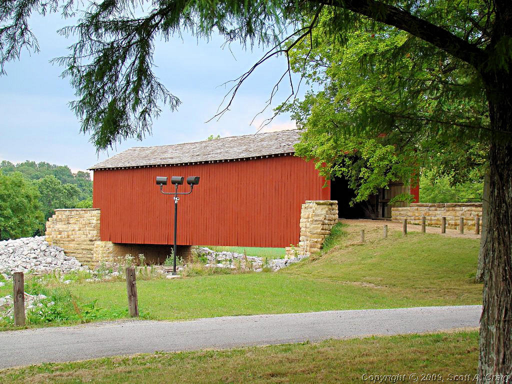
look through my maps and find a way south around this mess. When I did I happened across this little covered
bridge. I have a friend who loves to visit covered bridges so this one is for you! GPS coordinates are
N:27.94783, W:89.76635. I don't know the significance of it other than what the plaque shows, but it is a nice little
bridge. Right on Illinois Highway 150 east of Chester, IL.
Update - 06/23/2008 - According to my resident Covered Bridge Expert this is the Mary's River Covered Bridge. There
is some information about it at
This Link.
|
Mary's River Covered Bridge - Chester, IL |
Mary's River Covered Bridge - Chester, IL |
Mary's River Covered Bridge - Chester, IL |
|
|
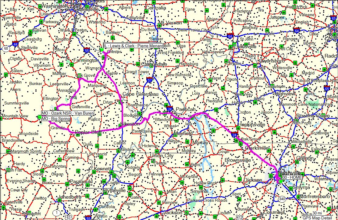
In this part of Illinois there are not a lot of highways running north and south. The locals could probably
tell me a dozen routes I could have taken, but looking through my map book my best alternative appeared to be to head
southwest back across the river into Missouri to Interstate 55. I-55 runs north and south on the west side
of the river, and I could pick up I-57 headed east toward Paducah, KY which was my next destination. What I
needed to do was get back on Illinois Highway 3 but somewhere along the way it was underwater and I wasn't going to waste
a lot of time finding out where. I really wanted to get back to Nashville tonight and riding around southern Illinois
and Missouri in flooded areas wasn't conducive to that goal.
After detouring out of my way about 50 miles or so I got back to Paducah about 7:30pm. I felt good and could have made
it the rest of the way to Nashville, but the clear face shield for my helmet was in my basement (damn good place for it
to be!) and all I had with me was a dark smoked shield. Not the best thing for riding at night on the interstate so I
decided to spend the night in Paducah. Took a shower (God that felt good!), got some food, got some sleep, and
headed home Sunday morning.
All in all a great trip and one for the books. 742 miles from door to door, visited two new states, got three new
passport stamps, and had a blast! That's what it's all about.
|
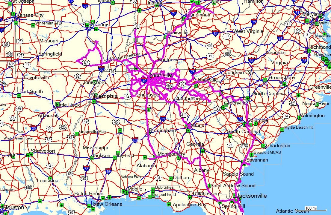
GPS Track Log - 06/21/2008 - 06/22/2008 |
|
|
|
|
|
SLOW WEEKEND - June 28 & 29, 2008
|
|
Not a lot going on this weekend. I rode about 750 miles last weekend and next weekend will be about the
same. I've already ridden 1,600 miles this month so nobody can ever accuse me of letting my bikes sit
idle. Also, as can be seen in the section at the bottom of this page I've got several longer trips
semi-scheduled. I want to do a 4-day trip through parts of Arkansas and Louisiana (which will also catch
the corners of Oklahoma and Texas), as well as a trip to Pensacola, FL. These two will probably wait until
fall when it is a bit cooler, and I may combine them into one long trip. I'm not sure about that yet.
This weekend I'm just taking it easy and doing some maintenance on my bikes. The front tire
on my VFR was cupped pretty badly and coming back from Paducah, KY last weekend I noticed that the front brakes
were feeling somewhat spongy. So, among other things, I'm replacing the front tire on my VFR and bleeding
the brake systems on that bike. My V-Strom needs a bath and it needs to have the chain cleaned, lubed, and
adjusted so I'm going to get that taken care of as well. Additionally there is a good chance of rain on
Saturday so it's just a good weekend to take it easy.
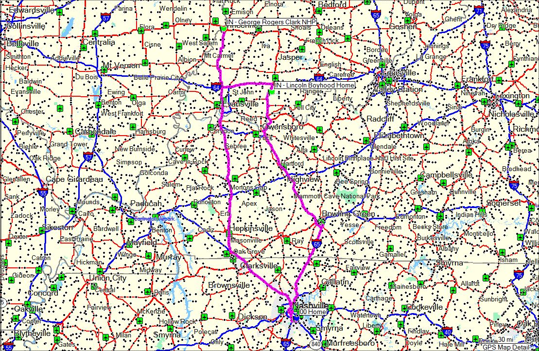
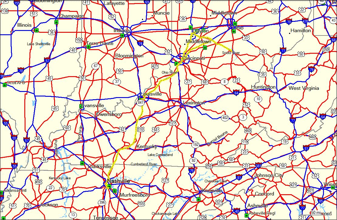
Early next Saturday morning I'm heading out on a 3-day trip to Dayton, OH with a friend. We are planning to
pick up 6 National Park Passport Stamps
in Cincinatti, OH, Dayton, OH and Chillicothe, OH. We also plan on spending most of Sunday at the USAF Museum
at Wright-Patterson AFB in Dayton. Should be a great trip and I'm looking forward to it.
I did get out and ride a little this weekend, just up and down the Natchez Trace Parkway, because I needed to scuff
in the new front tire on my VFR. New tires are a bit slippery and I didn't want to head out on a 3-day
trip on a brand new unscuffed tire. OK, so that was just an excuse to get out and ride a little. Like I
ever take much convincing!
|
|
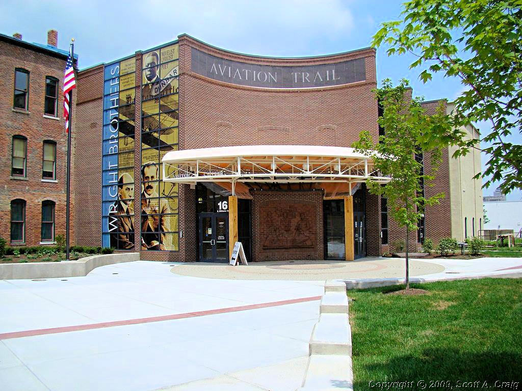
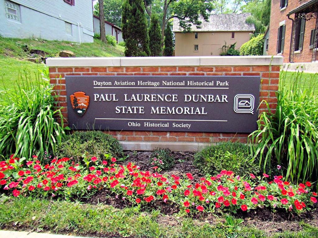
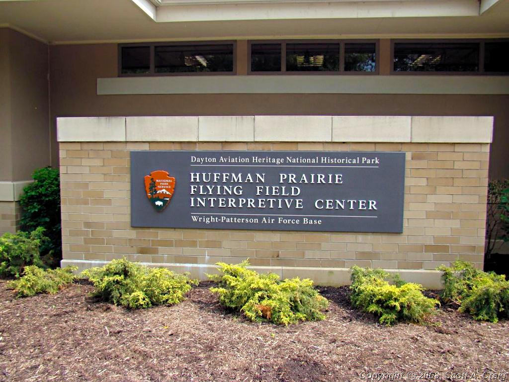
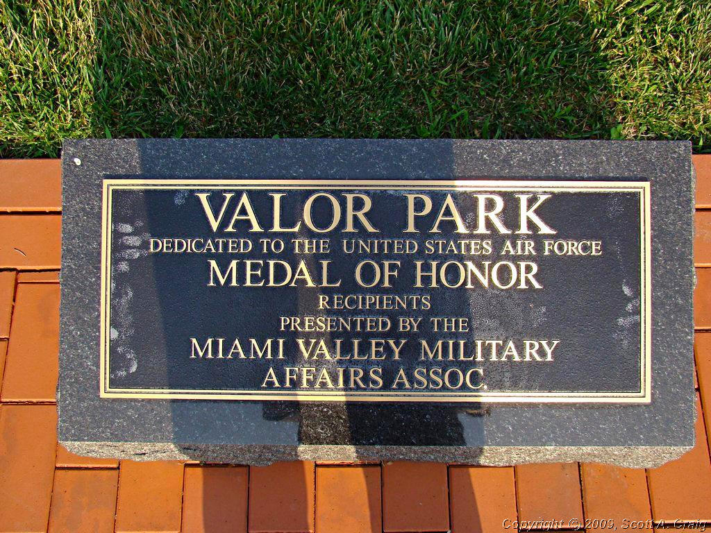
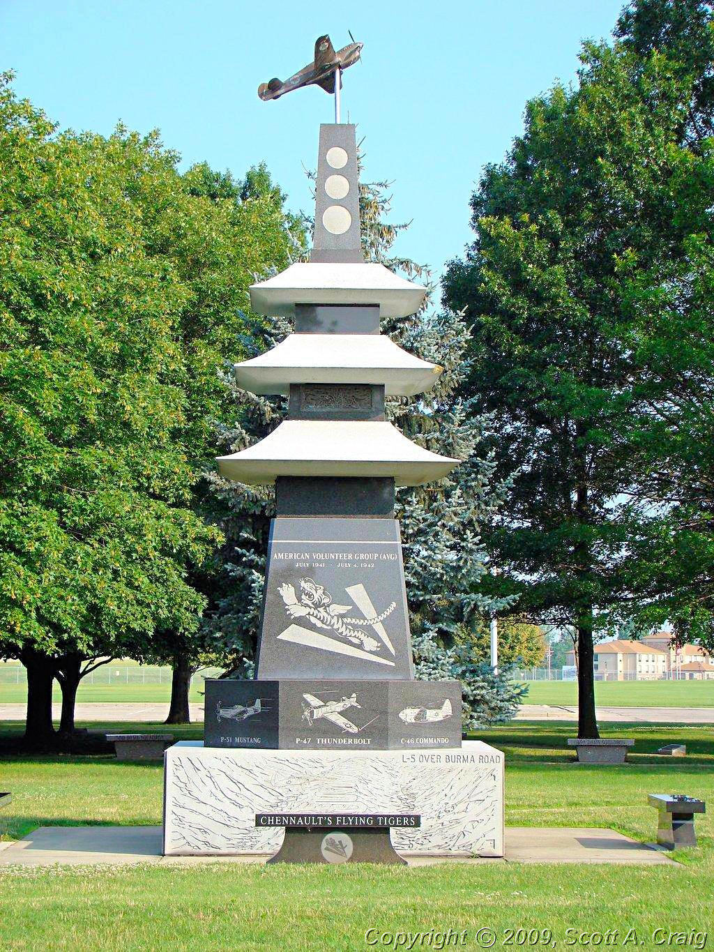
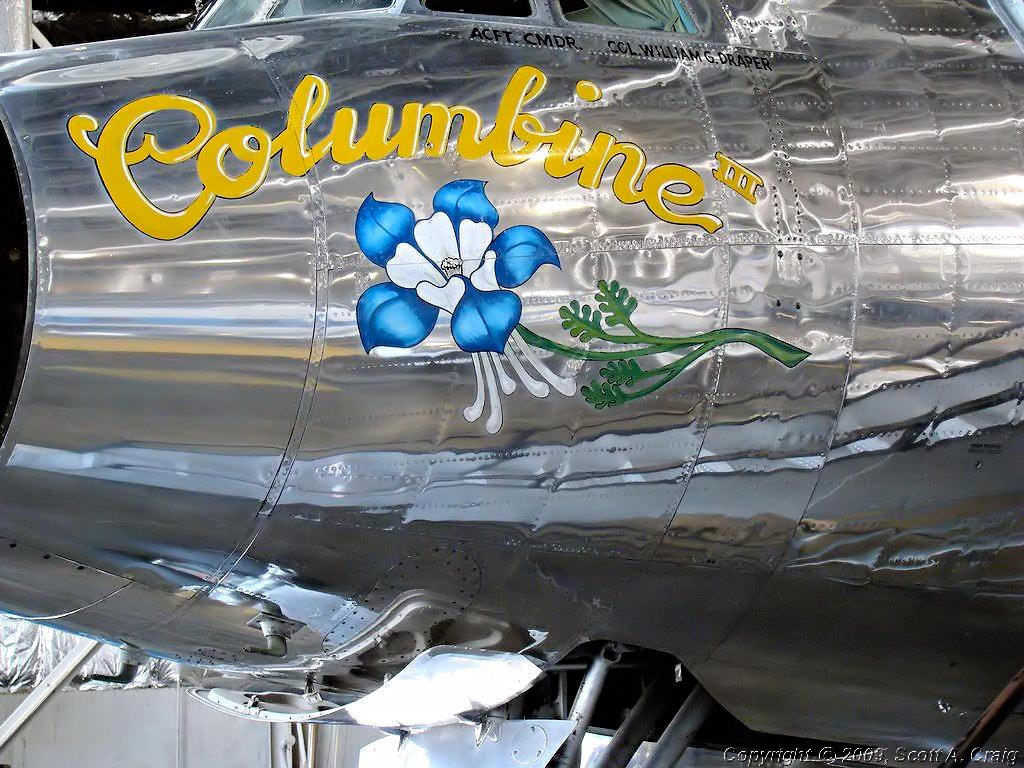
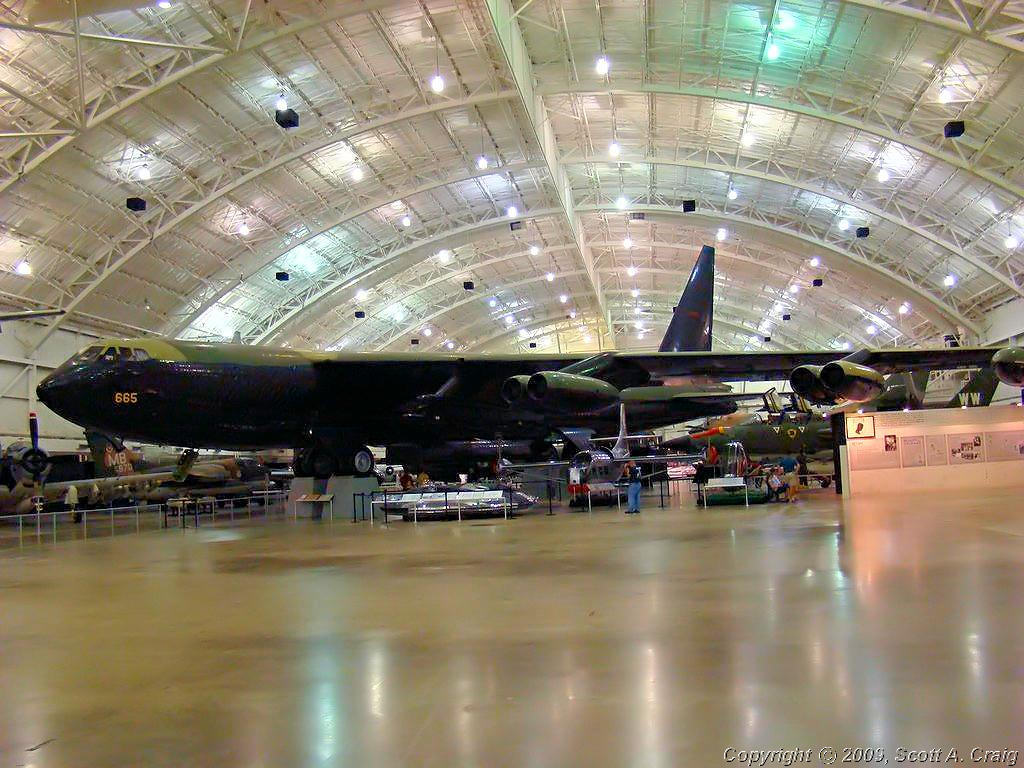
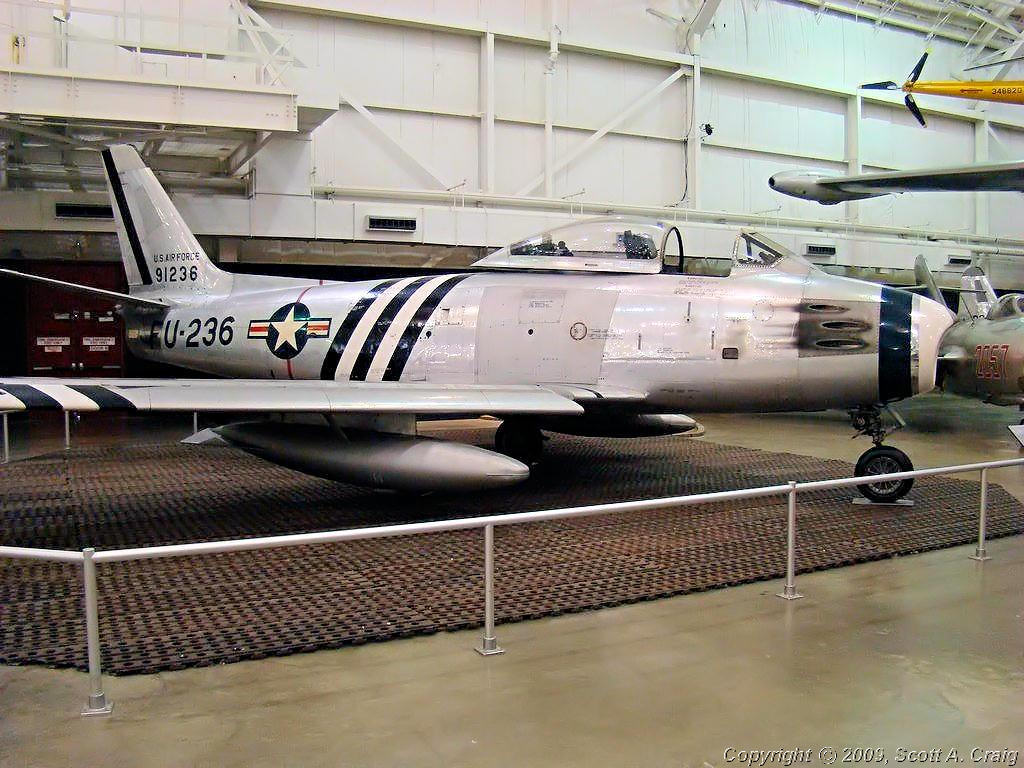
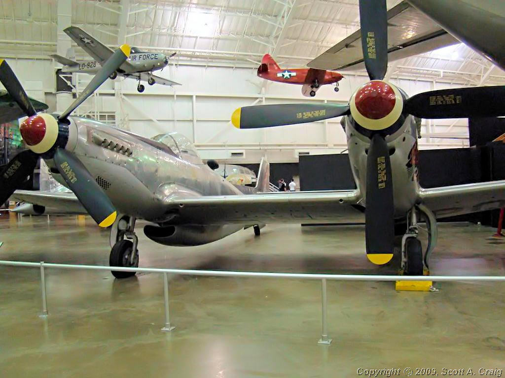
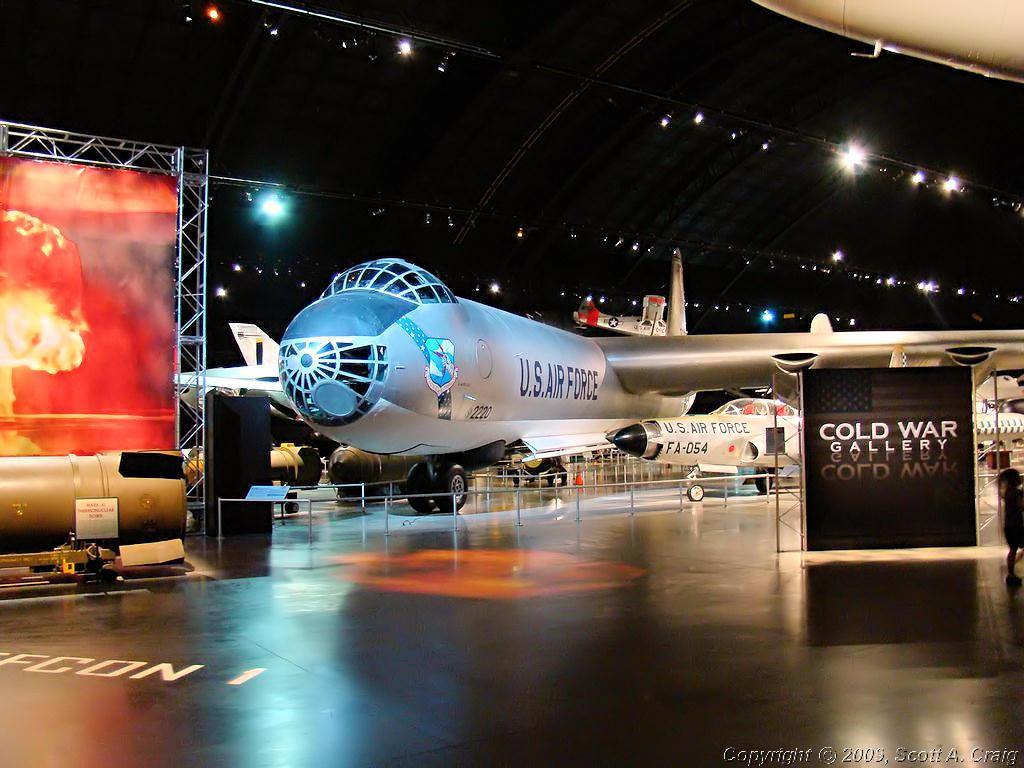
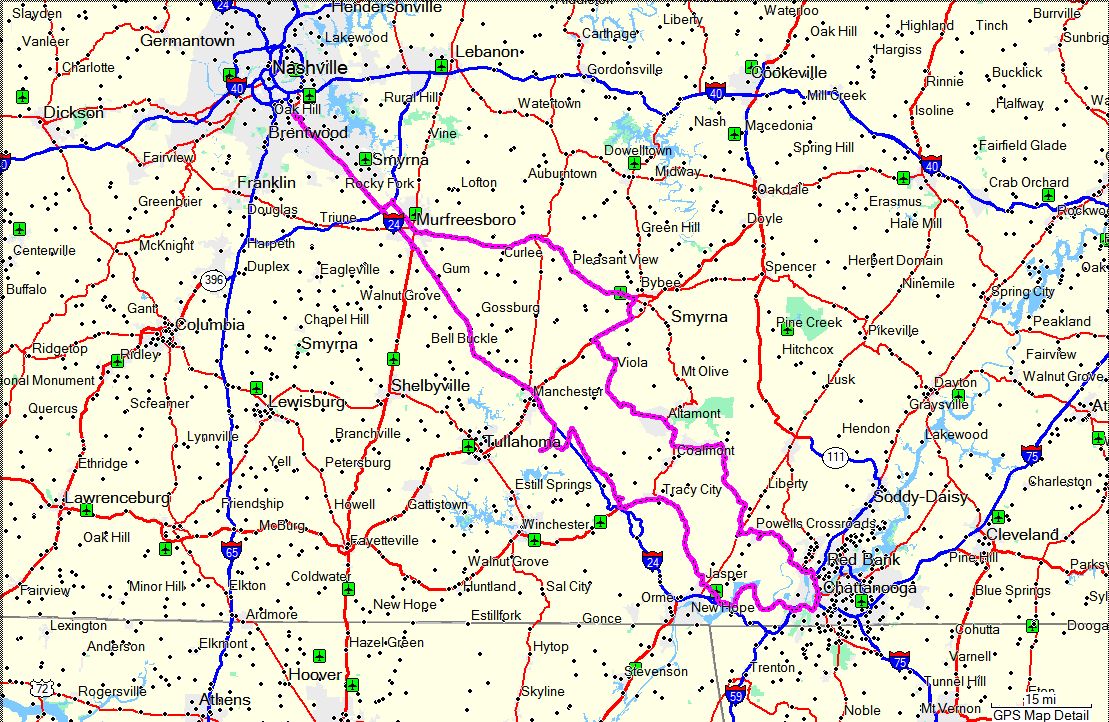
DAYTON, OH - July 5-7, 2008
2007 Honda VFR800
|
|
|
ATLANTA, GA - July 19, 2008
2007 Honda VFR800FI
|
|
I had originally planned to head for South Carolina this weekend but decided to put that trip off yet
again. I've been trying to get back there since last summer and haven't made it yet. I will
one of these weekends but since I've spent a couple of weekends in the past month in motels I decided to
just make a Day Trip to Atlanta, GA today to pick up three
National Park Passport Stamps
that I've been procrastinating over for a long time. I don't particularly care for going to Atlanta
since virtually every time that I do traffic is horrendous, usually due to road construction in one place
or another. Today was no different and lived up to my expectations completely.
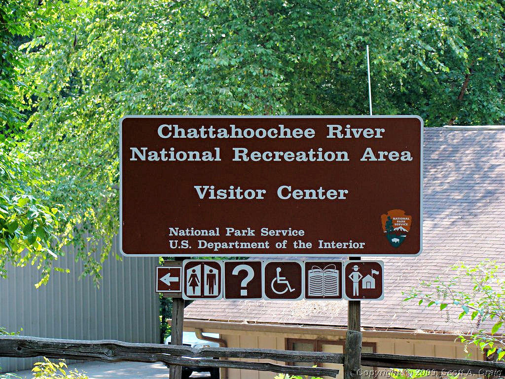
My plan was to pick up a stamp at the Chattahoochee River NRA and then head south into downtown Atlanta to
the Martin Luther King NHS for a second stamp. On the way back north I planned to stop at the Kennesaw
Mountain National Battlefield for a third stamp. About the only good thing that can be said about this
trip is that I did accomplish my goal in that I got all three stamps.
Traffic was horrendous. It started going downhill about 25 miles north of Atlanta where the construction
on I-75 started. Luckily I got off the interstate to go to Chattahoochee River about 20 miles north of
Atlanta so I didn't have to deal with it too much. At least that's what I thought at the time.
I got the stamp at Chattahoochee River and then headed further south toward Atlanta. I was hoping that since
the Island Ford Visitor Center was east of the interstates into Atlanta that I could sneak in the back way. It
wasn't allowed to happen. I got on I-285 West (I think) and went about a mile before traffic came to a dead
stop. I jumped off at the first exit I could hit and headed in the general direction of the Martin Luther King
NHS. I figured I'd get close and let my GPS guide me the rest of the way. My GPS wanted to put me on I-75
but there was no way to get there. Not only were they paving the interstate but virtually every single ramp to
it was closed! My GPS would tell me to turn right on such-and-such street, and when I got there it was closed or
there was a detour sign. I went through this 6 times before I finally managed to get to a point that my GPS
decided to give up on the interstate.
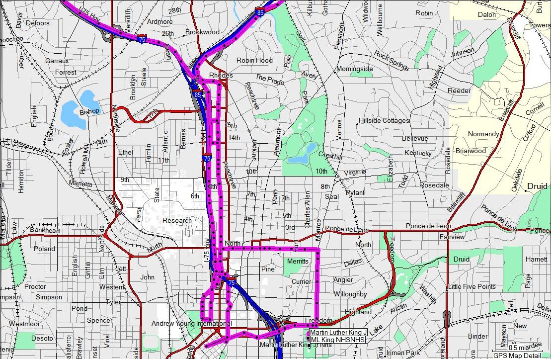
|
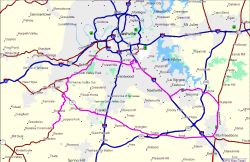
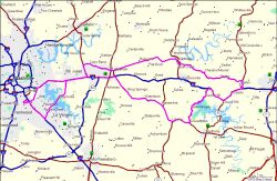
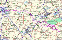
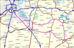
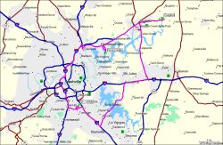
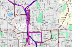
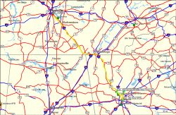
Here is a GPS track log of my "Trip" through downtown Atlanta. The image is just a thumbnail so to view a larger
map click it. The track log doesn't really do the "Trip" justice though since it doesn't show all the stoplights
I had to wait through. Atlanta has the longest traffic lights I have ever had the misfortune to sit
through. On top of that, if you hit one on red you better get ready to hit all the rest on red. I honestly
do not know how people who live there deal with this mess. It is an absolute disaster. I feel for you guys,
I really do. I thought the area around Nashville was bad but you have it even worse.
|
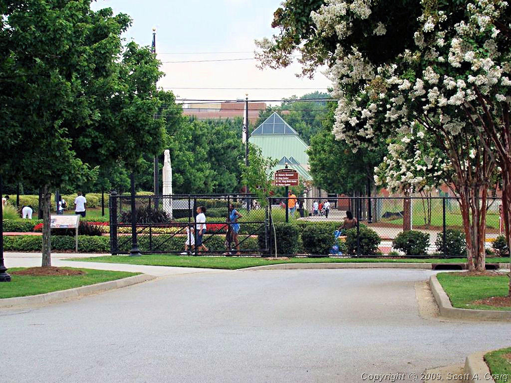
I finally got to the ML King site though. I think I may have spent less time at this historic site than any of the
others I have ever visited. I was so fed up with Atlanta that all in the world I wanted to do was get my stamp,
snap a couple of photographs, and get out of there.
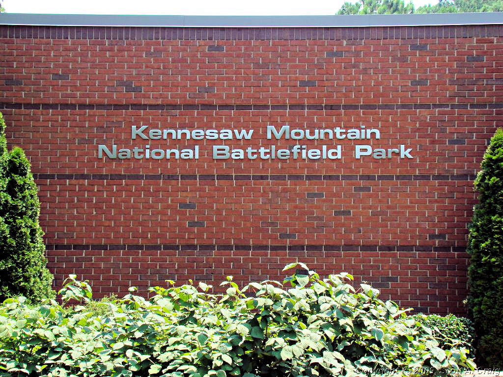
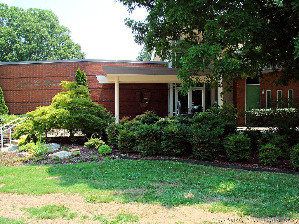
After fighting my way out of Atlanta I headed toward the Kennesaw Mountain National Battlefield. To get there I had
to head up I-75 (yeah, the one that was being repaved) but at least the traffic was minimal. Not real surprising since
nearly every entrance to the interstate is closed!
Once again, I grabbed my stamp and a couple of photos and headed north. I was hot, tired, frustrated, and just
wanted to get something cold to drink and simmer down for a few minutes. Needless to say my ordeal wasn't over
just yet though. Kennesaw Mountain is not far from I-75 so I stopped at a store by the interstate and got some
iced tea to cool off. While resting I happened to notice that north-bound traffic on the interstate was not
moving at all! Perfect! That's exactly what I needed to see. I looked at my GPS and noticed that I-575
was only a half mile or so to the east so I decided to take that a mile or so north before it veered around to the east and
maybe get around whatever was causing the problem. This turned out to be my one and only break of the
day. Apparently whatever was causing the traffic to stop was just south of where I got back on I-75 because when I
got to the interstate there was virtually no traffic at all. I hopped on and sailed north, very glad indeed to be
leaving Atlanta behind me.
This was one of those trips that I can find very little good in. It was very hot and humid, I spent most of the
day snarled in traffic, and it was just generally a miserable trip. The only thing missing was some summer thunderstorms
and they were dotted all around me. I managed to miss most of them but got a little damp in Chattanooga. But,
I acheived my goal: I got my three passport stamps. I've been putting this one off since last year because I knew
it would be an ordeal. Now that I've done it all I can say is that I'm glad it's over and I don't have to go
back! Atlanta is a beautiful city but it is large, the traffic is horrible, and I have never been through there that
there wasn't road construction causing nightmares. Nashville is the same way in that respect but we are nowhere
near as large as Atlanta so it isn't quite as bad.
The mid-south heat and humidity have most assuredly arrived in force now. The forecast for the coming week includes
97° on Monday with heavy humidity and I just don't deal with heat and humidity like that very well. It drains
me entirely and I can't function very well so this may be my last "Longer" trip for a couple of months until it starts to
cool off a little bit. I'll still be out and about but will probably forego anything that keeps me out in the heat
for more than a day. I'm still planning on a long trip in late September but I'm undecided on which way to go. I'll
figure something out before I leave though!
|
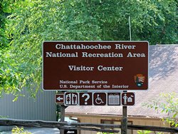
Chattahoochee River NRA |
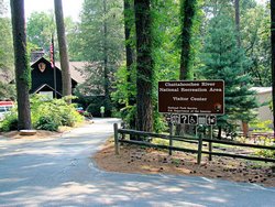
Chattahoochee River NRA |
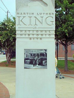
Martin Luther King NHS |

Martin Luther King NHS |
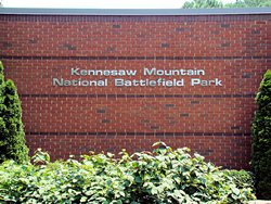
Kennesaw Mountain NB |
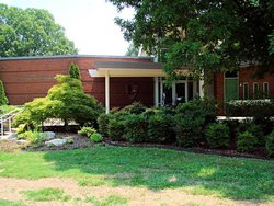
Kennesaw Mountain NB |
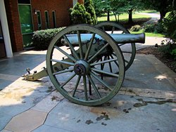
Kennesaw Mountain NB |
GPS Track Log - 07/19/2008 |
|
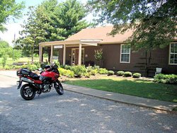
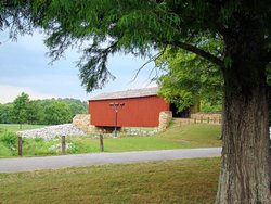
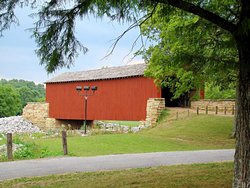
THC STAMPS - July 26, 2008
2006 Suzuki DL650
|
|
I decided to head out this morning and pick up a few Tennessee Historical Commission stamps for my
National Park Passport Stamps
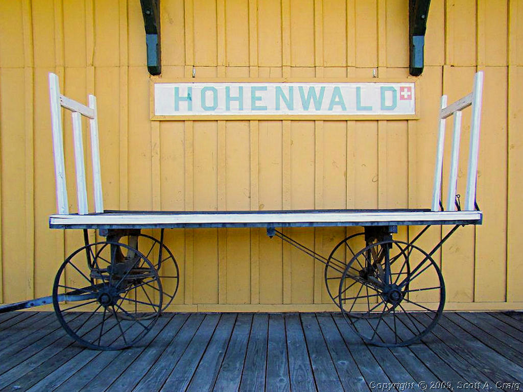
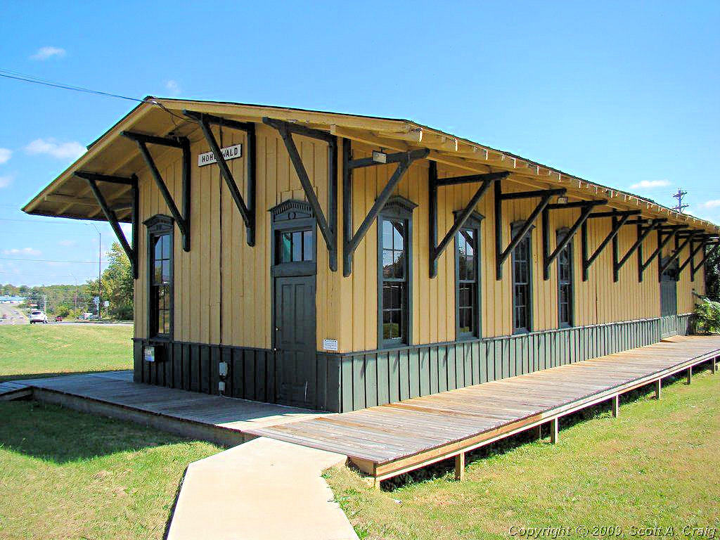
collection. They were all close by in Franklin, Columbia, and Hohenwald, TN. It rained overnight
and as I headed south the clouds really started to build up in the southwest. I decided the smart thing
to do was to skip the Hohenwald stamp since that was the direction the heaviest cloud cover was located in.
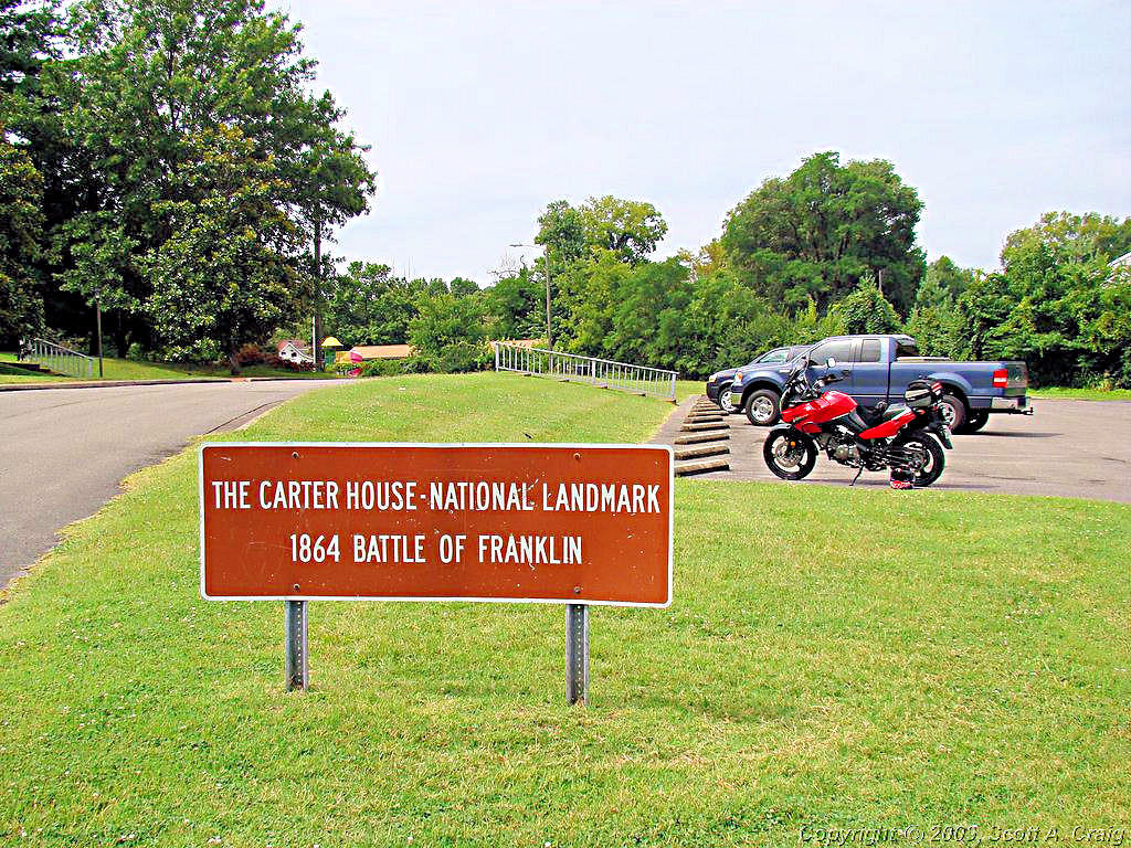
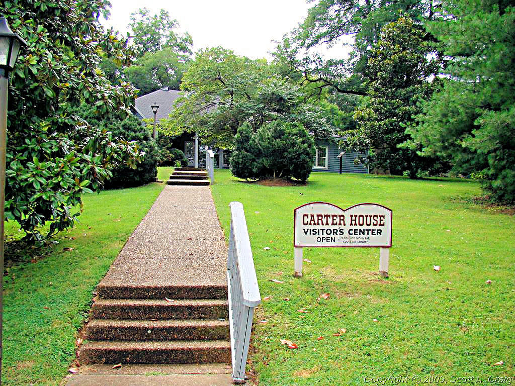
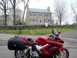
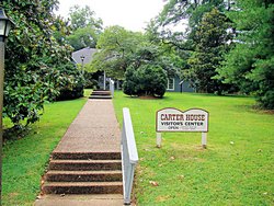
My first stop was the Carter House in Franklin, TN (GPS
coordiantes: N35.91741 W86.87319). It is a "A non-profit museum and interpretive center for The Battle of
Franklin" and is a beautiful example of antebellum architecture. There were lots of Civil War relics inside
but unfortunately photography inside the building was not allowed.
|

Carter House - Franklin, TN |
Carter House - Franklin, TN |
|
|
|
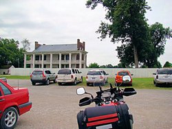
From the Carter House I headed to the Carnton Plantation (GPS
coordinates: N35.90656 W86.86375), also in Franklin, TN. I didn't get a stamp there, it has been misplaced, but
I did take a photograph of the home.
Both the Carter House and the Carnton Plantation charge a fee to view the facility so I decided not to visit the sites
any further. It's understandable since they probably don't get much in the way of state funds, and I'd be willing
to bet they get zero funds from the federal government.
|
Carnton Plantation - Franklin, TN |
|
|
|
|
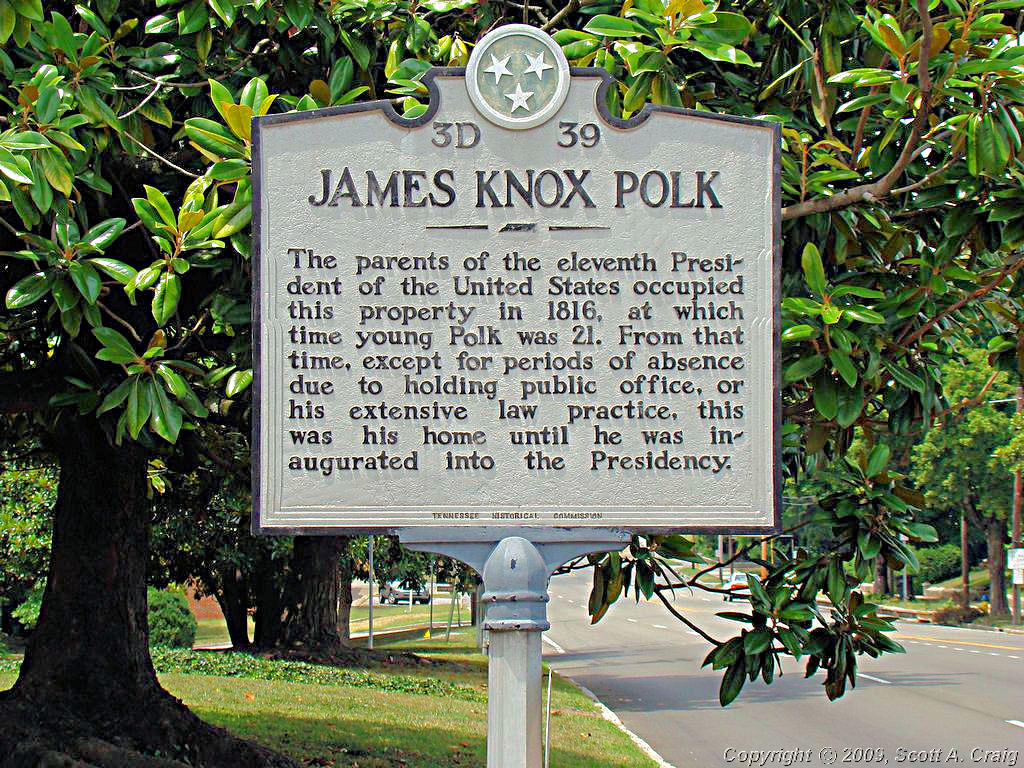
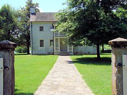
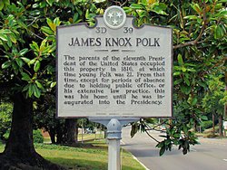
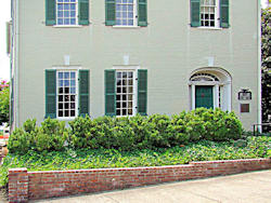
I then headed a bit further south to Columbia, TN. My first stop there was the ancestral home of
President James K. Polk (GPS coordinates:
N35.61500 W87.03720). I did get my stamp at this site. As with the previous two sites a fee was required
to tour the facility so I decided to be on my way.
|
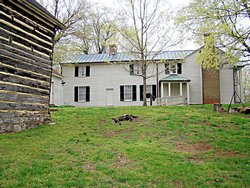
James K. Polk Home - Columbia, TN |
James K. Polk Home - Columbia, TN |
|
|
|
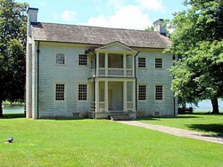
The next site was a long haul from the James K. Polk home, about 1/2 mile by GPS! It is called
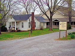
The Athenaeum Rectory (GPS coordiantes:
N35.61431 W87.04082). It was a former Girl's School from 1852 to 1904. It is a really interesting
looking structure with very unique architecture. They were preparing for their Bicentennial Celebration so
I got my stamp and got out of their way. Tony, thanks for the help finding the stamp! I really appreciate it.
|

The Athenaeum Rectory - Columbia, TN |

The Athenaeum Rectory - Columbia, TN |
|
|
|
When I got to The Athenaeum Rectory there was a note on the
window stating that everyone had gone to lunch so I waited. While waiting I started wondering what it would have been
like back in the 1800's when the area was much quieter, much slower, and much calmer. Perhaps I would have heard
the Tap-Tap of a gentleman's cane as he walked to the Rectory to visit a young lady, perhaps even a young James K. Polk
himself since his home was only a few blocks away. I would have undoubtedly have heard the clip-clop of horse-drawn
carriages carrying the well-to-do about their everyday business. It would be interesting to take a trip back there
to see how things actually were. I guess that's why we preserve sites like this, so people like me can take a few minutes
to reflect on what it might have been like. Certainly nobody I might have encountered would have envisioned someone on
a motor-driven bicycle showing up with a plastic bucket over his head.
Ah, well. Enough day dreaming. One more stamp stop for the day at the
Rattle and Snap Plantation at Mt. Pleasant, TN
(GPS coordinates: N35.56371 W87.15699) a few miles west of Columbia.
I got skunked at this site. As can be seen in the photos there was a gate across the driveway so I couldn't
even get to the house for photos. Apparently they are pretty serious about their security to!
|

Rattle and Snap Plantation - Mt. Pleasant, TN |
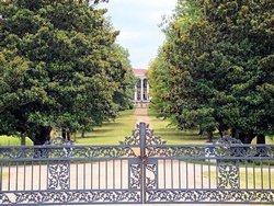
Rattle and Snap Plantation - Mt. Pleasant, TN |
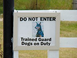
Rattle and Snap Plantation - Mt. Pleasant, TN |
|
|
I was only about 10 miles from the Natchez Trace Parkway so I headed west to pick it up and head back toward
Nashville. Riding the Trace is relaxing and I just enjoy it. As always it was a relaxing and enjoyable
ride north.
I really enjoy days like this one. It was terribly humid after our overnight rain but since I was close to home
I didn't have to be in a hurry, I could stop when I wanted to and do what I wanted to do. I picked up a few stamps,
saw some historic sites, and rode about 130 miles or so.
I don't envy riders whose idea of riding is to ride up and down roads they have been on dozens of times before. I
enjoy getting out and going places, places that I haven't been to before. I use my motorcycles to get me to places
I've wanted to visit and interesting places that I never even considered visiting until now. There are so many
interesting places around here that I haven't been to yet it's hard to know where to head next. To me that's
what it is all about! Tomorrow I'm going to get the VFR out of the basement and play with it for a while to!
|
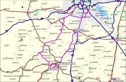
GPS Track Log - 07/26/2008 |
|
|
|
|
FALL CREEK FALLS - August 3, 2008
2007 Honda VFR800
|
|
I made my annual pilgramage to Fall Creek Falls State Park today. I don't really know why this has turned into
an annual event but for some reason I went to Fall Creek Falls in August in 2006 and 2007 so I figured I might as well
do the same thing in 2008. August is a lousy month to go there since it's always hot and humid. Next time
I establish an annual tradition I'm going to pick a cooler month!
Regardless it was a fun trip. It felt pretty good early. I left home about 6:30 to beat the heat and stopped
for some breakfast in Murfreesboro. Then east through McMinnville and Woodbury to Spencer. The road from
Spencer to the park is a blast and this was the first time I have had the VFR on it so it was a learning experience.
There was some patchy dense fog between McMinnville and the park that was really nasty. It was so dense it was
almost like riding in rain. The good thing is that it kept the heat down and when I got to the park it was still
only about 70°. It didn't last though and when I got back home about 12:30 it was already 88° and still
going up!
Summers in Tennessee are not much fun. In the morning everything is damp from the dew and that drives the
humidity up. We normally start the day with a temperature around 75° and 90% relative humidity. By
mid-day the humidity is down to about 55% but the temperature is up in the upper 80's. By the time the sun
goes down the humidity is down around 40% but the temperature is frequently well into the 90's. The net result
is that we start the day sweating and end the day sweating. I worked outside for a number of years and looking
back now I really don't know how I dealt with it.
Today was a good ride though, and a lot of fun. Photos are below but they look a lot like the
2006 Photos and the
2007 Photos. There
was a good bit more water of the falls today than there was last year though so apparently we don't have the same
drought conditions we did last year. You can also see the haze in the air caused by our humidity. Visibility
is frequently less than a mile this time of year because of the haze. If you look closely in the last photo
below you can barely see some additional mountains in the "V" formed by the mountains in the foreground. Compare
that photo to This One taken on
November 11, 2007 from the same spot.
On a completely unrelated note, my VFR will be one year old this coming Wednesday. As of today when I got home
it has 9,142 miles on it. During the past year (actually it's only since May) it has been to Missouri,
Illinois, Indiana, Georgia, Ohio, Kentucky, and (of course) Tennessee. In a month it will head south for
Mississippi, Louisiana, Florida, and Alabama. Guess it's safe to say I like riding this bike. Of course
during the same time period I've also put 6,400 miles on my V-Strom so neither one of them sit idle for long.
|
|
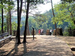
Fall Creek Falls State Park |
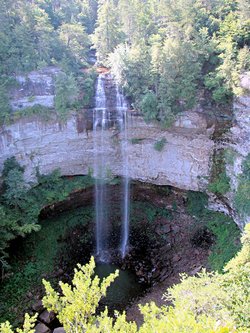
Fall Creek Falls State Park |
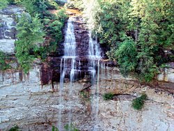
Fall Creek Falls State Park |

Fall Creek Falls State Park |

Fall Creek Falls State Park |
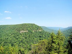
Fall Creek Falls State Park |
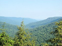
Fall Creek Falls State Park |
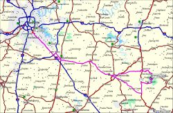
GPS Track Log - 08/03/2008 |
|
DAY OUT WITH THE BOYS! - August 9, 2008
2007 Honda VFR800
|
|
The weather today was forecast to be great. A high temperature of about 85° and no rain at all. For
once they were actually right! A rider from the VFR World Forum
invited me to have breakfast with him and some friends and then go for a ride "Somewhere". The "Somewhere" part
was somewhat ambiguous and to be honest it just didn't matter. Just being able to ride without sweat pouring off
my face was an absolute treat.
We met at the Murfreesboro Airport since the EAA has a monthly breakfast there. After eating and ogling the airplanes
for a bit we headed north and east and north and east and south and west, and so on. The GPS track log below
tells the story but basically we just hit a bunch of great twisty roads between Murfreesboro and Crossville. We
stopped for a little while in Livingston, TN and then headed on further east. We cut south through Crossville
and then back along Highway 30 through Spencer, TN. and then back to Murfreesboro through McMinnville. We split
up in The Boro and I headed on back to Nashville.
325 miles for me today. I only took a few pictures when we stopped at Defeated Creek northeast of Carthage,
TN. Unlike most of my solo trips we actually spent a lot of time on the road today and I didn't get many photos.
Great weather, great company, and a great ride. That's what it's all about!
|
|

Defeated Creek - Cordell Hull Lake |
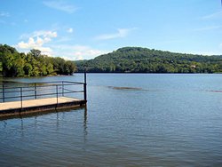
Defeated Creek - Cordell Hull Lake |
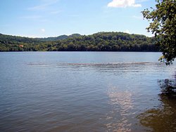
Defeated Creek - Cordell Hull Lake |

GPS Track Log - 08/09/2008 |
|
CHATTANOOGA, TN - August 17, 2008
2007 Honda VFR800
|
|
I was supposd to go ride the Cherohala Skyway yesterday with a group from the
VFR World Forum but I backed out. My
back has been hurting all week and late in the week it started feeling like a kidney stone (I've
had 3 of them so I know that feeling!). I didn't want to get caught 300 miles from home with
a kidney stone so I backed out. That doesn't mean I didn't go riding though! I know, it
was a little bit of a gamble given that I might get hit with a kidney stone, but I gave a bit of thought
to the route. I know people in several of the towns we passed close to so I wouldn't have had to
go far to find some help.
I met a friend in Murfreesboro and we rode to Chattanooga, TN to ... well I don't know why we did, probably
just because it was there. On the way we stopped at Tullahoma, TN to look at the fighters they have
on display there. I didn't take any photos but they haven't changed much since I was there in
June, 2007. Here Is A
Link to the photos I took then.
After mulling over the jets for a while we headed north to Hillsboro, TN and picked up old US Highway 41 and
took it through Monteagle, Tracy City, and Jasper to Chattanooga. Highway 41 from Jasper into Chattanooga
is a really pretty ride with Nickajack Lake and the mountains for scenery. Once again I didn't take any
photos but Here Is A Link
to some photos I took last year along the same road.
We got into Chattanooga, rode north for a few miles and picked up Highway 27 back west. No reason to
stop, other than for something to drink, since we really didn't have a good reason for going to Chattanooga
anyway!
Highway 27 out of Chattanooga, also known as Suck Creek Road, is a fantastic motorcycle road. Very twisty
and relatively sharp curves but sweeping enough that you can get some speed up. One or two switchbacks
just to make sure everyone is paying attention, but really just a fast, twisty road.
We headed back northwest through Gruetli-Laager, Altamont, McMinnville, and Woodbury to Murfreesboro where we
split up. Kelly jeaded home and I headed for Nashville and home. Once again an absolutely great
ride and relatively decent weather. A little warm during the afternoon but the humidity was pretty low
so as long as we kept moving it was comfortable.
|
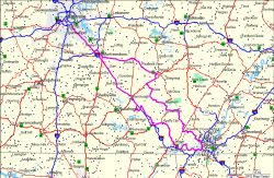
GPS Track Log - 08/17/2008 |
|
|
|
|
THC STAMPS - August 23, 2008
2006 Suzuki DL650
|
|
I haven't felt real great all week, nothing really bad, just a "Yukky" feeling. I decided that what I needed
was a bike trip so I headed out this morning to try and get a few more Tennessee Historical Commission stamps for my
National Park Passport Stamps
collection. As usual I started with some breakfast at a Waffle House and then I headed east for Cookeville, TN.
My first stop was the Cookeville Depot Museum in
Cookeville, TN. This is an old railroad depot built in 1909 and refurbished through the years. Now it
is a railroad museum with numerous artifacts on display including a 1913 Baldwin 4-6-0 locomotive and cars. The
locomotive was originally owned by the Louisville and Arkansas Railroad and acquired by the Friends of the Depot Museum
in 2002. It was painted in Tennessee Central livery since the TCRR ran a number of Baldwin 4-6-0 locomotives.
|
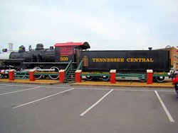
Cookeville Depot Museum - Cookeville, TN |
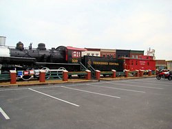
Cookeville Depot Museum - Cookeville, TN |
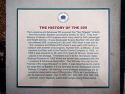
Cookeville Depot Museum - Cookeville, TN |

Cookeville Depot Museum - Cookeville, TN |

Cookeville Depot Museum - Cookeville, TN |
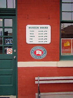
Cookeville Depot Museum - Cookeville, TN |
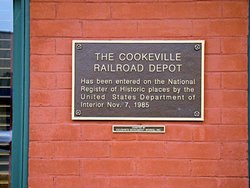
Cookeville Depot Museum - Cookeville, TN |
|
|
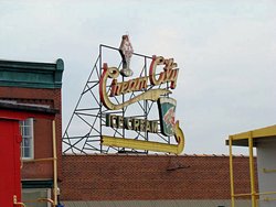
|
While at the Cookeville Depot Museum I saw this sign and took a photo of it for nostalgic reasons. It reminded me of
so many similar signs I remember from my childhood that are now long gone. These big neon signs were constructed in
place on top of buildings, and seeing one again brought back vivid memories from days gone by. No peeling the sign face
off and sticking someone else's up in its place, these big steel and neon structures were meant to stay. They are part
of a bygone era. A slower, quieter, and more permanent era.
I did a little digging and this particular sign, while built in the 1950's, still works quite well.
Here Is A Link to a YouTube video of it at
night. Apparently the building below was the old Cream City Ice Cream company, but now is part of a retail center.
|
From the Cookeville Depot Museum I headed further northeast to the home of Sgt. Alvin C. York
(Link to Wikipedia Info about him). Sgt. Alvin
York was a recipient of the Congressional Medal of Honor for valor near Chatel-Chehery, France on October 8, 1918.
The site I visited was his original homeplace in Pall Mall, TN and is a magnificently maintained site. It is filled
with memorabilia of Sgt. York's life and is a very interesting place to visit.
I did make one mistake though. As I was leaving one of the rangers asked if I had any questions. I thanked him
and said no but that I was going to get my camera and take some photos. I noticed that he had a State Park uniform on
and it had "York" on it. I assumed that this simply meant the Alvin York State Park, but when I got home and started
writing this I found out that he was in fact Andrew York, the son of Alvin York. Had I known that I could probably
have thought of several dozen questions to ask!
I don't know what the tracked artillery piece is, but it was there, it had guns on it, so I took photos of it! If
anyone knows what it is please let me know.
Update: The artillery piece is an M-247 "Sgt. York". It consists of (2) radar-directed 40mm Bofors guns mounted on
an M48A5 tank chassis. It was never successful and only 50 were ever built. Details are on
This Web Site.
|

Sgt. Alvin C. York Homeplace - Pall Mall, TN |
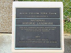
Sgt. Alvin C. York Homeplace - Pall Mall, TN |
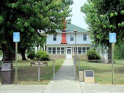
Sgt. Alvin C. York Homeplace - Pall Mall, TN |
|
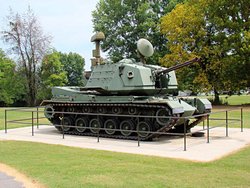
Sgt. Alvin C. York Homeplace - Pall Mall, TN |

Sgt. Alvin C. York Homeplace - Pall Mall, TN |

Sgt. Alvin C. York Homeplace - Pall Mall, TN |
|
|
From the Alvin York site I headed back southwest to the
Cordell Hull Museum just west of Byrdstown,TN. Mr. Hull was a Congressman, a Senator, Secretary of State,
a recipient of the Nobel Peace Prize, and is considered to be the father of the United Nations. He was active
in national government from 1907 until 1944 when he resigned from office due to ill health. This was in the
era when we had an effective government, and Mr. Hull exemplified the qualities of someone truly dedicated to his position.
The photos below are of the museum. His birthplace is slightly to the east and for some reason I failed to get
photographs of it. Brain fade, I guess.
|
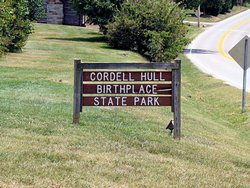
Cordell Hull Museum - Byrdstown, TN |
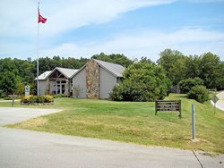
Cordell Hull Museum - Byrdstown, TN |
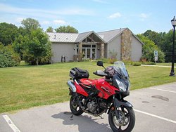
Cordell Hull Museum - Byrdstown, TN |
Cordell Hull Museum - Byrdstown, TN |
|
I got skunked all the way around on Tennessee Historical Commission stamps today. They had been lost at all three
of the sites that I visited. Two of them did have an "I Was Here" stamp that showed the name of the site, but they
weren't the "Official" Tennessee Historical Commission stamps. Oh well, who cares? I visit these sites to get
out and see them, to ride my bikes to places I haven't been before, and to enjoy the scenery in my area. The stamps
are secondary and if I don't get any I don't come home unhappy.
Today accounted for 275 miles and three historic sites I had never been to. I saw some parts of my home state that I
haven't seen before and had a great time doing it. To me that is what riding a bike is all about.
|
GPS Track Log - 08/23/2008 |
|
|
|
|
LABOR DAY WEEKEND - August 30-September 1, 2008
2007 Honda VFR800 - 2006 Suzuki DL650
|
|
Saturday - August 30, 2008
I was invited to go riding with another VFR owner today, so I asked my friend Kelly if he wanted to join us. He
did so we met Mike for breakfast and then headed for the Center Hill Dam via Highway 96. Highway 96 is a great
motorcycle road and that alone made the ride worthwhile. The company of kindred spirits just made it better!
Center Hill Dam is a hydroelectric dam over the Caney Fork River. Construction was completed in 1949 and the
dam is still generating 135 megawatts of electricity today.
After the dam we headed on up Highway 96 to the interstate and ran east about 5 miles to Highway 56. This is
another good road that cuts back across Center Hill Lake and runs into Smithville, TN. We then headed for my
house to pick up some parts for one of the bikes. Mike had to head back home so Kelly and I decided to make a
run down the Natchez Trace Parkway. He had never been down it before but I somehow suspect that he'll be back.
|
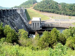
Center Hill Dam |
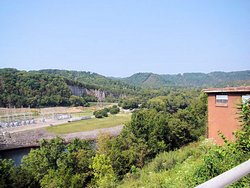
Center Hill Dam |
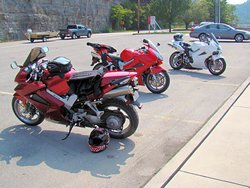
A Trio of VFR's |
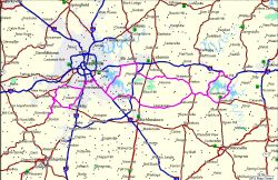
GPS Track Log - 08/30/2008 |
|
Sunday - August 31, 2008
I rode to Clarksville today to visit my mother and then rode around Clarksville for a little while. When I lived in
Clarksville I ran a survey crew and knew virtually every road in the county like the back of my hand. When I go back
now I always enjoy looking around to see what has changed, what new development is going in, and so on. I guess
hanging around engineering companies for as long as I have has caused me to do that ;)
Not a very memorable ride, I just blew up I-24 to Clarksville, got some breakfast at the local Waffle House, and then went
to visit my mom. The ride home was more scenic since I came back through Ashland City and down River Road back into
Nashville. A little bit longer ride but certainly more scenic beside the river. It was most assuredly hot and humid
today though. When I got home the Weather Channel was showing 91° with 50% relative humidity. The humidity
makes that 91° seem much, much warmer because you can't get away from it. Even in the shade it is still very hot.
No photos today but the usual GPS track log is included below.
|
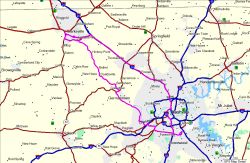
GPS Track Log - 08/31/2008 |
|
|
|
|
6 STATES, 4 DAYS - SEPTEMBER 13-16, 2008
2007 Honda VFR800
|
|
I took a little trip south to collect a few National Park Passport Stamps and to see the ocean again. I
headed out on September 13 and returned on September 16 after riding 1,800 miles in 6 states. I took a
ton of photos but rather than put them all on this page they are all on a page to themselves.
Here Is A Link to the trip page.
I've included a few photos below just to keep this paragraph from getting lost!
Oh, and the six states were parts of TN, AL, GA, FL, SC, and NC.
|
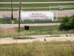 |
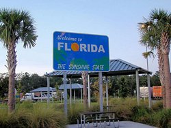 |
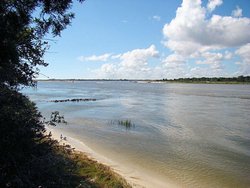 |
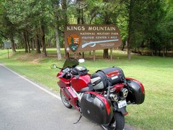 |
|
FUN WEEKEND - SEPTEMBER 27 & 28, 2008
2007 Honda VFR800 / 2006 Suzuki DL650
|
|
You'd think I'd get enough riding but I never seem to. The weather this weekend was GREAT and I put
about 500 more miles on my bikes.
Saturday, September 27, 2008
I made my third trip to visit the Barber Vintage Motorsports Museum in Birmingham, AL today. Much like
riding itself I can never seem to get enough of that place. I had mentioned on a couple of motorcycle
forums that I would like to go again so a couple of other riders joined me.
A full set of photographs is at This Page
but I have included a few photos below to get you started!
|
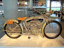 |
 |
 |
 |
|
Sunday, September 28, 2008
Since I rode my VFR yesterday I decided to get my V-Strom out today to keep it from feeling neglected. We headed
down the Natchez Trace Parkway, another place I can't seem to get enough of, just because the weather was fantastic
and I hadn't been out there for a while.
It was rather cool this morning, and when I stopped at one of the pull-offs I saw that some fog had settled among the
hills east of the parkway. The photos don't do the view justice because everything was backlighted since I was
shooting into the sun and I couldn't get the hills to show up correctly. I started to just include one image,
but the lighter one on the left doesn't show the hills as well but the darker one on the right makes it look like it
was much earlier than it actually was.
|
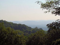 |
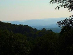 |
|
|
|
I headed on down the parkway and to my surprise I kept seeing trees that appeared to be changing color already. When
I got down to Garrison Creek they had really started to change colors. It is very early in the year for us to see
trees changing color and I suspect this is an indication that we can expect an early fall, and possibly an early winter.
|
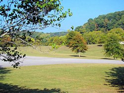 |
 |
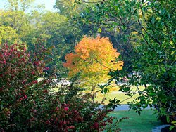 |
|
|
The weather this weekend was fantastic for riding. A little on the cool side Saturday morning heading down the
interstate. No, actually it was damn cold heading down the interstate! It warmed up to the low 80's by the
afternoon though. Sunday morning when I left it was about 65° and was just right for a morning jaunt down
the Natchez Trace Parkway. Too bad it won't stay like this, it will either get hot again or get cold early. I'm
not sure which way it will go but regardless I'm going to keep putting in the miles.
|
|
A "ROCKY" DAY - OCTOBER 4, 2008
2006 Suzuki DL650
|
|
No, nothing happened. I didn't run over a "Rock", I didn't dump my bike in the "Rocks" or anything, but it
was a "Rocky" day.
The weather was absolutely gorgeous today so I had to get out for a while. Not a cloud in the sky, about 50° when
I left home and about 83° when I got back. I decided that the V-Strom needed to get out for a little romp
so I headed east on I-40 and stopped at my usual Waffle House at Gordonsville. It was a little chilly heading
down the interstate but not enough to be uncomfortable. The hot coffee was welcome though.
It was also really nice not to be on a schedule for a change. For the past few weeks it seems like every place
I've ridden I've been on a schedule of some sort. It seems like I always had to meet someone at a specific time,
or I needed to get to a Visitor Center before they closed or I needed to get to a motel or home before it got
dark. Don't get me wrong, I really enjoy going places and I really enjoy riding with others but sometimes it just
really feels good to be out by myself with no schedule except to go where I wanted to go and get there when I wanted to
get there.
I was heading for White County and took Highway 56 across Center Hill Lake. That is a really nice road on a
bike, wide and curvy and a lot of fun. A few miles off the interstate there is a Scenic Overlook (GPS coordinates
N36.04448 W85.75118) and as I passed the sun was blasting down out of a clear, blue sky so I stopped for a couple of
photos. Sorry that they are a little bit washed out, I was shooting straight into the sun.
I was hoping for a little more color in the trees, they are really changing very early this year, but there isn't
much. There is some though. Compare the three photos below to
These Photos that I took at Couchville Lake on October 6, 2007. Last year everything was still completely
green at this time but this year there is some color starting to show. You can also scroll up this page to
last weekend and see the trees down the Natchez Trace Parkway.
|
 |
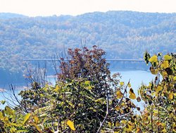 |
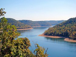 |
|
|
I headed on down Highway 56 and cut across Highway 287 to Rock Island State Park (there's the first "Rock"!). There
are a couple of water falls there that are just beautiful. I didn't take a lot of photos since I have several
on my web site from last year (Click
This Link), but I did take a couple. GPS coordinates at the falls are: N35.80805 W85.63304.
|
 |
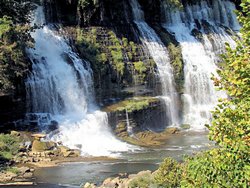 |
|
|
|
I had to stop at the Rock Island Visitor Center to get directions to the falls since I couldn't remember how to get
to them. When I came out I noticed a plaque beside a tree. The plaque reads "Angie's Tree" and is dedicated
to the memory of Angeline Greene (1965-1996). I never knew Ms. Greene but I think it would please her to know
that someone thought enough of her to plant a tree in her memory. It is growing right beside the Visitor Center
so it is very well cared for. It is also in a place where people who knew her can think of her often.
|
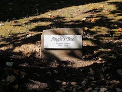 |
 |
|
|
|
After Rock Island I headed north on Highway 36 and east on Highway 70 to Sparta, TN to visit the "Rock House" (yep,
there's the second "Rock"). The Rock House was built between 1835 and 1839 and served as a frontier toll house
along the Wilderness Trail. My reason for heading there was that there is a Tennessee Historic
Commission stamp for my Passport Stamp Collection. It
is an interesting place though and worth the trip.
|
 |
 |
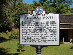 |
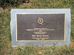 |
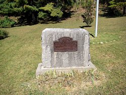 |
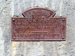 |
|
|
|
I headed back west on Highway 70 through Smithville, and cut across Highway 96 to Murfreesboro for a quick stop at
Sloans Motorcycle Superstore. I needed some chain lube, and an excuse to browse a motorcycle store is always
welcome! After that a quick jaunt from Murfreesboro back home.
A great ride in absolutely perfect weather. Clear and bright with just enough bite in the air to make it feel
clean again. Summer around here always feels like a sauna. The air is hot and humid and wraps around us
like steam. In the fall everything clears up, the sun seems brighter, the air is clear and clean, and it's just
great to get outside. These are the days that I enjoy riding a motorcycle the most and I made good use of this
one! I've got one more long ride I want to make this year and I hope I can get it in before the weather starts
getting wet and cold again.
|

GPS Track Log - 10/04/2008 |
|
|
|
|
FALL FUN - OCTOBER 12, 2008
2007 Honda VFR800
|
|
It got kind of warm today, up to 80° but it was still a great day to be out riding so I decided to just
enjoy myself. I had to meet a V-Strom owner in Monterey, TN today to take him a part for his bike so I
decided to come home the "Fun" way.
I met Jason and a couple of his friends in Monterey and delivered his part. We talked for a while and had
a cup of coffee before they headed back to Knoxville and me to Nashville. None of us planned on taking the
straight-and-narrow home though. They headed for Crossville via I-40 and thence along the backroads to
Knoxville. I headed slightly west and then dropped down Highway 84 to Sparta, Highway 111 to Spencer, and
then Highway 30 to McMinnville. Highway 30 around Spencer is one of my favorite roads in this area and I
always enjoy riding it on a bike.
I do have to say that I didn't enjoy parts of Highway 84 though. As far as the road itself goes it's a great
one, I've been on it before. It is, however, rather narrow with no shoulders and trees hanging out over
the roadway. Walnut trees! I had never given it much thought before today but riding through a bunch
of walnuts in a corner is a lot like riding over great big chunks of gravel. It doesn't really inspire
much confidence. To make things worse there were a lot of leaves on the road and the walnuts were hidden in
the leaves. Most people can probably tell the leaf of a walnut tree from on top of a motorcycle but I'm not
one of them. It was fun when I could see but coming around some of the blind corners only to see a bunch of
"Stuff" in the road was not a lot of fun. I was glad to hit the area where the road had shoulders again and
the trees moved back a little bit. It's gorgeous through there with the trees starting to change color and
peeks of the mountains in between but those damn walnuts kept me on edge the whole time.
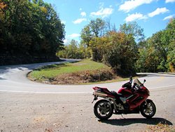
|
I only took one photo today but it's one I've been wanting to take for a good while. Highway 30 east and west of
Spencer, TN has numerous switchback turns. There was very little traffic today so I decided to stop on the runoff
area right in the middle of one of them and grab a photograph.
As you can see you come down (or up) one side, make a 180° turn, and go right back the way you were coming. It
doesn't have a very large radius either so they do get your attention.
|
I picked up Highway 70 in McMinnville and took it into Smyrna where I jumped on I-24 and headed home. 225 miles in
really nice weather and some gorgeous scenery. That's the kind of day I enjoy. Jason, it was great meeting
you guys. Hope you had a safe and fun ride back home.
|
GPS Track Log - 10/12/2008 |
|
|
|
|
TREES ALONG THE TRACE PART I - OCTOBER 18, 2008
2006 Suzuki DL650
|
|
I haven't been down the Natchez Trace Parkway to check on the leaves for a couple of weeks so I decided to make a
run to Hohenwald, TN to try and get a Tennessee Historical Commission stamp at the Hohenwald Depot for my
Passport Stamp Collection. The trees were
disappointing and I didn't get the stamp. I've got several things going on in my life right now and I needed
some time to think though, and riding along the Natchez Trace Parkway is the perfect place to do that.
As usual I stopped at a local Waffle House for some breakfast and then headed for the Natchez Trace Parkway. It
was actually on the cold side this morning, as in about 50° when I left home. Fall temperatures are truly
here but we haven't had any frost in the Nashville area yet. I don't know about the outlying areas but judging
from the trees there hasn't been much if any.
My first stop was the Hohenwald Depot
(GPS coordinates: N35.54776 W87.55019) in Hohenwald, TN. The depot was built in 1896 and has been reconstructed
to its original appearance. Unfortunately it was closed so I couldn't see the inside. It is flanked by the
Lewis County Museum of Natural History which was open though, so I spent a little while there taking some photos. It
is unusual and pleasant to see a Museum of Natural History in a county as small as Lewis County. Many counties much
larger than they are, with much higher budgets, do not have facilities like this for people to visit. It's good to
see them going to the effort to provide a place like this.
|
Hohenwald Depot |

Hohenwald Depot |
Hohenwald Depot |
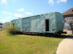
Hohenwald Depot |
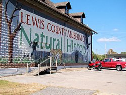
Lewis County Museum of Natural History |

Lewis County Museum of Natural History |
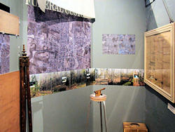
Lewis County Museum of Natural History |
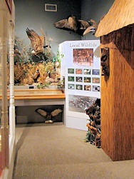
Lewis County Museum of Natural History |
I headed back southeast to the Natchez Trace Parkway, and took it a few miles south to the Metal Ford. I expected
to see some color in the trees there but was quite disappointed. Since it adjoins the Buffalo River I had
expected it to be cool enough that the trees would be changing but there was very little color in them as can be seen
in the photos below.
|
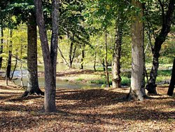
Metal Ford on the NTP |
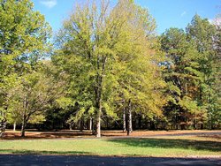
Metal Ford on the NTP |
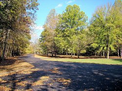
Metal Ford on the NTP |
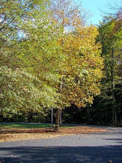
Metal Ford on the NTP |
Farther up the NTP toward Nashville I stopped at the "Tobacco Farm". For some reason I have never stopped at
this site before. I thought I had hit all of them in this area but somehow I had missed this one. I
suppose I never stopped at it since I was born and raised in this part of the country and have seen tobacco barns
and tobacco farms all my life. But for those who have never seen a tobacco barn, pics are below.
|

The Tobacco Farm on the NTP |
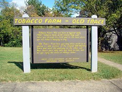
The Tobacco Farm on the NTP |
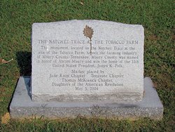
The Tobacco Farm on the NTP |
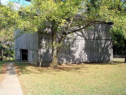
The Tobacco Farm on the NTP |
I stopped a few miles from Highway 100 to take a break and to my surprise there was more color in the trees there
than in most places farther south. Still not much, but it was still surprising to see a little bit of color
in the trees closer in to Nashville than well outside of town. Our "Heat Dome" usually insures that this
doesn't happen.
|

Near Highway 100 on the NTP |

Near Highway 100 on the NTP |
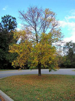
Near Highway 100 on the NTP |
|
Not much color in the trees at all and I didn't get my stamp. But who cares? It was a great day for riding
and the Natchez Trace Parkway is always a good place to go.
|
GPS Track Log - 10/18/2008 |
|
|
|
|
MORE FALL FUN - OCTOBER 26, 2008
2007 Honda VFR800
|
|
I got an email from a friend yesterday inviting me to ride today and the weather was so nice I just
couldn't resist. It was a little cool when I left Nashville, to the tune of 43° but it warmed
up nicely in the afternoon. Too nice actually because I wore my heavy winter jacket and I started
getting hot!
We met in Murfreesboro for breakfast and were joined by another rider. After some breakfast we headed
south toward Shelbyville, TN.
|
We stopped at Bomar Field in Shelbyville to see this magnificent Douglas DC-3 parked on the ramp. This
aircraft has the tail number NC17334 and first flew on March 2, 1937. It was one of the DC-3 Flagships
for American Airlines and is named Flagship Detroit. There is a lot of information about the airplane
on This Web Site.
|
|
We rode through Tullahoma and Winchester and headed for Sewanee. The road up Sewanee Mountain is a great road, and
we stopped at an overlook about halfway up to take a break and a couple of photos. A beautiful view even though
there is a good bit of haze in the air.
|
We headed across I-24 to Tracy City and picked up Highway 56 west. This is another fantastic motorcycle road that
took us through Beersheba Springs. We rode north to McMinnville, TN, then south to Manchester, TN and back toward
home. A great ride and a great day to be out riding. Our weather is supposed to change dramatically tonight
and the high tomorrow is only supposed to be 51° so it looks like it's going to be an early winter for us.
Kelly, Tracy, thanks for the invitation. I had a blast and hope we don't have to wait until Spring to do it again!
|
GPS Track Log - 10/26/2008 |
|
|
|
|
TREES ALONG THE TRACE PART II - NOVEMBER 2, 2008
|
|
|
TREES ALONG THE TRACE PART III - NOVEMBER 16, 2008
|
|
With only a few exceptions the trees that were so vibrant and gorgeous along the Natchez Trace Parkway two weeks ago are
barren scarecrows now. The bulk of the leaves are on the ground or being driven across the road by the gusty autumn
wind. There are a few trees with some color left in places that have been sheltered from the wind, but for the
most part everything has the look of winter on it now. It's as if everything is simply holding its breath waiting
for the cold and the rain and the ice to show up.
I didn't even take any photos today since there was really nothing worth stopping for. The colors were gone and the
sky was milky blue from yesterday's clouds and rain. The Natchez Trace Parkway is an enjoyable place to ride even
without the color from the trees, but late fall is always depressing to me. I love fall; the colors of the trees and
the trace of cold in the air, but as I get older I really have begun to dread winter. We don't get much snow in this
part of the country so winter sports to us are foreign concepts. Winter means nothing but several months of cold, wet
sloppy weather. There isn't much to look forward to and I really do not enjoy it at all any longer. To make
matters worse, since I started riding motorcycles again it means having to bundle up in heavy clothes and take short rides
around the area as opposed to all-day rides to places of interest.
Oh well, I'll still ride when I can and enjoy it. At least I don't have to park my bikes for the winter, I can still
ride from time to time.
|
|
ANOTHER MONTH GONE - NOVEMBER 30, 2008
|
|
Another month is gone, and almost another year. I didn't get out and ride much during November, and in fact
rode less than any month since I've had my bikes. It has been cold and rainy much of this weekend and tomorrow
there is a forecast of a 70% chance of snow showers with a high of 38°. Not premium riding weather but
I did manage to get out a few times.
Hopefully I'll be able to make up for my lack of winter riding opportunities in late January / early February. I'm
heading for Arizona on January 30 to visit my close friend and riding buddy AGirl and others. On Decmeber 2 I told
her what my schedule would be. On December 4 I got an email that told me what we would be riding for most of the
week. Three days will be a trip to the Hearst Castle at
San Simeon, CA. That will be a GREAT trip, in fact the whole week will be a great trip and I am really looking
forward to it. I get to visit parts of the country I've never seen before, and I get to do so in company of some
close friends. I'm ready! Is it time to go yet?

|
|
PLAYING IN THE COLD ON PEARL HARBOR DAY - DECEMBER 7, 2008
|
|
It appears that FDR was wrong. December 7, 1941 did not live in infamy as he predicted, it apparently died
of Political Correctness. Today is the 67th anniversary of the attack at Pearl Harbor, HI and what little
television I watched today never made any mention of it whatsoever. Perhaps I'm being cynical and just
missed it, but I doubt it. Our new Politically Correct world doesn't like to be reminded of things like
that so we try and sweep them under the rug by not mentioning them again. I call that the "Ostrich
Syndrome". Stick your head in the sand and pretend nothing happened. I wasn't even born in 1941 but
I for one will never forget the 2,402 people who lost their lives there that Sunday morning. I will never
forget standing on the Arizona Memorial and thinking about 1,102 sailors entombed within the ship (yes, I did
look up the statistics on Google, and yes, I have been to the Arizona Memorial). I will never forget seeing
drops of bunker oil rising to the surface as if the ship was still bleeding and mourning her losses. Anyone
who can stand on the deck of that memorial and not feel something is not human. The hell with Political
Correctness, I refuse to let them be forgotten. Pearl Harbor Day may not be a recognized day of remembrance
but it is a special one to me.
I just had to get that off my chest.
I decided to brave the cold weather and get out and ride a while today. And it was cold! When I left
home it was 23° and when I got back home it had warmed to a sultry 32°. I only rode about 80 miles
or so but it actually felt pretty good. The air was crisp and clear, the sun was out, and other than cold
toes it was great to get out and ride some. Strangely enough I only saw one other motorcycle out. I
wonder why.
I have pretty good cold-weather riding gear so the cold generally doesn't bother me that much. My only problem
comes from the bulkiness of my gear. It makes it hard to turn my head to look left and right at intersections
and it just generally makes me feel clumsy. It's worth it not to be cold though, and really the only thing that
does get cold is my toes. I have some electrically heated socks but they are so painful to wear I'd rather put
up with the cold.
Only 54 more days until I head west for a romp in the desert! THAT is going to be a great trip and I can hardly wait!
|
|
PLAYING IN THE COLD - DECEMBER 13-14, 2008
|
|
It is rides like this that make me very glad I have good cold weather riding gear. I rode to Clarksville, TN
on Saturday to spend the night with my mother and came home Sunday morning. It's about 60 miles each way which
is no big deal most of the time. Both trips this weekend the thermometer on my VFR showed that it was
41°. Running down I-24 that equates to 25° of wind chill. Add to that a 15 mph crosswind coming
back home and it made for a pretty rough ride. It still felt good to get out and ride some though, it just
clears my head of other thoughts and problems and allows me to focus on the ride itself.
My cold weather gear does a great job though. I didn't get cold in the slightest going either direction. The
problem is the bulk. By the time I get it all on I can barely move and it makes the effects of the wind even
worse.
|
|
CHRISTMAS RIDE - DECEMBER 25, 2008
|
|
My favorite day of the year is December 26 because Christmas is as far in the future as it can possibly
be. Christmas this year was, if anything, more depressing than usual. The only thing good
about it, from my point of view, was that for the first time in a week the sun was out and it wasn't
terribly cold. To try and clear the cobwebs out of my head I got out and rode my bike for a while.
Winter in Tennessee is depressing in and of itself. Everything is brown and dead, the sky is normally
slate grey and heavy with moisture. We get a great deal of rain this time of year but luckily the
temperatures are normally mild enough that it doesn't turn into snow. Today was unusual in that the
sun was out and the sky mostly clear for a change.
I rode down the Natchez Trace Parkway for a while, and then rode back into Nashville and stopped at
Centennial Park for a little while. There is an F-86L mounted on a pedestal at Centennial Park
that, for some reason, always cheers me up a little bit. I think it's because of the way that it
is mounted. It's mounted in a nose-high attitude and looks like it is climbing out after making
a low pass on the park. I get the impression that even after all these years he still enjoys the
freedom of flight. Being a former pilot myself I can understand and respect that, and I think that
solitary freedom is a lot of what I enjoy about riding motorcycles.
Regardless, after riding about 80 miles I felt a little bit better, a little bit colder, and like I could
face the remainder of Christmas day so I headed back home. It's supposed to start raining again
tomorrow, as it has virtually every day for the past couple of weeks, so I'm going to finish up some winter
maintenance on my bikes. If it isn't too cold, the forecast is for close to 70°, I may give them
both a much-needed bath and a little bit of wax.
|
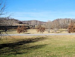 |
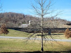 |
 |
|
|
POST-CHRISTMAS RIDE - DECEMBER 26-28, 2008
|
Friday, December 26, 2008
There was a good chance of rain today so I didn't ride very far, but it was just too warm not to
get out and ride for a little while. We don't get many days in late December when the temperature
hits 65° so I just couldn't waste it.
I rode to Couchville Lake at Long Hunter State Park to enjoy the silence for a little while, but apparently
a number of others had the same idea. It was a constant parade of cars coming in and going out so I
decided to move on. The wind was picking up and it looked a lot like rain anyway.
|
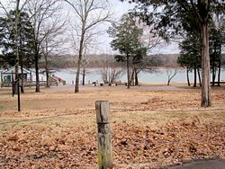
Couchville Lake at Long Hunter State Park |

Couchville Lake at Long Hunter State Park |
|
|
|
I headed back in the general direction of home but then decided I didn't really want to go home. I rode
over to the airport to watch the airplanes for a little while. Nothing really interesting came in or went
out, but I love airports and airplanes so I took a few photos anyway.
|
Southwest Airlines Boeing 737-7H4 |
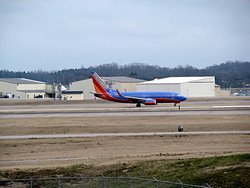
Southwest Airlines Boeing 737-7H4 |
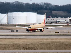
Southwest Airlines Boeing 737-7H4 |
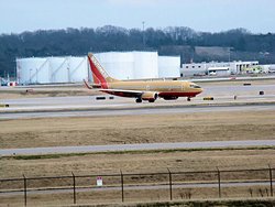
Southwest Airlines Boeing 737-7H4 |

Frontier Airlines Airbus 318-111 |
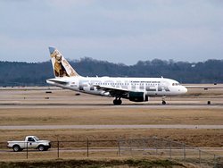
Frontier Airlines Airbus 318-111 |

Learjet Model 45 |
|
Saturday, December 27, 2008
What a waste. Seldom do we get a day between Christmas and New Year when the temperature is 70°. I
guess that just to make up for sending a decent day our way, the weather gods felt compelled to make it windy as
hell. The forecast was for 20-30 mph gusting to 40 mph. I didn't get out of the house but I had my
basement door open and that wind forecast was probably pretty close at times. I did manage to get both of my
bikes cleaned up though so I accomplished something.
Sunday, December 28, 2008
Today was probably my last chance for a ride in 2008 so I took advantage of it. The rain came down in buckets
late last night but a cold front blew through and left us with sparkling clear skies even though it was a little
bit cool. Not cold just cool. When I left home it was 42° and warmed up to about
48°. Still not too shabby for the end of the year.
I didn't ride far, just headed down the Natchez Trace Parkway which is usual for me when I have no place to go. I
love the quiet serenity that the Parkway provides, and just really enjoy riding there. There is very little
traffic, and most of what is there is bicycles. There are a couple of places that I ride to and just sit and
listen to the silence. There are two things that living in a large city causes me to miss the most; it is never
quiet and it is never dark. I enjoy the silence of the Parkway every chance I get, and today was my last chance
for this year.
It is supposed to be clear and comparatively mild this coming week so hopefully I'll get to ride to work some. A
few more miles in 2008 but it's pretty much over now. Bring on 2009 though! Only 32 more days until I head
west for a romp in the desert, and I am more than ready to go!
|
|
END OF YEAR - DECEMBER 31, 2008
|
|
Coast to coast across the USA the prefered route distance from Monterey, CA to Virginia Beach, VA, both of which
are on the same degree of latitude as Nashville, TN is right at 3,000 miles. I have ridden enough this past
year to make that trip 5 times with some miles left over. I don't consider myself to be a prolific rider
though and I just ride when I can and go when I want to go. While some of those 15,000+ miles were "Just Out
Riding" or riding to work the majority of them were going "Someplace". The context of "Someplace" in this
instance means simply that I had a specific destination in mind when I left home, or in other words I simply wanted to
visit something.
The 2008 riding season is coming to a close now, and one of the goals I set for myself at the beginning of this year
was to get out and see parts of this country from a motorcycle. I accomplished that goal to my satisfaction. I
visited parts of 11 states on my motorcycles, and visited over 50 National and State Historic Sites or other
interesting sites. In one day I went from the sultry hot of the Atlantic Ocean at Tybee Island, GA to the
misty cool of the Smoky Mountains at Asheville, NC. I visited the homes of Presidents and Statesmen and I
visited the Museum of the United States Air Force. I saw the place where aviation was born in Dayton, OH and
I saw the place where Alvin York was born in Pall Mall, TN. I saw so many sites this past year that it's hard
to keep them all straight in my mind but at the same time I'll never forget them.
I won't go so far as to say that I enjoyed every single mile because some of them were cold, hot, wet or otherwise
miserable. I will say that I wouldn't trade them for anything because cold or hot or wet they are all part of
the overall experience. When I get to my destination and warm up, cool off, or dry off the discomfort is
quickly forgotten but the memory of the trip lasts forever and that makes it all worthwhile.
Traveling on a motorcycle is a joy that most people will never experience or understand. I think all of us
who do, though, understand how much closer it brings us to our surroundings. The wet and cold and heat are
obvious but there are also the smells and the sounds and the sights. Everything is just so much more intense
from a motorcycle than the sealed environment of car that there is just no comparison. It is something that
must be experienced to be understood and appreciated. I'm fortunate enough to have enjoyed this experience,
and it is something that I plan to continue doing.
I'm already planning some trips for 2009 and waiting for the weather to let me get out and start all over
again. I would love to travel parts of the original Route 66, and that just might happen in
2009. I'll have to wait and see, but if you happen to see a red Suzuki V-Strom or a red Honda VFR with
Tennessee plates out on the road somewhere it may well be me!
So long, 2008! Thanks for the memories.
|
|
|
UPCOMING TRIPS |
|
Below is a tentative listing of places I would like to visit it 2009. I may or may not
get to visit all of them but I am certainly going to try.
|
|
Arizona & California
|
Trip Complete (01/31-02/06) - Click Here!
|
|
General George Patton Museum
|
Trip Complete (04/25) - Click Here!
|
|
New River Gorge - Beckley & Fayetteville, WV
|
Trip Complete (05/23) - Click Here!
|
|
Naval Aviation Museum
|
Pensacola, FL
|
|
Gulf Islands National Seashore
|
Pensacola, FL
|
|
USS Cairo Museum
|
Vicksburg, MS
|
|
Southern Museum of Flight - Birmingham, AL
|
Trip Complete (07/18) - Click Here!
|
|
USS Alabama Battleship Memorial
|
Mobile, AL
|
|
National Historic sites around
|
Richmond, VA
|
|
Wright Brothers Monument - Site of First Flight
|
Kitty Hawk, NC
|
|
Cape Hatteras National Seashore
|
Nags Head, NC
|
|
USS North Carolina Battleship Memorial
|
Wilmington, NC
|
|
Hot Springs National Park
|
Trip Complete (10/02) - Click Here!
|
|
National Historic sites around
|
New Orleans, LA
|
|
Portions of the original Route 66
|
Trip Complete (10/18) - Click Here!
|
|
Fall Trip through the western states again
|
Trip Complete (10/18) - Click Here!
|
|
|
YEAR TO DATE STATISTICS - Through December 31, 2008 |
| 2008 Miles Ridden: |
15,695 mi (Suzuki DL650: 5,540 - Honda VFR800FI: 10,155) |
| Most Miles In A Day: |
605 mi (09/13/08) |
| Longest Multi-Day Trip: |
1,800 mi (09/13 - 09/16) |
| States Visited: |
11 (TN, KY, NC, IN, MO, IL, OH, GA, AL, FL, SC) |
|
|
RIDE MAPS |
May 2, 2006 - December 31, 2006 |
January 1, 2007 - December 31, 2007 |
January 1, 2008 - December 31, 2008 |
|

| Copyright © 1997-2024, Scott A. Craig, All Rights Reserved |
|
|
|
|